Jefferson County

Log in to your account

AroundUs is a community-driven map of interesting places, built by curious explorers like you. It grows with every review, story, and photo you share.
Connect to save your favorite spots, contribute locations, and create personalized routes.
By continuing, you accept our Terms and Conditions and our Privacy Policy
Add to collection
Map
Suggest a change
Share

Jefferson County, County administrative division in Missouri, United States.

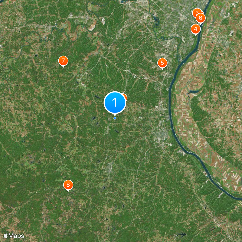
Jefferson County is an administrative division in eastern Missouri that encompasses residential communities, government facilities, and public services spread across the region. The county operates with a central administration center managing day-to-day operations and public records for residents.

The county was established in 1818 as organized local governance developed in early Missouri during the statehood period. A major shift occurred in 2008 when the Home Rule Charter was adopted, which changed how the county government operates.

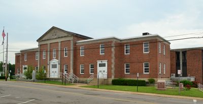
The Administration Center in Hillsboro serves as the main gathering place where residents attend planning meetings and public forums throughout the year. These regular community sessions shape how local decisions are made and reflect the county's approach to civic participation.

Residents can handle tax payments, get permits, and access property documents through the official website or at the Administration Center on Maple Street. Most services operate during standard business hours and may require specific documents depending on the request.

The Department of Administrative Services continues to oversee the transition to the Home Rule Charter system, a process that has reshaped how local government operates since 2008. This shift gave residents more direct influence over county governance and decision-making procedures.

Location: Missouri

Inception: 1818

Capital city: Hillsboro

Shares border with: St. Louis County, St. Francois County, Washington County, Franklin County, Ste. Genevieve County, Monroe County

Website: http://jeffcomo.org

GPS coordinates: 38.26000,-90.54000

Latest update: December 6, 2025 22:07

Photos
Around this place
Show the full map
Jefferson Barracks Military Post
United States of America

Jefferson Barracks Military Post

34.5 km
Jefferson Barracks National Cemetery
United States of America

Jefferson Barracks National Cemetery

34.5 km
Route 66 State Park
United States of America

Route 66 State Park

27.8 km
Lone Elk County Park
United States of America

Lone Elk County Park

30.3 km
Cliff Cave County Park
United States of America

Cliff Cave County Park

31.1 km
Mastodon State Historic Site
United States of America

Mastodon State Historic Site

18.4 km
Jefferson Barracks Bridge
United States of America

Jefferson Barracks Bridge

34.1 km
Don Robinson State Park
United States of America

Don Robinson State Park

19.6 km
Washington State Park
United States of America

Washington State Park

23.2 km
Sandy Creek Covered Bridge State Historic Site
United States of America

Sandy Creek Covered Bridge State Historic Site

4.2 km
Tyson Research Center
United States of America

Tyson Research Center

28.6 km
Young Conservation Area
United States of America

Young Conservation Area

22.3 km
Koch, Missouri
United States of America

Koch, Missouri

33.2 km
Swing-A-Round Fun Town
United States of America

Swing-A-Round Fun Town

29.5 km
West Tyson County Park
United States of America

West Tyson County Park

29 km
Gov. Daniel Dunklin's Grave State Historic Site
United States of America

Gov. Daniel Dunklin's Grave State Historic Site

14.4 km
Fountain Creek Bridge
United States of America

Fountain Creek Bridge

31 km
Myron and Sonya Glassberg Family Conservation Area
United States of America

Myron and Sonya Glassberg Family Conservation Area

23.5 km
Forest 44 Conservation Area
United States of America

Forest 44 Conservation Area

29.2 km
Stonebrook
United States of America

Stonebrook

13.1 km
Gustave Greystone-Meissner House
United States of America

Gustave Greystone-Meissner House

14.8 km
Thomas C. Fletcher House
United States of America

Thomas C. Fletcher House

3.9 km
Windsor Harbor Road Bridge
United States of America

Windsor Harbor Road Bridge

19.4 km
Allenton Access
United States of America

Allenton Access

26.1 km
Kimmswick Historic District
United States of America

Kimmswick Historic District

19.4 km
Central School Campus
United States of America

Central School Campus

13.7 km
Louis J. and Harriet Rozier House
United States of America

Louis J. and Harriet Rozier House

13.7 km
LaBarque Creek Conservation Area
United States of America

LaBarque Creek Conservation Area

22.7 km
Show the full map
Reviews

Visited this place? Tap the stars to rate it and share your experience / photos with the community! Try now! You can cancel it anytime.

« Jefferson County - County administrative division in Missouri, United States » is provided by Around Us (aroundus.com). Images and texts are derived from Wikimedia project under a Creative Commons license. You are allowed to copy, distribute, and modify copies of this page, under the conditions set by the license, as long as this note is clearly visible.

Discover hidden gems everywhere you go!

From secret cafés to breathtaking viewpoints, skip the crowded tourist spots and find places that match your style. Our app makes it easy with voice search, smart filtering, route optimization, and insider tips from travelers worldwide. Download now for the complete mobile experience.

Around Us App Screenshot

A unique approach to discovering new places

Le Figaro

All the places worth exploring

France Info

A tailor-made excursion in just a few clicks

20 Minutes