Hardin County

Log in to your account

AroundUs is a community-driven map of interesting places, built by curious explorers like you. It grows with every review, story, and photo you share.
Connect to save your favorite spots, contribute locations, and create personalized routes.
Continue with Google
Continue with Apple
Continue with X
Continue with Facebook
Continue with email
By continuing, you accept our Terms and Conditions and our Privacy Policy
Create an account
Add to collection
Map
Suggest a change
Share

Hardin County, Administrative county in western Ohio, United States

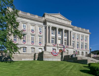
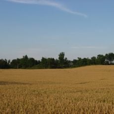
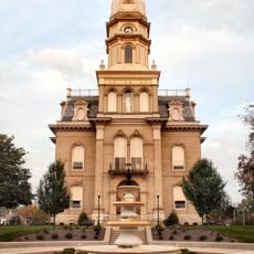
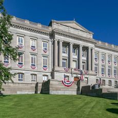
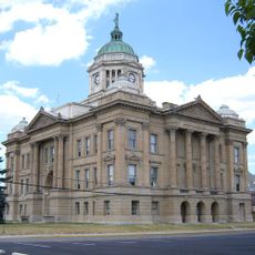
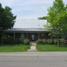
Hardin County is an administrative area in west central Ohio with a landscape of rural communities, small towns, and farmland spread across the region. Its county seat, Kenton, houses the courthouse and governmental offices that serve the area.

The county was created on February 12, 1820, when portions of Logan and Union counties were combined to form this new administrative division. This founding established governance for the growing rural communities in the region.

The Hardin County Fair draws residents annually to celebrate local farming traditions, handmade crafts, and the seasonal life of rural communities throughout the fairgrounds. Visitors experience firsthand how agriculture remains central to the region's identity and way of life.

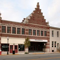
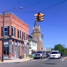
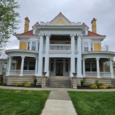
The county seat of Kenton serves as the hub for governmental services and is where the courthouse and administrative offices are located. Visitors can easily access public services and explore the downtown area that serves both town and surrounding communities.

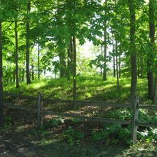
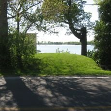
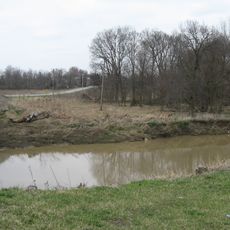
Eagle Creek State Nature Preserve protects natural habitats that are characteristic of this part of Ohio. This protected area gives visitors a look at the ecological systems and native landscapes that define the region's natural identity.

Location: Ohio

Inception: February 12, 1820

Capital city: Kenton

Shares border with: Allen County, Logan County, Auglaize County, Union County, Marion County, Wyandot County, Hancock County

Website: http://co.hardin.oh.us

GPS coordinates: 40.66000,-83.66000

Latest update: December 7, 2025 19:28

Photos
Around this place
Campbell Hill
United States of America

Campbell Hill

32.7 km
Indian Lake
United States of America

Indian Lake

28.1 km
J.H. Manchester Round Barn
United States of America

J.H. Manchester Round Barn

22.6 km
Zane Shawnee Caverns
United States of America

Zane Shawnee Caverns

32 km
Dunns Pond Mound
United States of America

Dunns Pond Mound

26.7 km
Zimmerman Kame
United States of America

Zimmerman Kame

16.6 km
Logan County Courthouse
United States of America

Logan County Courthouse

34.4 km
Schine Holland Theatre
United States of America

Schine Holland Theatre

34.3 km
Lake Ridge Island Mounds
United States of America

Lake Ridge Island Mounds

25.3 km
Hardin County Courthouse
United States of America

Hardin County Courthouse

4.5 km
William Lawrence House
United States of America

William Lawrence House

33.9 km
Kenton Public Library
United States of America

Kenton Public Library

4.4 km
Wyandot County Courthouse and Jail
United States of America

Wyandot County Courthouse and Jail

37 km
Hugh T. Rinehart House
United States of America

Hugh T. Rinehart House

32.2 km
Mount Victory Historic District
United States of America

Mount Victory Historic District

18.3 km
North Main-North Detroit Street Historic District
United States of America

North Main-North Detroit Street Historic District

4.6 km
Logan County History Center
United States of America

Logan County History Center

34.1 km
Ada Theatre
United States of America

Ada Theatre

18.3 km
The Lincoln Highway
United States of America

The Lincoln Highway

38 km
Old Sandusky Trail and Shawnee Ford
United States of America

Old Sandusky Trail and Shawnee Ford

14.3 km
Campbell Hill
United States of America

Campbell Hill

32.7 km
Knowlton Library
United States of America

Knowlton Library

34.1 km
Flatwoods Schoolhouse
United States of America

Flatwoods Schoolhouse

29.9 km
Hog-Creek Marsh
United States of America

Hog-Creek Marsh

14 km
Bickham Covered Bridge
United States of America

Bickham Covered Bridge

25.7 km
Sandy Beach Amusement Park
United States of America

Sandy Beach Amusement Park

28.8 km
Departure of the Wyandot Indians
United States of America

Departure of the Wyandot Indians

37.7 km
Ohio Northern University
United States of America

Ohio Northern University

18.1 km
Show the full map
Reviews

Visited this place? Tap the stars to rate it and share your experience / photos with the community! Try now! You can cancel it anytime.

« Hardin County - Administrative county in western Ohio, United States » is provided by Around Us (aroundus.com). Images and texts are derived from Wikimedia project under a Creative Commons license. You are allowed to copy, distribute, and modify copies of this page, under the conditions set by the license, as long as this note is clearly visible.

Discover hidden gems everywhere you go!

From secret cafés to breathtaking viewpoints, skip the crowded tourist spots and find places that match your style. Our app makes it easy with voice search, smart filtering, route optimization, and insider tips from travelers worldwide. Download now for the complete mobile experience.

Around Us App Screenshot

A unique approach to discovering new places

Le Figaro

All the places worth exploring

France Info

A tailor-made excursion in just a few clicks

20 Minutes