Chest opened
+${chestReward.xp} XP
Explorer
NOUVEAU ×${chestReward.collectible.quantity}
tapez pour fermer
Chest locked

Open chests in the app

Around Us is built for your phone — chests unlock when you walk, explore and capture nearby places.

Enable Location

We need your location to show you interesting places around you

Discover nearby places

Find interesting locations and hidden gems around you

Precise directions

Get accurate directions and distances to places

Your location is never shared with other users. It's only used when you tap the location button.

Log in to your account

Start exploring — it's free

Trusted by 72,898 travelers worldwide

Continue with Google
Continue with Apple
or

We will send you a code to connect

By continuing, you accept our Terms and Conditions and our Privacy Policy

Check your inbox

We've sent a pincode in your inbox. Please enter the code below.

Cataloochee
Discussion Reviews Photo
15.9k Popularity

Cataloochee, human settlement in North Carolina, United States of America

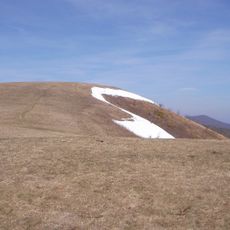
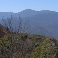
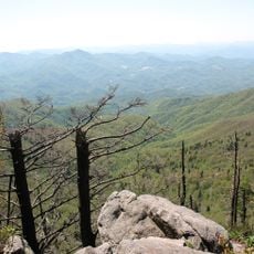
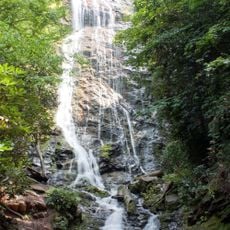
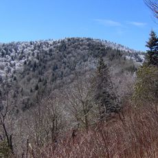
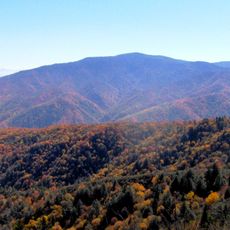
Cataloochee is a valley settlement in the Great Smoky Mountains of North Carolina within a large national park. The area is surrounded by tall mountain ridges, with three narrow valleys running side by side, and hosts around 200 elk that roam through the forested landscape.

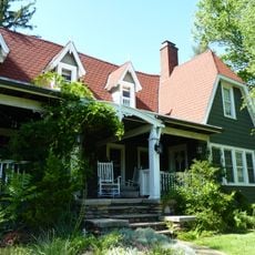
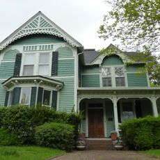
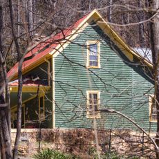
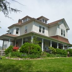
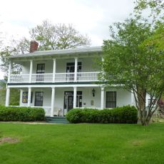
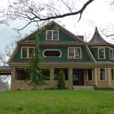
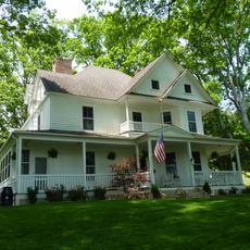
The Cherokee hunted in this valley for generations before European settlers arrived in the early 1800s and began farming the land. By the 1930s, the government created the national park and relocated residents, preserving some of their historic homes and structures that remain today.

The name Cataloochee comes from the Cherokee word Gadalutsi, meaning 'fringe standing erect', likely referring to the tall trees framing the valley ridges. Visitors can see old homes, churches, and cemeteries today that show how families built their lives in these mountains.

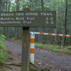
Getting here means driving winding gravel roads through the mountains, with the main route having steep sections without guardrails that require careful navigation. Arriving early helps with parking, and wearing sturdy shoes, bringing water, and protecting yourself from sun are important for enjoying the trails.

Elk, which had been hunted to extinction in these mountains, were reintroduced in recent years and now number around 200 in the valley. Visitors often encounter these large animals during fall and spring when they move through the forests and grasslands.

The community of curious travelers

AroundUs brings together thousands of curated places, local tips, and hidden gems, enriched daily by 60,000 contributors worldwide.

Start exploring
Location
GPS coordinates
35.63970,-83.08190
Latest update
February 19, 2026 23:00
Around this place
Ghost Town in the Sky
United States of America

Ghost Town in the Sky

12.5 km
Max Patch
United States of America

Max Patch

20.8 km
Mount Guyot
United States of America

Mount Guyot

17.5 km
Waterrock Knob
United States of America

Waterrock Knob

20.2 km
Mingo Falls
United States of America

Mingo Falls

21.2 km
Old Black
United States of America

Old Black

17.8 km
United States of America

Mount Chapman

17.9 km
Snake Den Ridge Trail
United States of America

Snake Den Ridge Trail

17.2 km
Frog Level Historic District
United States of America

Frog Level Historic District

18.2 km
United States of America

Lower Mount Cammerer Trail

16.7 km
Frank Smathers House
United States of America

Frank Smathers House

17.4 km
Boone-Withers House
United States of America

Boone-Withers House

18.6 km
Shook-Welch-Smathers House
United States of America

Shook-Welch-Smathers House

19.1 km
Davis Family House
United States of America

Davis Family House

10 km
Dr. J. Howell Way House
United States of America

Dr. J. Howell Way House

18.9 km
Waynesville Main Street Historic District
United States of America

Waynesville Main Street Historic District

18.2 km
United States of America

Mount Zion United Methodist Church

16.6 km
Masonic Hall
United States of America

Masonic Hall

18.7 km
Shackford Hall
United States of America

Shackford Hall

15.9 km
Charles and Annie Quinlan House
United States of America

Charles and Annie Quinlan House

19 km
Shelton House
United States of America

Shelton House

19.3 km
Haywood County Courthouse
United States of America

Haywood County Courthouse

18.5 km
Alden and Thomasene Howell House
United States of America

Alden and Thomasene Howell House

18.6 km
Clyde H. Ray Sr. House
United States of America

Clyde H. Ray Sr. House

17.9 km
Former Citizens Bank and Trust Company Building
United States of America

Former Citizens Bank and Trust Company Building

18.7 km
Mount Cammerer Fire Lookout
United States of America

Mount Cammerer Fire Lookout

15.5 km
Mount Sterling Tower
United States of America

Mount Sterling Tower

7.9 km
Mount Sterling
United States of America

Mount Sterling

7.8 km
Show the full map
Reviews
Share your experience

No review yet

Discussions
Start a discussion...

No discussion yet

« Cataloochee - human settlement in North Carolina, United States of America » is provided by Around Us (aroundus.com). Images and texts are derived from Wikimedia project under a Creative Commons license. You are allowed to copy, distribute, and modify copies of this page, under the conditions set by the license, as long as this note is clearly visible.

Discover hidden gems everywhere you go!

From secret cafés to breathtaking viewpoints, skip the crowded tourist spots and find places that match your style. Our app makes it easy with voice search, smart filtering, route optimization, and insider tips from travelers worldwide. Download now for the complete mobile experience.

Around Us App Screenshot

A unique approach to discovering new places

Le Figaro

All the places worth exploring

France Info

A tailor-made excursion in just a few clicks

20 Minutes

Around Us
Travel Guide & Maps
Download

Send to your phone

QR Code
1

Open the camera app on your mobile.

2

Point at the QR code with your camera. A notification will appear.

3

Tap the notification to open the link.