Chest opened
+${chestReward.xp} XP
Explorer
NOUVEAU ×${chestReward.collectible.quantity}
tapez pour fermer
Chest locked

Open chests in the app

Around Us is built for your phone — chests unlock when you walk, explore and capture nearby places.

Enable Location

We need your location to show you interesting places around you

Discover nearby places

Find interesting locations and hidden gems around you

Precise directions

Get accurate directions and distances to places

Your location is never shared with other users. It's only used when you tap the location button.

Log in to your account

Start exploring — it's free

Trusted by 72,901 travelers worldwide

Continue with Google
Continue with Apple
or

We will send you a code to connect

By continuing, you accept our Terms and Conditions and our Privacy Policy

Check your inbox

We've sent a pincode in your inbox. Please enter the code below.

Frankford
Discussion Reviews Photo
2.4k Popularity

Frankford, Residential neighborhood in Northeast Philadelphia, United States

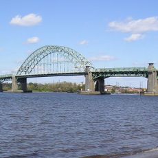
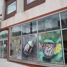
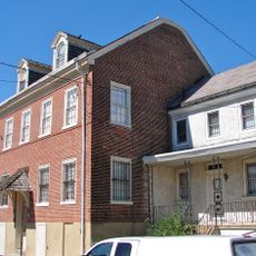
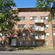
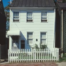
Frankford is a residential neighborhood in Northeast Philadelphia stretching across a significant area bounded by local waterways and major avenues. The area consists mainly of single-family homes, row houses, and smaller apartment buildings interspersed with corner stores and community facilities.

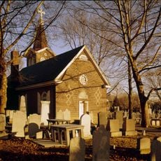
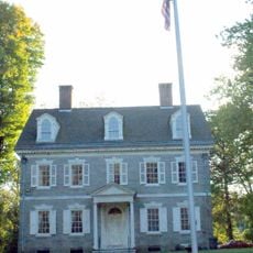
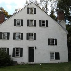
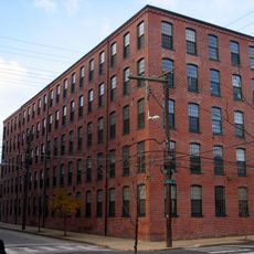
The area was founded by Quaker settlers in the late 17th century and later became an industrial center with mills and manufacturing facilities. Industrial growth shaped its expansion throughout the 19th and 20th centuries.

The neighborhood reflects waves of immigration, with Irish, Polish, African American, and Hispanic families shaping local businesses, food, and street celebrations. Residents actively gather in public spaces throughout the year, creating a strong sense of community identity.

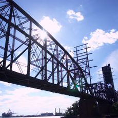
The neighborhood connects easily to Philadelphia's transportation network through multiple bus routes and rapid transit services. A central transit hub provides convenient transfers to reach other parts of the city.

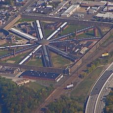
The neighborhood once housed a major munitions factory that operated at massive scale during World War II, producing critical supplies for the war effort. This facility was a dominant employer that shaped the lives of thousands of local residents for several decades.

The community of curious travelers

AroundUs brings together thousands of curated places, local tips, and hidden gems, enriched daily by 60,000 contributors worldwide.

Start exploring
Location
GPS coordinates
40.01580,-75.07470
Latest update
March 5, 2026 21:07
Around this place
Holmesburg Prison
United States of America

Holmesburg Prison

5.3 km
Betsy Ross Bridge
United States of America

Betsy Ross Bridge

3.4 km
Tacony–Palmyra Bridge
United States of America

Tacony–Palmyra Bridge

2.7 km
Frankford Avenue Bridge
United States of America

Frankford Avenue Bridge

5.5 km
Delair Bridge
United States of America

Delair Bridge

3.8 km
Insectarium
United States of America

Insectarium

5.1 km
John Ruan House
United States of America

John Ruan House

1.5 km
Ryerss Mansion
United States of America

Ryerss Mansion

6 km
Carl Mackley Houses
United States of America

Carl Mackley Houses

2.1 km
Old Trinity Church
United States of America

Old Trinity Church

4.4 km
Upsala
United States of America

Upsala

6.2 km
Rowland House
United States of America

Rowland House

5.2 km
Adams Avenue Bridge
United States of America

Adams Avenue Bridge

4.4 km
Beatty's Mills Factory Building
United States of America

Beatty's Mills Factory Building

5.8 km
Andrew J. Morrison School
United States of America

Andrew J. Morrison School

5 km
Tacony Music Hall
United States of America

Tacony Music Hall

2.9 km
David Wilmot School
United States of America

David Wilmot School

622 m
Frankford Friends Meeting House
United States of America

Frankford Friends Meeting House

964 m
Comly Rich House
United States of America

Comly Rich House

1.2 km
Griffith Morgan House
United States of America

Griffith Morgan House

3.6 km
St. Josaphat Ukrainian Catholic Church, Philadelphia
United States of America

St. Josaphat Ukrainian Catholic Church, Philadelphia

3 km
William W. Axe School
United States of America

William W. Axe School

907 m
David Farragut School
United States of America

David Farragut School

6.1 km
Feltonville School No. 2
United States of America

Feltonville School No. 2

4.2 km
Kensington Branch of the Philadelphia YWCA
United States of America

Kensington Branch of the Philadelphia YWCA

5.3 km
Fisher's Lane Bridge
United States of America

Fisher's Lane Bridge

2.5 km
Lithuanian Hall (Philadelphia, Pennsylvania)
United States of America

Lithuanian Hall (Philadelphia, Pennsylvania)

4.3 km
Riverton Historic District
United States of America

Riverton Historic District

5.2 km
Show the full map
Reviews
Share your experience

No review yet

Discussions
Start a discussion...

No discussion yet

« Frankford - Residential neighborhood in Northeast Philadelphia, United States » is provided by Around Us (aroundus.com). Images and texts are derived from Wikimedia project under a Creative Commons license. You are allowed to copy, distribute, and modify copies of this page, under the conditions set by the license, as long as this note is clearly visible.

Discover hidden gems everywhere you go!

From secret cafés to breathtaking viewpoints, skip the crowded tourist spots and find places that match your style. Our app makes it easy with voice search, smart filtering, route optimization, and insider tips from travelers worldwide. Download now for the complete mobile experience.

Around Us App Screenshot

A unique approach to discovering new places

Le Figaro

All the places worth exploring

France Info

A tailor-made excursion in just a few clicks

20 Minutes

Around Us
Travel Guide & Maps
Download

Send to your phone

QR Code
1

Open the camera app on your mobile.

2

Point at the QR code with your camera. A notification will appear.

3

Tap the notification to open the link.