Chest opened
+${chestReward.xp} XP
Explorer
NOUVEAU ×${chestReward.collectible.quantity}
tapez pour fermer
Chest locked

Open chests in the app

Around Us is built for your phone — chests unlock when you walk, explore and capture nearby places.

Enable Location

We need your location to show you interesting places around you

Discover nearby places

Find interesting locations and hidden gems around you

Precise directions

Get accurate directions and distances to places

Your location is never shared with other users. It's only used when you tap the location button.

Lordstown

Log in to your account

Start exploring — it's free

Trusted by 72,881 travelers worldwide

Continue with Google
Continue with Apple
or

We will send you a code to connect

By continuing, you accept our Terms and Conditions and our Privacy Policy

Check your inbox

We've sent a pincode in your inbox. Please enter the code below.

Discussion Reviews 1 Photos
19.1k Popularity

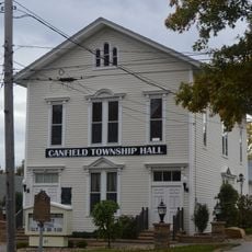
Lordstown, Village in Trumbull County, Ohio, United States of America

Lordstown is a small town in southern Ohio near Youngstown and Warren. The community spans roughly 23 square miles with mostly flat land and open spaces surrounding modest homes and small businesses.

Founded in the 1700s from surveyed land, Lordstown became officially separate as a village in the 1970s. The town later gained prominence through the Lordstown Assembly factory, which produced cars for decades until its closure in 2019, after which new manufacturers moved in.

The town is named after Samuel P. Lord, who helped plan the area in its early days. It holds a strong working-class identity that remains visible in how residents gather for local events and share stories about the factory era and its impact on their community.

Weekdays offer the quietest experience for exploring, with less traffic and easier access to local spots. A car is the most practical way to get around, as the town is built around automobile travel and most destinations are easily reachable by road.

After the factory closed in 2019, new manufacturers took over the site to produce electric vehicles and batteries. This transformation reveals how the town has adapted to economic shifts while preserving its working-class roots and finding new purpose.

The community of curious travelers

AroundUs brings together thousands of curated places, local tips, and hidden gems, enriched daily by 60,000 contributors worldwide.

Start exploring
Location
Elevation above the sea
290 m
GPS coordinates
41.17167,-80.86667
Latest update
February 16, 2026 23:01
Around this place
Beeghly Center
United States of America

Beeghly Center

19.6 km
Idora Park
United States of America

Idora Park

18.8 km
Stambaugh Stadium
United States of America

Stambaugh Stadium

19.5 km
Butler Institute of American Art
United States of America

Butler Institute of American Art

19.9 km
Stambaugh Auditorium
United States of America

Stambaugh Auditorium

19.1 km
National McKinley Birthplace Memorial
United States of America

National McKinley Birthplace Memorial

8.5 km
Powers Auditorium
United States of America

Powers Auditorium

19.5 km
Mill Creek Park Suspension Bridge
United States of America

Mill Creek Park Suspension Bridge

18.5 km
Basilica and National Shrine of Our Lady of Lebanon
United States of America

Basilica and National Shrine of Our Lady of Lebanon

6 km
United States of America

Youngstown Historical Center of Industry and Labor

19.6 km
Chalker High School
United States of America

Chalker High School

17.1 km
Austintown Log House
United States of America

Austintown Log House

16.6 km
Newton Falls Covered Bridge
United States of America

Newton Falls Covered Bridge

9 km
Judge William Shaw Anderson House
United States of America

Judge William Shaw Anderson House

9.5 km
Harriet Taylor Upton House
United States of America

Harriet Taylor Upton House

8.4 km
Wick Building
United States of America

Wick Building

19.8 km
George J. Renner, Jr. House
United States of America

George J. Renner, Jr. House

19.3 km
Westside Bowl
United States of America

Westside Bowl

16.1 km
Masonic Temple
United States of America

Masonic Temple

19.9 km
YWCA Youngstown
United States of America

YWCA Youngstown

19.8 km
Arlington Avenue District
United States of America

Arlington Avenue District

19.3 km
Niles Masonic Temple
United States of America

Niles Masonic Temple

8.5 km
Dog Beach
United States of America

Dog Beach

17 km
Medici Museum of Art
United States of America

Medici Museum of Art

14.1 km
Youngstown Historical Center of Industry & Labor
United States of America

Youngstown Historical Center of Industry & Labor

19.6 km
Idora Park Experience
United States of America

Idora Park Experience

14.2 km
Metropolitan Tower
United States of America

Metropolitan Tower

19.8 km
Canfield Township Hall
United States of America

Canfield Township Hall

18.7 km
Show the full map
Reviews
Share your experience

No review yet

Discussions
Start a discussion...

No discussion yet

« Lordstown - Village in Trumbull County, Ohio, United States of America » is provided by Around Us (aroundus.com). Images and texts are derived from Wikimedia project under a Creative Commons license. You are allowed to copy, distribute, and modify copies of this page, under the conditions set by the license, as long as this note is clearly visible.

Discover hidden gems everywhere you go!

From secret cafés to breathtaking viewpoints, skip the crowded tourist spots and find places that match your style. Our app makes it easy with voice search, smart filtering, route optimization, and insider tips from travelers worldwide. Download now for the complete mobile experience.

Around Us App Screenshot

A unique approach to discovering new places

Le Figaro

All the places worth exploring

France Info

A tailor-made excursion in just a few clicks

20 Minutes

Around Us
Travel Guide & Maps
Download

Send to your phone

QR Code
1

Open the camera app on your mobile.

2

Point at the QR code with your camera. A notification will appear.

3

Tap the notification to open the link.