Bartholomew's Cobble

Log in to your account

AroundUs is a community-driven map of interesting places, built by curious explorers like you. It grows with every review, story, and photo you share.
Connect to save your favorite spots, contribute locations, and create personalized routes.
Continue with Google
Continue with Apple
Continue with X
Continue with Facebook
Continue with email
By continuing, you accept our Terms and Conditions and our Privacy Policy
Create an account
Add to collection
Map
Suggest a change
Share

Bartholomew's Cobble, Nature reserve and National Natural Landmark in Berkshire County, US.

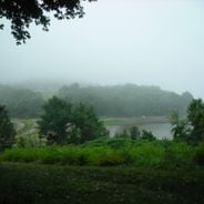
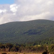
Bartholomew's Cobble is a 329-acre nature reserve in Berkshire County with two rocky hilltops and river floodplains along the Konkapot and Housatonic Rivers. The land includes open meadows, pastures, and stream valleys that create a mosaic of different habitats.

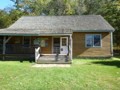
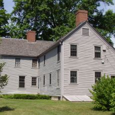
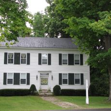
The land was originally part of a large colonial property before George Bartholomew developed and farmed it in the early 1800s. These two periods of ownership shaped how the landscape looks and functions today.

The meadows and pastures reflect a long tradition of land stewardship that shapes how the reserve looks and functions today. Visitors notice how this managed landscape continues to support both agriculture and wild species in harmony.

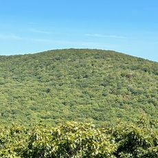
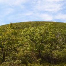
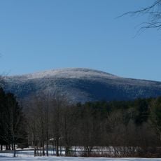
About five miles of moderate hiking trails wind through different habitats and reach Hurlburt's Hill at the highest point. The trails suit visitors of various fitness levels with different difficulty options throughout.

The reserve holds the largest diversity of fern species in North America and supports one of Massachusetts' largest populations of bobolinks. This combination makes it an unusually rich habitat for these specialized creatures.

Location: Berkshire County

GPS coordinates: 42.05720,-73.35080

Latest update: December 6, 2025 17:41

Photos
Hidden Massachusetts: natural sites, heritage and architecture

Massachusetts offers a range of locations beyond Boston and Cape Cod that receive fewer visitors. In the western part of the state, stone tower lookouts rise above forested hills, while waterfalls are located within state forests. Historic buildings from the 19th century stand in smaller...

Around this place
Mount Frissell
United States of America

Mount Frissell

10.9 km
Bear Mountain
United States of America

Bear Mountain

8.7 km
Mount Everett
United States of America

Mount Everett

8.4 km
Brace Mountain
United States of America

Brace Mountain

11.8 km
Colonel John Ashley House
United States of America

Colonel John Ashley House

525 m
Mount Everett State Reservation
United States of America

Mount Everett State Reservation

8.4 km
Great Falls
United States of America

Great Falls

10.7 km
South Taconic Trail
United States of America

South Taconic Trail

11.8 km
Old Covered Bridge
United States of America

Old Covered Bridge

7.4 km
Mount Riga State Park
United States of America

Mount Riga State Park

7.3 km
Campbell Falls State Park Reserve
United States of America

Campbell Falls State Park Reserve

10.4 km
United States of America

Round Mountain

10.4 km
Scoville Library
United States of America

Scoville Library

10.4 km
Blackberry River Inn
United States of America

Blackberry River Inn

10.7 km
Beckley Furnace Industrial Monument
United States of America

Beckley Furnace Industrial Monument

7 km
Mill River Historic District
United States of America

Mill River Historic District

9.3 km
Mount Riga Ironworks
United States of America

Mount Riga Ironworks

11.3 km
South Canaan Congregational Church
United States of America

South Canaan Congregational Church

10.7 km
Sheffield Plain Historic District
United States of America

Sheffield Plain Historic District

7.3 km
Sheffield Center Historic District
United States of America

Sheffield Center Historic District

5.4 km
Salisbury Center Historic District
United States of America

Salisbury Center Historic District

10.2 km
Isaac Lawrence House
United States of America

Isaac Lawrence House

4.3 km
John C. Coffing House
United States of America

John C. Coffing House

10.9 km
Westover-Bacon-Potts Farm
United States of America

Westover-Bacon-Potts Farm

11.5 km
Holabird House
United States of America

Holabird House

11.5 km
General John and Mary Fellows Farmstead
United States of America

General John and Mary Fellows Farmstead

4 km
Mount Race
United States of America

Mount Race

7.3 km
Falls Village District
United States of America

Falls Village District

11.3 km
Show the full map
Reviews

Visited this place? Tap the stars to rate it and share your experience / photos with the community! Try now! You can cancel it anytime.

« Bartholomew's Cobble - Nature reserve and National Natural Landmark in Berkshire County, US » is provided by Around Us (aroundus.com). Images and texts are derived from Wikimedia project under a Creative Commons license. You are allowed to copy, distribute, and modify copies of this page, under the conditions set by the license, as long as this note is clearly visible.

Discover hidden gems everywhere you go!

From secret cafés to breathtaking viewpoints, skip the crowded tourist spots and find places that match your style. Our app makes it easy with voice search, smart filtering, route optimization, and insider tips from travelers worldwide. Download now for the complete mobile experience.

Around Us App Screenshot

A unique approach to discovering new places

Le Figaro

All the places worth exploring

France Info

A tailor-made excursion in just a few clicks

20 Minutes