Enable Location

We need your location to show you interesting places around you

Discover nearby places

Find interesting locations and hidden gems around you

Precise directions

Get accurate directions and distances to places

Your location is never shared with other users. It's only used when you tap the location button.

Mount Everett State Reservation

Log in to your account

Start exploring — it's free

Trusted by 61,580 travelers worldwide

Continue with Google
Continue with Apple
or

We will send you a code to connect

By continuing, you accept our Terms and Conditions and our Privacy Policy

Check your inbox

We've sent a pincode in your inbox. Please enter the code below.

Mount Everett State Reservation

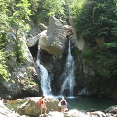
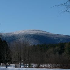
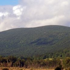
Mount Everett State Reservation, State park in Mount Washington, Massachusetts.

Description

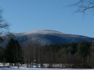
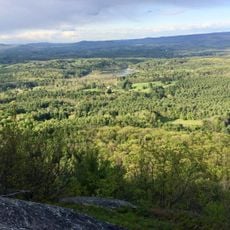
Mount Everett State Reservation is a protected area in western Massachusetts featuring a summit at about 2,624 feet in elevation. The reservation includes multiple hiking trails accessible from East Street, with the main parking area located at the nearby state forest headquarters.

History

The reservation was established through Massachusetts conservation efforts aimed at protecting regional forests and natural areas. These protection measures helped create connected wilderness corridors that preserve the landscape for future generations.

Culture

The Appalachian Trail passes through the reservation and links hikers to a major long-distance hiking route that crosses the eastern United States. This connection makes the place important for people who hike across multiple states and regions.

Practical

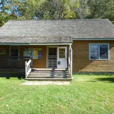
Access the trails from multiple starting points along East Street, with free parking available at Mount Washington State Forest headquarters. Plan your visit between sunrise and sunset when the grounds are fully accessible.

Did you know?

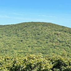
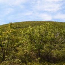
The summit area contains a rare dwarf pitch pine and scrub oak forest that thrives in high-elevation conditions. This specialized plant community adapted to strong winds and shallow soil creates a landscape quite different from surrounding forests.

Location
GPS coordinates
42.10160,-73.43270
Latest update
December 12, 2025 07:54

AroundUs brings together thousands of curated places, local tips, and hidden gems, enriched daily by 60,000 contributors worldwide. Discover all places nearby (Massachusetts).

Around this place
Bash Bish Falls
United States of America

Bash Bish Falls

5.2 km
Mount Frissell
United States of America

Mount Frissell

6.9 km
Bear Mountain
United States of America

Bear Mountain

6.6 km
Bash Bish Falls State Park
United States of America

Bash Bish Falls State Park

5.5 km
Mount Everett
United States of America

Mount Everett

24 m
Bartholomew's Cobble
United States of America

Bartholomew's Cobble

8.4 km
W.E.B. Du Bois Boyhood Homesite
United States of America

W.E.B. Du Bois Boyhood Homesite

9.1 km
Brace Mountain
United States of America

Brace Mountain

8.1 km
Mount Washington State Forest
United States of America

Mount Washington State Forest

5.1 km
Colonel John Ashley House
United States of America

Colonel John Ashley House

7.9 km
South Taconic Trail
United States of America

South Taconic Trail

8.1 km
Old Covered Bridge
United States of America

Old Covered Bridge

6.9 km
Jug End State Reservation and Wildlife Management Area
United States of America

Jug End State Reservation and Wildlife Management Area

5.3 km
Mount Riga State Park
United States of America

Mount Riga State Park

7.4 km
United States of America

Round Mountain

6.9 km
Copake Iron Works Historic District
United States of America

Copake Iron Works Historic District

7 km
Church of St. John in the Wilderness
United States of America

Church of St. John in the Wilderness

7.4 km
Benjamin Osborn House
United States of America

Benjamin Osborn House

3.5 km
Sheffield Plain Historic District
United States of America

Sheffield Plain Historic District

6.8 km
South Egremont Village Historic District
United States of America

South Egremont Village Historic District

6.5 km
Copake Memorial Clock
United States of America

Copake Memorial Clock

9.6 km
Sheffield Center Historic District
United States of America

Sheffield Center Historic District

6.6 km
North Chatham Historic District
United States of America

North Chatham Historic District

7 km
Columbia Turnpike-East Tollhouse
United States of America

Columbia Turnpike-East Tollhouse

10.4 km
Westover-Bacon-Potts Farm
United States of America

Westover-Bacon-Potts Farm

5.3 km
Wheeler Family Farmstead
United States of America

Wheeler Family Farmstead

10.3 km
General John and Mary Fellows Farmstead
United States of America

General John and Mary Fellows Farmstead

5.3 km
Mount Race
United States of America

Mount Race

2.2 km
Show the full map
« Mount Everett State Reservation - State park in Mount Washington, Massachusetts » is provided by Around Us (aroundus.com). Images and texts are derived from Wikimedia project under a Creative Commons license. You are allowed to copy, distribute, and modify copies of this page, under the conditions set by the license, as long as this note is clearly visible.

Discover hidden gems everywhere you go!

From secret cafés to breathtaking viewpoints, skip the crowded tourist spots and find places that match your style. Our app makes it easy with voice search, smart filtering, route optimization, and insider tips from travelers worldwide. Download now for the complete mobile experience.

Around Us App Screenshot

A unique approach to discovering new places

Le Figaro

All the places worth exploring

France Info

A tailor-made excursion in just a few clicks

20 Minutes

Around Us
Travel Guide & Maps
Download

Send to your phone

QR Code
1

Open the camera app on your mobile.

2

Point at the QR code with your camera. A notification will appear.

3

Tap the notification to open the link.