Copake Iron Works Historic District

Log in to your account

AroundUs is a community-driven map of interesting places, built by curious explorers like you. It grows with every review, story, and photo you share.
Connect to save your favorite spots, contribute locations, and create personalized routes.
Continue with Google
Continue with Apple
Continue with X
Continue with Facebook
Continue with email
By continuing, you accept our Terms and Conditions and our Privacy Policy
Create an account
Add to collection
Map
Suggest a change
Share

Copake Iron Works Historic District, Industrial heritage site in Copake Falls, New York, US.

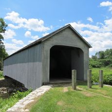
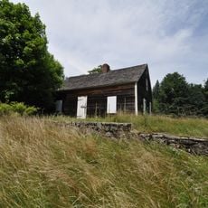
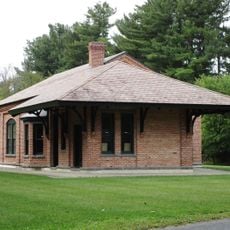
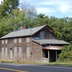
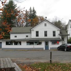
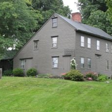
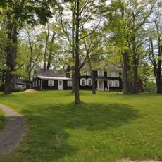
The Copake Iron Works Historic District is an industrial heritage site in Copake Falls, New York, containing 11 buildings, a charcoal blast furnace, workers' houses, and a Greek Revival residence across about 30 acres. The grounds stretch along a stream and include workshops, storage areas, and residential quarters that show the full scope of 19th-century iron production operations.

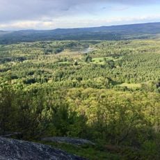
The iron works were founded in 1845 along a stream and operated until the late 1800s as a major production center for the country's industrial needs. The site played an important role in early American industrialization and was an economic hub in this rural region.

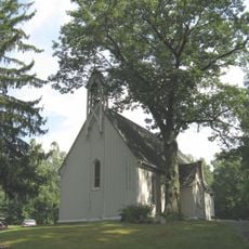
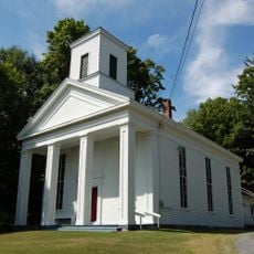
The district preserves structures from multiple architectural periods, including a brick engine house, pattern shop, and the Church of St. John in the Wilderness. These buildings show how people lived and worked together while producing iron for a growing nation.

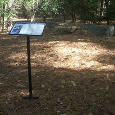
Visitors can explore the site through self-guided tours from dawn to dusk, with access to trails and an educational museum. Sturdy shoes and weather-appropriate clothing are advisable since the grounds contain both developed and natural areas.

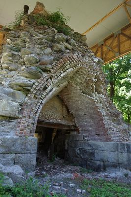
The site preserves original industrial production equipment from the 19th century, including a rare blast furnace from 1872. These well-maintained machines still show how workers of that era forged and processed iron.

Location: New York

GPS coordinates: 42.11929,-73.51379

Latest update: December 14, 2025 18:10

Photos
Around this place
Bash Bish Falls
United States of America

Bash Bish Falls

1.7 km
Mount Frissell
United States of America

Mount Frissell

8 km
Bear Mountain
United States of America

Bear Mountain

9.6 km
Bash Bish Falls State Park
United States of America

Bash Bish Falls State Park

1.5 km
Mount Everett
United States of America

Mount Everett

7 km
W.E.B. Du Bois Boyhood Homesite
United States of America

W.E.B. Du Bois Boyhood Homesite

11.9 km
Brace Mountain
United States of America

Brace Mountain

8.5 km
Mount Washington State Forest
United States of America

Mount Washington State Forest

3.7 km
Mount Everett State Reservation
United States of America

Mount Everett State Reservation

7 km
South Taconic Trail
United States of America

South Taconic Trail

8.5 km
Old Covered Bridge
United States of America

Old Covered Bridge

13.1 km
Jug End State Reservation and Wildlife Management Area
United States of America

Jug End State Reservation and Wildlife Management Area

6.1 km
Mount Riga State Park
United States of America

Mount Riga State Park

11.4 km
United States of America

Round Mountain

8.4 km
Church of St. John in the Wilderness
United States of America

Church of St. John in the Wilderness

466 m
Benjamin Osborn House
United States of America

Benjamin Osborn House

3.6 km
Sheffield Plain Historic District
United States of America

Sheffield Plain Historic District

13.1 km
South Egremont Village Historic District
United States of America

South Egremont Village Historic District

9.5 km
Hillsdale Hamlet Historic District
United States of America

Hillsdale Hamlet Historic District

6.8 km
Copake Memorial Clock
United States of America

Copake Memorial Clock

3.4 km
North Chatham Historic District
United States of America

North Chatham Historic District

0 m
Columbia Turnpike-East Tollhouse
United States of America

Columbia Turnpike-East Tollhouse

7.5 km
North Egremont Historic District
United States of America

North Egremont Historic District

10.7 km
Westover-Bacon-Potts Farm
United States of America

Westover-Bacon-Potts Farm

8.6 km
General John and Mary Fellows Farmstead
United States of America

General John and Mary Fellows Farmstead

11.5 km
Copake Country Club
United States of America

Copake Country Club

8.5 km
Mount Race
United States of America

Mount Race

7.9 km
North Hillsdale Methodist Church
United States of America

North Hillsdale Methodist Church

13.2 km
Show the full map
Reviews

Visited this place? Tap the stars to rate it and share your experience / photos with the community! Try now! You can cancel it anytime.

« Copake Iron Works Historic District - Industrial heritage site in Copake Falls, New York, US » is provided by Around Us (aroundus.com). Images and texts are derived from Wikimedia project under a Creative Commons license. You are allowed to copy, distribute, and modify copies of this page, under the conditions set by the license, as long as this note is clearly visible.

Discover hidden gems everywhere you go!

From secret cafés to breathtaking viewpoints, skip the crowded tourist spots and find places that match your style. Our app makes it easy with voice search, smart filtering, route optimization, and insider tips from travelers worldwide. Download now for the complete mobile experience.

Around Us App Screenshot

A unique approach to discovering new places

Le Figaro

All the places worth exploring

France Info

A tailor-made excursion in just a few clicks

20 Minutes