Chest opened
+${chestReward.xp} XP
Explorer
NOUVEAU ×${chestReward.collectible.quantity}
tapez pour fermer
Chest locked

Open chests in the app

Around Us is built for your phone — chests unlock when you walk, explore and capture nearby places.

Enable Location

We need your location to show you interesting places around you

Discover nearby places

Find interesting locations and hidden gems around you

Precise directions

Get accurate directions and distances to places

Your location is never shared with other users. It's only used when you tap the location button.

Log in to your account

Start exploring — it's free

Trusted by 72,993 travelers worldwide

Continue with Google
Continue with Apple
or

We will send you a code to connect

By continuing, you accept our Terms and Conditions and our Privacy Policy

Check your inbox

We've sent a pincode in your inbox. Please enter the code below.

Foot Hills State Forest
Discussion Reviews Photo
1.8k Popularity

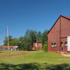
Foot Hills State Forest, State forest in Cass County, Minnesota, US

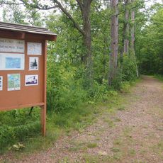
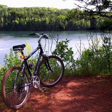
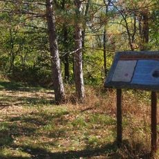
Foot Hills State Forest is a large woodland area spanning roughly 47,000 acres across Cass and Hubbard counties in Minnesota. The landscape combines northern hardwood forests with scattered small lakes and a system of trails for different recreational activities.

This forest was established in 1931 following intensive logging that took place in the early twentieth century. Protected patches of older red pine and black ash trees still grow in certain sections today.

The forest serves multiple purposes through shared management between Minnesota Department of Natural Resources, Cass County, and private landowners under conservation agreements.

The forest provides roughly 64 kilometers of trails for off-road vehicles, additional paths for hiking, and groomed routes for cross-country skiing during winter months. Visitors should prepare for seasonal changes and bring gear suited to the conditions they will encounter.

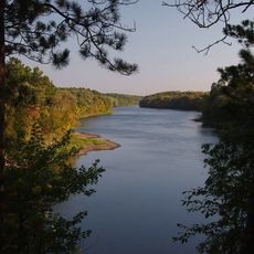
Glacial deposits shaped the landscape into a network of small depressions and scattered lakes that formed naturally over time. These water features now provide important habitats for great blue herons and beavers.

The community of curious travelers

AroundUs brings together thousands of curated places, local tips, and hidden gems, enriched daily by 60,000 contributors worldwide.

Start exploring
Location
Location
GPS coordinates
46.67996,-94.68418
Latest update
December 14, 2025 12:23
Around this place
Brainerd International Raceway
United States of America

Brainerd International Raceway

43 km
Milford Mine
United States of America

Milford Mine

56.9 km
Crow Wing State Park
United States of America

Crow Wing State Park

52.8 km
Cuyuna Country State Recreation Area
United States of America

Cuyuna Country State Recreation Area

58.1 km
Grand View Lodge
United States of America

Grand View Lodge

35.1 km
Minnesota State Sanatorium for Consumptives
United States of America

Minnesota State Sanatorium for Consumptives

44.3 km
Brainerd Water Tower
United States of America

Brainerd Water Tower

51.6 km
Old Wadena Historic District
United States of America

Old Wadena Historic District

30.8 km
Crow Wing County Courthouse and Jail
United States of America

Crow Wing County Courthouse and Jail

51.6 km
Brainerd Public Library
United States of America

Brainerd Public Library

51.6 km
Badoura State Forest
United States of America

Badoura State Forest

17.8 km
Wilford H. Fawcett House
United States of America

Wilford H. Fawcett House

37.8 km
Finn Creek Museum
United States of America

Finn Creek Museum

55.6 km
Hewitt Public School
United States of America

Hewitt Public School

49.8 km
Franklin Junior High School
United States of America

Franklin Junior High School

51.8 km
Nevis Tiger Muskie
United States of America

Nevis Tiger Muskie

33.9 km
Almond A. White House
United States of America

Almond A. White House

38.4 km
Parker Building
United States of America

Parker Building

51.8 km
Minnesota Highway 371 Bridge
United States of America

Minnesota Highway 371 Bridge

51.9 km
Hubbard County Courthouse
United States of America

Hubbard County Courthouse

39.4 km
Cole Memorial Building
United States of America

Cole Memorial Building

29.5 km
Washington Street Bridge
United States of America

Washington Street Bridge

50.9 km
Ironton Sintering Plant Complex
United States of America

Ironton Sintering Plant Complex

58.3 km
Pequot Fire Lookout Tower
United States of America

Pequot Fire Lookout Tower

30.8 km
Nimrod Fire Tower
United States of America

Nimrod Fire Tower

14.6 km
Northern Pacific Railroad Shops Historic District
United States of America

Northern Pacific Railroad Shops Historic District

52.4 km
Leisure Suites
United States of America

Leisure Suites

36.9 km
Badoura Lookout Tower
United States of America

Badoura Lookout Tower

20.4 km
Show the full map
Reviews
Share your experience

No review yet

Discussions
Start a discussion...

No discussion yet

« Foot Hills State Forest - State forest in Cass County, Minnesota, US » is provided by Around Us (aroundus.com). Images and texts are derived from Wikimedia project under a Creative Commons license. You are allowed to copy, distribute, and modify copies of this page, under the conditions set by the license, as long as this note is clearly visible.

Discover hidden gems everywhere you go!

From secret cafés to breathtaking viewpoints, skip the crowded tourist spots and find places that match your style. Our app makes it easy with voice search, smart filtering, route optimization, and insider tips from travelers worldwide. Download now for the complete mobile experience.

Around Us App Screenshot

A unique approach to discovering new places

Le Figaro

All the places worth exploring

France Info

A tailor-made excursion in just a few clicks

20 Minutes

Around Us
Travel Guide & Maps
Download

Send to your phone

QR Code
1

Open the camera app on your mobile.

2

Point at the QR code with your camera. A notification will appear.

3

Tap the notification to open the link.