Fincastle County, Former administrative territory in Virginia, United States
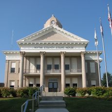
Fincastle County was a historical administrative territory in Virginia that stretched from the New River to the Mississippi River, encompassing much of present-day Kentucky and parts of West Virginia. Its administrative center was located in the Lead Mines area of what is now Wythe County, where the community of Austinville later developed.
The territory was separated from Botetourt County in 1772 and had a brief existence. In 1776 it was divided into Montgomery, Washington, and Kentucky counties.
The Fincastle Resolutions of 1775 showed how residents of the territory expressed their desire for independence from British rule. These political declarations reflected the will of local people to break free from overseas control.
Those interested in learning about this historical region can find records and information in Southwest Virginia archives and in communities like Austinville. The warmer months are best for exploring the areas where the territory once existed.
Land in this territory was frequently granted as payment to veterans of the French and Indian War, leading to the establishment of early settlements in Kentucky. These grants played an important role in opening the region to European settlement.
The community of curious travelers
AroundUs brings together thousands of curated places, local tips, and hidden gems, enriched daily by 60,000 contributors worldwide.