Fort Carroll Light

Log in to your account

AroundUs is a community-driven map of interesting places, built by curious explorers like you. It grows with every review, story, and photo you share.
Connect to save your favorite spots, contribute locations, and create personalized routes.
Continue with Google
Continue with Apple
Continue with X
Continue with Facebook
Continue with email
By continuing, you accept our Terms and Conditions and our Privacy Policy
Create an account
Add to collection
Map
Suggest a change
Share

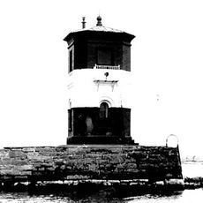
Fort Carroll Light, Wooden lighthouse in Sparrows Point, Baltimore County, US

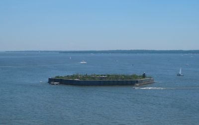
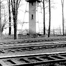
Fort Carroll Light is a wooden lighthouse with a short square tower structure positioned on the walls of a hexagonal fortification in the Patapsco River near Baltimore. The tower sits within the fortress, which occupies an artificial island built to defend the harbor entrance.

The original structure was built in 1854 to help guide ships through the Patapsco River, but it was completely rebuilt in 1900 to fit within the modernized fort. After this reconstruction, it continued serving ships heading toward Baltimore Harbor until becoming inactive in 1964.

A lighthouse keeper once lived alone on this artificial island, maintaining both the light and fog signals as the sole resident of the fortification. This isolated existence shaped daily life on the fortress and made it a symbol of human perseverance in remote posts.

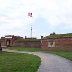
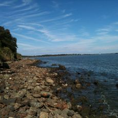
The structure has been inactive for many decades and cannot be visited by the public due to its remote location on the decaying artificial island. You can view it from the mainland if you visit the surrounding area, though access to the island itself is restricted.

The tower was relocated multiple times during various fort modifications and finally settled in its central position on the fortress walls in 1900. These relocations make it an unusual example of a maritime structure that moved with the changing needs of the fortification.

Location: Baltimore County

GPS coordinates: 39.21470,-76.51990

Latest update: December 13, 2025 12:42

Photos
Around this place
Fort McHenry
United States of America

Fort McHenry

7.5 km
NS Savannah
United States of America

NS Savannah

5.8 km
Francis Scott Key Bridge
United States of America

Francis Scott Key Bridge

769 m
SS John W. Brown
United States of America

SS John W. Brown

7.3 km
Fort Carroll
United States of America

Fort Carroll

61 m
Patterson Park
United States of America

Patterson Park

9.7 km
Fort Howard
United States of America

Fort Howard

6.8 km
Baltimore Museum of Industry
United States of America

Baltimore Museum of Industry

9.6 km
Fort Smallwood Park
United States of America

Fort Smallwood Park

6.7 km
Hanover Street Bridge
United States of America

Hanover Street Bridge

9.6 km
Silo Point
United States of America

Silo Point

8.7 km
Baltimore
United States of America

Baltimore

9.6 km
Coca-Cola Baltimore Branch Factory
United States of America

Coca-Cola Baltimore Branch Factory

9 km
Orpheus with the Awkward Foot
United States of America

Orpheus with the Awkward Foot

7.7 km
Todd Farmhouse
United States of America

Todd Farmhouse

7 km
Polish Home Hall
United States of America

Polish Home Hall

6.2 km
Lazaretto Point Light
United States of America

Lazaretto Point Light

6.9 km
Christ United Church of Christ
United States of America

Christ United Church of Christ

9 km
Craighill Channel Upper Range Front Light
United States of America

Craighill Channel Upper Range Front Light

6.5 km
Craighill Channel Upper Range Rear Light
United States of America

Craighill Channel Upper Range Rear Light

4.9 km
North Point State Park
United States of America

North Point State Park

7.5 km
Statue of John O'Donnell
United States of America

Statue of John O'Donnell

8.7 km
Maryland White Lead Works
United States of America

Maryland White Lead Works

9.4 km
Patterson Park-Highlandtown Historic District
United States of America

Patterson Park-Highlandtown Historic District

9.7 km
Cherry Hill Branch
United States of America

Cherry Hill Branch

9.7 km
Curtis Bay Water Tank
United States of America

Curtis Bay Water Tank

6.4 km
Broening Park
United States of America

Broening Park

9.2 km
I-895 Curtis Bay Steel Bridge
United States of America

I-895 Curtis Bay Steel Bridge

7.2 km
Show the full map
Reviews

Visited this place? Tap the stars to rate it and share your experience / photos with the community! Try now! You can cancel it anytime.

« Fort Carroll Light - Wooden lighthouse in Sparrows Point, Baltimore County, US » is provided by Around Us (aroundus.com). Images and texts are derived from Wikimedia project under a Creative Commons license. You are allowed to copy, distribute, and modify copies of this page, under the conditions set by the license, as long as this note is clearly visible.

Discover hidden gems everywhere you go!

From secret cafés to breathtaking viewpoints, skip the crowded tourist spots and find places that match your style. Our app makes it easy with voice search, smart filtering, route optimization, and insider tips from travelers worldwide. Download now for the complete mobile experience.

Around Us App Screenshot

A unique approach to discovering new places

Le Figaro

All the places worth exploring

France Info

A tailor-made excursion in just a few clicks

20 Minutes