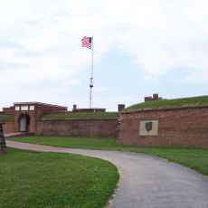
Fort Howard, Military fort in Baltimore County, Maryland, United States.
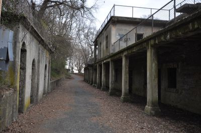
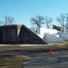
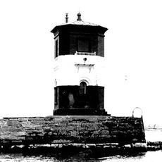
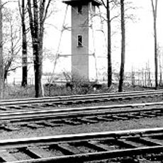
Fort Howard is a military fort located at the mouth of the Patapsco River in Baltimore County, Maryland. The site contains stone fortifications, gun emplacements, and defensive structures oriented toward the Chesapeake Bay.
Built in 1814 during the War of 1812, this fort was designed to defend Baltimore Harbor from British naval forces. It served as a critical defensive position when enemy ships threatened the city multiple times during that conflict.
This fort represents how Americans built military defenses along their coast and trained soldiers to protect their ports. The structures reflect the construction methods and defensive thinking of the early 19th century.
The grounds feature walking paths and interpretive signs that explain the military structures and coastal defense systems. Wear comfortable shoes since exploring the fortifications and terrain involves considerable walking.
The fort includes underground storage chambers and tunnels that connected different defensive positions, allowing soldiers to move safely during potential attacks. These hidden passages remain a fascinating reminder of the military engineering from that era.
Location: Fort Howard
GPS coordinates: 39.19833,-76.44361
Latest update: December 8, 2025 19:54
Fort McHenry
13.8 km
NS Savannah
11.7 km
Francis Scott Key Bridge
7.6 km
SS John W. Brown
13.4 km
Fort Carroll
6.8 km
National Brewing Company
13.9 km
United States Coast Guard Yard
10.7 km
Fort Smallwood Park
4.7 km
Hart-Miller Island State Park, Maryland
8.2 km
Craighill Channel Lower Range Front Light
4.4 km
Orpheus with the Awkward Foot
14 km
Fort Carroll Light
6.8 km
Todd Farmhouse
1.8 km
Hancock's Resolution
7.1 km
Craighill Channel Lower Range Rear Light
5.4 km
Ballestone Mansion
6.4 km
Lazaretto Point Light
13.1 km
Bodkin Island Light
7.3 km
Craighill Channel Upper Range Front Light
419 m
Craighill Channel Upper Range Rear Light
2.6 km
Freetown Rosenwald School
13.2 km
Marley Neck Rosenwald School
11.1 km
North Point State Park
2.2 km
Wilson Point Mens' Club; Stansbury Beach Club
13.3 km
Statue of John O'Donnell
14.5 km
Curtis Bay Water Tank
13.2 km
I-895 Curtis Bay Steel Bridge
14 km
Miami Beach
13.6 kmVisited this place? Tap the stars to rate it and share your experience / photos with the community! Try now! You can cancel it anytime.
Discover hidden gems everywhere you go!
From secret cafés to breathtaking viewpoints, skip the crowded tourist spots and find places that match your style. Our app makes it easy with voice search, smart filtering, route optimization, and insider tips from travelers worldwide. Download now for the complete mobile experience.
A unique approach to discovering new places❞
— Le Figaro
All the places worth exploring❞
— France Info
A tailor-made excursion in just a few clicks❞
— 20 Minutes