Gateway State Trail, Rail trail and National Recreation Trail in Ramsey County, US.
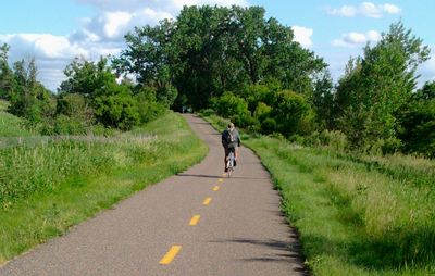
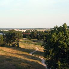
Gateway State Trail is a paved pathway spanning multiple communities in Ramsey County from Saint Paul through Maplewood, North Saint Paul, and Oakdale to Pine Point Regional Park near Stillwater. The route features multiple parking areas, restroom facilities, and water fountains positioned to serve cyclists, hikers, and inline skaters year-round on its surface.
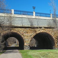
The trail follows the route of the former Soo Line Railroad, which connected the Twin Cities to Lake Superior ports before its closure in 1980. This conversion of an abandoned rail corridor demonstrates how historic transportation infrastructure was repurposed for public recreation.
The trail features community gardens and local art installations where people naturally gather for outdoor activities and recreation. Residents use these spaces to connect with nature and participate in hands-on conservation work that benefits the broader landscape.
The path remains accessible year-round for cycling, hiking, and inline skating, with multiple entry points along its length. Parking areas and restroom facilities are distributed throughout, and water fountains are available at regular intervals to support longer visits.
A parallel unpaved path runs east of Interstate 694 and serves specifically for horseback riding and carriage driving. This separate route demonstrates how the trail system accommodates different recreational uses alongside the main paved path.
The community of curious travelers
AroundUs brings together thousands of curated places, local tips, and hidden gems, enriched daily by 60,000 contributors worldwide.