·

Enable Location

We need your location to show you interesting places around you

Discover nearby places

Find interesting locations and hidden gems around you

Precise directions

Get accurate directions and distances to places

Your location is never shared with other users. It's only used when you tap the location button.

Green Bay National Wildlife Refuge

Log in to your account

Start exploring — it's free

Trusted by 62,714 travelers worldwide

Continue with Google
Continue with Apple
or

We will send you a code to connect

By continuing, you accept our Terms and Conditions and our Privacy Policy

Check your inbox

We've sent a pincode in your inbox. Please enter the code below.

Green Bay National Wildlife Refuge

Green Bay National Wildlife Refuge, National Wildlife Refuge in Door County, Wisconsin.

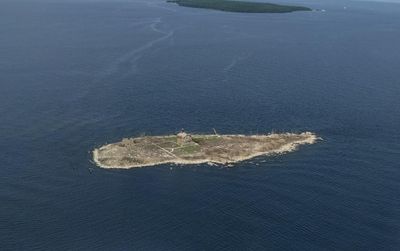
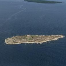
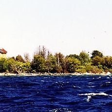
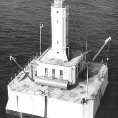
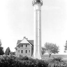
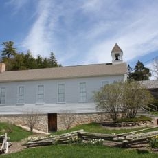
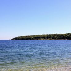
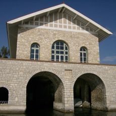
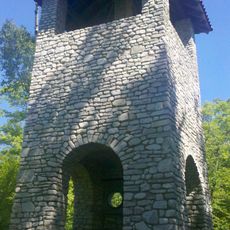
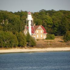
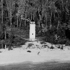
Green Bay National Wildlife Refuge contains several islands scattered across Lake Michigan between Wisconsin and Michigan's peninsulas, including Plum, Hog, and Pilot islands. The islands support different habitats with forests, grasslands, and rocky shorelines.

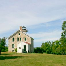
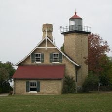
The United States established this protected area in 1912 to preserve habitats for species whose populations were declining in the region. The islands were recognized as essential for restoring these threatened populations.

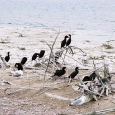
The islands serve as a vital stopover for migratory birds moving across the lake, and you can observe the birdlife that defines the refuge today. Watching these visitors move through the landscape connects you to the natural rhythms of the region.

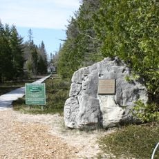
You can reach Plum and Detroit Island only by private boat or kayak from late May through early September during daylight. Be prepared for changing weather conditions on the lake and take water safety seriously.

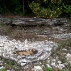
The islands grow rare plants like dwarf lake iris and Canada yew in special habitats such as coastal fens and rocky outcrops that exist nowhere else nearby. These plants are adapted to the unique conditions found only in this location.

The community of curious travelers

AroundUs brings together thousands of curated places, local tips, and hidden gems, enriched daily by 60,000 contributors worldwide.

Start exploring
Location
Inception
1912
GPS coordinates
45.31670,-86.95000
Latest update
December 14, 2025 09:40
Around this place
Peninsula State Park
United States of America

Peninsula State Park

27.9 km
Cana Island
United States of America

Cana Island

26.6 km
Cana Island Light
United States of America

Cana Island Light

26.5 km
Newport State Park
United States of America

Newport State Park

9.7 km
Rock Island State Park
United States of America

Rock Island State Park

15 km
Pilot Island
United States of America

Pilot Island

4.3 km
Baileys Harbor Range Lights
United States of America

Baileys Harbor Range Lights

30.3 km
The Clearing Folk School
United States of America

The Clearing Folk School

11.4 km
Pilot Island Light
United States of America

Pilot Island Light

4.3 km
Pottawatomie Light
United States of America

Pottawatomie Light

15.6 km
The Ridges Sanctuary
United States of America

The Ridges Sanctuary

30.2 km
Eagle Bluff Light
United States of America

Eagle Bluff Light

27.9 km
United States of America

Mero Site

21.2 km
Gravel Island National Wildlife Refuge
United States of America

Gravel Island National Wildlife Refuge

12.5 km
Minneapolis Shoal Light Station
United States of America

Minneapolis Shoal Light Station

29.7 km
St. Martin Island Light
United States of America

St. Martin Island Light

25.6 km
Ephraim Moravian Church
United States of America

Ephraim Moravian Church

24.9 km
Free Evangelical Lutheran Church-Bethania Scandinavian Evangelical Lutheran Congregation
United States of America

Free Evangelical Lutheran Church-Bethania Scandinavian Evangelical Lutheran Congregation

24.8 km
Gibraltar District School No. 2
United States of America

Gibraltar District School No. 2

24.8 km
School House Beach Park
United States of America

School House Beach Park

9.2 km
Thordarson Estate Historic District
United States of America

Thordarson Estate Historic District

14.1 km
Water Tower
United States of America

Water Tower

15.5 km
Ephraim Village Hall
United States of America

Ephraim Village Hall

24.9 km
Peter Peterson House
United States of America

Peter Peterson House

24.7 km
Jacobsen Museum
United States of America

Jacobsen Museum

10.1 km
Washington Island Farm Museum
United States of America

Washington Island Farm Museum

9 km
Plum Island Range rear light
United States of America

Plum Island Range rear light

1.2 km
Plum Island Range front light
United States of America

Plum Island Range front light

1.5 km
Show the full map
« Green Bay National Wildlife Refuge - National Wildlife Refuge in Door County, Wisconsin » is provided by Around Us (aroundus.com). Images and texts are derived from Wikimedia project under a Creative Commons license. You are allowed to copy, distribute, and modify copies of this page, under the conditions set by the license, as long as this note is clearly visible.

Discover hidden gems everywhere you go!

From secret cafés to breathtaking viewpoints, skip the crowded tourist spots and find places that match your style. Our app makes it easy with voice search, smart filtering, route optimization, and insider tips from travelers worldwide. Download now for the complete mobile experience.

Around Us App Screenshot

A unique approach to discovering new places

Le Figaro

All the places worth exploring

France Info

A tailor-made excursion in just a few clicks

20 Minutes

Around Us
Travel Guide & Maps
Download

Send to your phone

QR Code
1

Open the camera app on your mobile.

2

Point at the QR code with your camera. A notification will appear.

3

Tap the notification to open the link.