Chest opened
+${chestReward.xp} XP
Explorer
NOUVEAU ×${chestReward.collectible.quantity}
tapez pour fermer
Chest locked

Open chests in the app

Around Us is built for your phone — chests unlock when you walk, explore and capture nearby places.

Enable Location

We need your location to show you interesting places around you

Discover nearby places

Find interesting locations and hidden gems around you

Precise directions

Get accurate directions and distances to places

Your location is never shared with other users. It's only used when you tap the location button.

Log in to your account

Start exploring — it's free

Trusted by 72,889 travelers worldwide

Continue with Google
Continue with Apple
or

We will send you a code to connect

By continuing, you accept our Terms and Conditions and our Privacy Policy

Check your inbox

We've sent a pincode in your inbox. Please enter the code below.

Keith line
Discussion Reviews Photo
3.4k Popularity

Keith line, Historical boundary line in central New Jersey, United States.

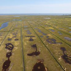
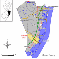
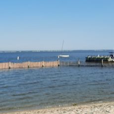
The Keith Line is a historical boundary in New Jersey that runs from Little Egg Harbor in the south to the south branch of the Raritan River in the north. It now follows the county lines between Burlington and Ocean counties as well as between Hunterdon and Somerset counties.

In 1687, Scottish surveyor George Keith drew this boundary line to separate the British provinces of East Jersey and West Jersey. The line was established during colonial times and guided the administration of these two distinct regions.

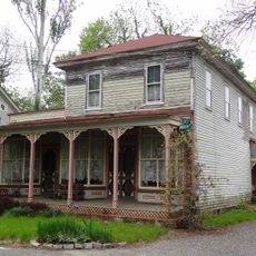
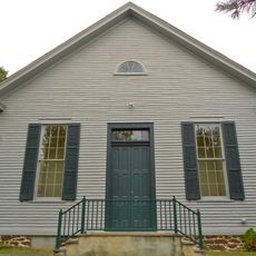
The line once separated two religious communities, with Quakers establishing themselves on the western side while Calvinists and Reformed Christians built communities to the east. This religious division still shapes how each region developed its own character.

The Keith Line has no physical markers on the ground, so it is best followed using maps or GPS coordinates. To fully appreciate it, spend time in the region and observe how the characteristics change as you move between the two sides.

Today this line marks subtle regional differences, from tax rates to sports team loyalties, reflecting Philadelphia influence on the west and New York on the east. These modern distinctions reveal how profoundly the original division shaped both sides.

The community of curious travelers

AroundUs brings together thousands of curated places, local tips, and hidden gems, enriched daily by 60,000 contributors worldwide.

Start exploring
Location
GPS coordinates
39.65100,-74.26400
Latest update
December 12, 2025 08:00
Around this place
Barnegat Lighthouse
United States of America

Barnegat Lighthouse

18.5 km
Batona Trail
United States of America

Batona Trail

24.2 km
Edwin B. Forsythe National Wildlife Refuge
United States of America

Edwin B. Forsythe National Wildlife Refuge

7.3 km
Double Trouble State Park
United States of America

Double Trouble State Park

27.7 km
Bass River State Forest
United States of America

Bass River State Forest

14.2 km
Manahawkin Bay Bridge
United States of America

Manahawkin Bay Bridge

5.4 km
Barnegat Lighthouse State Park
United States of America

Barnegat Lighthouse State Park

18.3 km
Tuckerton Seaport
United States of America

Tuckerton Seaport

8.7 km
Popcorn Park Zoo
United States of America

Popcorn Park Zoo

29.3 km
Penn State Forest
United States of America

Penn State Forest

19.7 km
Fantasy Island
United States of America

Fantasy Island

9.5 km
Noyes Museum
United States of America

Noyes Museum

26.4 km
Amanda Blake Store
United States of America

Amanda Blake Store

24.4 km
Little Egg Harbor Friends Meeting House
United States of America

Little Egg Harbor Friends Meeting House

8.5 km
Manahawkin Baptist Church
United States of America

Manahawkin Baptist Church

5.3 km
Beach Haven Historic District
United States of America

Beach Haven Historic District

10.4 km
Smithville Apothecary
United States of America

Smithville Apothecary

24.3 km
Manahawkin Bottomland Hardwood Forest
United States of America

Manahawkin Bottomland Hardwood Forest

5.3 km
Barnegat Light Public School
United States of America

Barnegat Light Public School

18.2 km
Port Republic Historic District
United States of America

Port Republic Historic District

24.4 km
Mary Etta Cox House
United States of America

Mary Etta Cox House

11.9 km
Converse Cottage
United States of America

Converse Cottage

10.5 km
Dr. Edward H. Williams House
United States of America

Dr. Edward H. Williams House

10.5 km
Edwin B. Forsythe National Wildlife Refuge
United States of America

Edwin B. Forsythe National Wildlife Refuge

24.4 km
Phare de Tucker's Beach
United States of America

Phare de Tucker's Beach

8.7 km
New Jersey Maritime Museum
United States of America

New Jersey Maritime Museum

9.6 km
Shore Beach
United States of America

Shore Beach

13.3 km
Harvey Cedars Bay Beach
United States of America

Harvey Cedars Bay Beach

12.4 km
Show the full map
Reviews
Share your experience

No review yet

Discussions
Start a discussion...

No discussion yet

« Keith line - Historical boundary line in central New Jersey, United States » is provided by Around Us (aroundus.com). Images and texts are derived from Wikimedia project under a Creative Commons license. You are allowed to copy, distribute, and modify copies of this page, under the conditions set by the license, as long as this note is clearly visible.

Discover hidden gems everywhere you go!

From secret cafés to breathtaking viewpoints, skip the crowded tourist spots and find places that match your style. Our app makes it easy with voice search, smart filtering, route optimization, and insider tips from travelers worldwide. Download now for the complete mobile experience.

Around Us App Screenshot

A unique approach to discovering new places

Le Figaro

All the places worth exploring

France Info

A tailor-made excursion in just a few clicks

20 Minutes

Around Us
Travel Guide & Maps
Download

Send to your phone

QR Code
1

Open the camera app on your mobile.

2

Point at the QR code with your camera. A notification will appear.

3

Tap the notification to open the link.