Enable Location

We need your location to show you interesting places around you

Discover nearby places

Find interesting locations and hidden gems around you

Precise directions

Get accurate directions and distances to places

Your location is never shared with other users. It's only used when you tap the location button.

Kennebunkport Historic District

Log in to your account

Start exploring — it's free

Trusted by 62,067 travelers worldwide

Continue with Google
Continue with Apple
or

We will send you a code to connect

By continuing, you accept our Terms and Conditions and our Privacy Policy

Check your inbox

We've sent a pincode in your inbox. Please enter the code below.

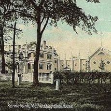
Kennebunkport Historic District, Historic district in Kennebunkport, Maine, US.

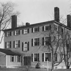
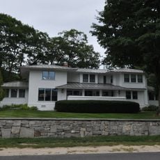
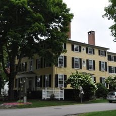
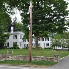
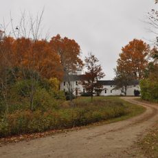
The Kennebunkport Historic District is a neighborhood with roughly 150 buildings spread across hillsides and along the river, displaying architectural styles from the Colonial, Federal, and Greek Revival periods. The houses range from modest worker cottages to large mansions, built from wood or brick, with many facing the river or tucked into quiet streets.

The neighborhood developed in the late 1700s when wealthy shipbuilders and merchants constructed homes here and made the town a major port center. In the 20th century, it was officially designated as a historic district to preserve its architectural past.

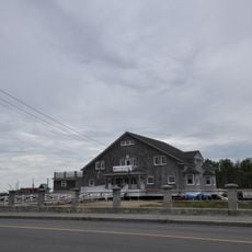
The streets preserve the character of a working port town, where families once lived in homes tied directly to shipbuilding trades and maritime commerce. Walking through, you sense how closely the community was bound to the river and the vessels that defined daily life.

The area is easy to explore on foot, with most significant buildings within a short walk of each other. It is wise to arrive early in the day, especially on nice weekends, to enjoy the quieter streets and find parking more easily.

Remarkably, the majority of the houses were built before 1925, making the district an unusually authentic window into early American port architecture. This high concentration of unchanged structures is rare in many modern neighborhoods.

The community of curious travelers

AroundUs brings together thousands of curated places, local tips, and hidden gems, enriched daily by 60,000 contributors worldwide.

Start exploring
Location
GPS coordinates
43.36278,-70.47583
Latest update
December 14, 2025 11:24
Around this place
Wedding Cake House
United States of America

Wedding Cake House

3.9 km
Seashore Trolley Museum
United States of America

Seashore Trolley Museum

5.3 km
Rachel Carson National Wildlife Refuge
United States of America

Rachel Carson National Wildlife Refuge

5.5 km
Goat Island Light
United States of America

Goat Island Light

4.2 km
Bourne Mansion
United States of America

Bourne Mansion

5.9 km
Wells National Estuarine Research Reserve
United States of America

Wells National Estuarine Research Reserve

6.8 km
Brick Store Museum
United States of America

Brick Store Museum

5.7 km
United States of America

National Streetcar Museum

5.3 km
Cape Arundel Summer Colony Historic District
United States of America

Cape Arundel Summer Colony Historic District

2.2 km
Kennebunk Historic District
United States of America

Kennebunk Historic District

5.6 km
Kennebunk River Club
United States of America

Kennebunk River Club

1.4 km
Abbott Graves House
United States of America

Abbott Graves House

1 km
Timber Point
United States of America

Timber Point

7.5 km
Clock Farm
United States of America

Clock Farm

6.2 km
Capt. Nathaniel Lord Mansion
United States of America

Capt. Nathaniel Lord Mansion

453 m
Melville Walker House
United States of America

Melville Walker House

394 m
Lord Mansion
United States of America

Lord Mansion

5.5 km
Emery School
United States of America

Emery School

14.1 km
First Parish Meetinghouse
United States of America

First Parish Meetinghouse

13.4 km
Spiller Farm Paleoindian Site
United States of America

Spiller Farm Paleoindian Site

10.5 km
Maine Trolley Cars
United States of America

Maine Trolley Cars

5.1 km
John Tarr House
United States of America

John Tarr House

13.4 km
Wallingford Hall
United States of America

Wallingford Hall

6.1 km
United States Customhouse
United States of America

United States Customhouse

126 m
Lower Alewive Historic District
United States of America

Lower Alewive Historic District

10.3 km
Old Kennebunk High School
United States of America

Old Kennebunk High School

5.4 km
Libby's Colonial Tea Room
United States of America

Libby's Colonial Tea Room

6.8 km
James Smith Homestead
United States of America

James Smith Homestead

10.6 km
Show the full map
« Kennebunkport Historic District - Historic district in Kennebunkport, Maine, US » is provided by Around Us (aroundus.com). Images and texts are derived from Wikimedia project under a Creative Commons license. You are allowed to copy, distribute, and modify copies of this page, under the conditions set by the license, as long as this note is clearly visible.

Discover hidden gems everywhere you go!

From secret cafés to breathtaking viewpoints, skip the crowded tourist spots and find places that match your style. Our app makes it easy with voice search, smart filtering, route optimization, and insider tips from travelers worldwide. Download now for the complete mobile experience.

Around Us App Screenshot

A unique approach to discovering new places

Le Figaro

All the places worth exploring

France Info

A tailor-made excursion in just a few clicks

20 Minutes

Around Us
Travel Guide & Maps
Download

Send to your phone

QR Code
1

Open the camera app on your mobile.

2

Point at the QR code with your camera. A notification will appear.

3

Tap the notification to open the link.