Cape Arundel Summer Colony Historic District

Log in to your account

AroundUs is a community-driven map of interesting places, built by curious explorers like you. It grows with every review, story, and photo you share.
Connect to save your favorite spots, contribute locations, and create personalized routes.
Continue with Google
Continue with Apple
Continue with X
Continue with Facebook
Continue with email
By continuing, you accept our Terms and Conditions and our Privacy Policy
Create an account
Add to collection
Map
Suggest a change
Share

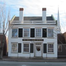
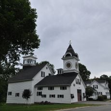
Cape Arundel Summer Colony Historic District, Historic district in Kennebunkport, United States.

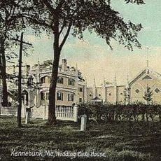
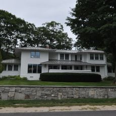
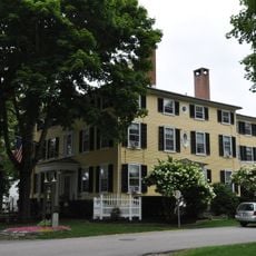
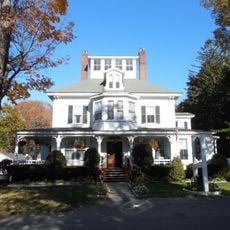
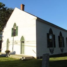
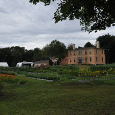
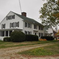
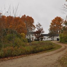
Cape Arundel Summer Colony Historic District is a coastal area featuring grand summer estates built between 1880 and 1940, primarily along Ocean Avenue. The homes were designed by prominent architects of the period and display a variety of architectural styles that characterize the waterfront landscape.

The area was developed in the 1870s when a company acquired the land and built the Ocean Bluff Hotel after a railroad connection was completed. This infrastructure enabled wealthy families to travel easily and construct their summer homes in what became an exclusive coastal destination.

The district served as a summer retreat for wealthy families from across the eastern United States who gathered for social events and leisure activities. The grand homes reflect how the affluent class spent their season and displayed their status through their choice of residence.

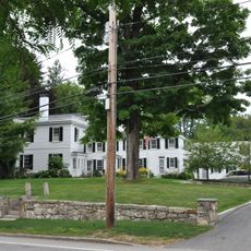
The district is best explored on foot since the estates and their grounds are visible from the road and most sit on spacious properties. Many houses remain privately owned, so visitors should stay on public paths and appreciate the architecture from outside.

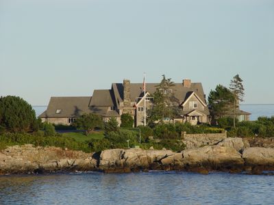
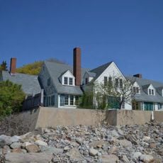
Walkers Point, a promontory within the district, features two Shingle-style houses built in 1903 that became home to a family of later historical prominence. This residence commands attention as one walks along the shoreline and represents a notable connection to American political history.

Location: Kennebunkport

GPS coordinates: 43.34342,-70.46866

Latest update: December 14, 2025 11:43

Photos
Around this place
Wedding Cake House
United States of America

Wedding Cake House

5.8 km
Seashore Trolley Museum
United States of America

Seashore Trolley Museum

7.5 km
Rachel Carson National Wildlife Refuge
United States of America

Rachel Carson National Wildlife Refuge

5.9 km
Goat Island Light
United States of America

Goat Island Light

3.9 km
Bourne Mansion
United States of America

Bourne Mansion

7.6 km
Wells National Estuarine Research Reserve
United States of America

Wells National Estuarine Research Reserve

6.9 km
Brick Store Museum
United States of America

Brick Store Museum

7.4 km
United States of America

National Streetcar Museum

7.5 km
Kennebunkport Historic District
United States of America

Kennebunkport Historic District

2.2 km
Kennebunk Historic District
United States of America

Kennebunk Historic District

7.4 km
Kennebunk River Club
United States of America

Kennebunk River Club

852 m
Abbott Graves House
United States of America

Abbott Graves House

1.2 km
Timber Point
United States of America

Timber Point

8.4 km
Clock Farm
United States of America

Clock Farm

7.7 km
Capt. Nathaniel Lord Mansion
United States of America

Capt. Nathaniel Lord Mansion

1.8 km
Melville Walker House
United States of America

Melville Walker House

1.9 km
Lord Mansion
United States of America

Lord Mansion

7.3 km
First Parish Meetinghouse
United States of America

First Parish Meetinghouse

15.3 km
Spiller Farm Paleoindian Site
United States of America

Spiller Farm Paleoindian Site

11.3 km
Maine Trolley Cars
United States of America

Maine Trolley Cars

7.4 km
Ogunquit Memorial Library
United States of America

Ogunquit Memorial Library

15.2 km
John Tarr House
United States of America

John Tarr House

15.1 km
Wallingford Hall
United States of America

Wallingford Hall

7.7 km
United States Customhouse
United States of America

United States Customhouse

2.1 km
Lower Alewive Historic District
United States of America

Lower Alewive Historic District

12.3 km
Old Kennebunk High School
United States of America

Old Kennebunk High School

7.1 km
Libby's Colonial Tea Room
United States of America

Libby's Colonial Tea Room

7.5 km
James Smith Homestead
United States of America

James Smith Homestead

12.6 km
Show the full map
Reviews

Visited this place? Tap the stars to rate it and share your experience / photos with the community! Try now! You can cancel it anytime.

« Cape Arundel Summer Colony Historic District - Historic district in Kennebunkport, United States » is provided by Around Us (aroundus.com). Images and texts are derived from Wikimedia project under a Creative Commons license. You are allowed to copy, distribute, and modify copies of this page, under the conditions set by the license, as long as this note is clearly visible.

Discover hidden gems everywhere you go!

From secret cafés to breathtaking viewpoints, skip the crowded tourist spots and find places that match your style. Our app makes it easy with voice search, smart filtering, route optimization, and insider tips from travelers worldwide. Download now for the complete mobile experience.

Around Us App Screenshot

A unique approach to discovering new places

Le Figaro

All the places worth exploring

France Info

A tailor-made excursion in just a few clicks

20 Minutes