Kentenia State Forest

Log in to your account

AroundUs is a community-driven map of interesting places, built by curious explorers like you. It grows with every review, story, and photo you share.
Connect to save your favorite spots, contribute locations, and create personalized routes.
By continuing, you accept our Terms and Conditions and our Privacy Policy
Add to collection
Map
Suggest a change
Share

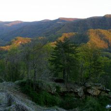
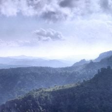
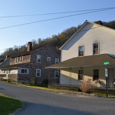
Kentenia State Forest, Protected forest in Harlan County, Kentucky, United States.
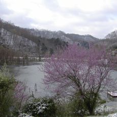
Kentenia State Forest encompasses 4,277 acres of land with seven distinct tracts situated along the southern side of Pine Mountain.

The Department of Natural Resources acquired the forest in 1919 through a land donation from the Kentenia-Cantron coal company, establishing Kentucky's first state forest.

The forest serves as an outdoor learning center where visitors connect with Kentucky's natural heritage through guided educational programs and environmental studies.

Multiple hiking trails throughout the forest allow visitors to explore the terrain while observing native wildlife and plant species in their natural habitat.

The forest maintains several protected zones that support local biodiversity and contribute to regional conservation efforts in southeastern Kentucky.

Location: Kentucky

GPS coordinates: 36.91830,-83.22220

Latest update: June 1, 2025 12:16

Photos
Around this place
United States Penitentiary
United States of America

United States Penitentiary

31 km
Black Mountain
United States of America

Black Mountain

29.2 km
Hensley Settlement
United States of America

Hensley Settlement

38.9 km
Wilderness Road State Park
United States of America

Wilderness Road State Park

41.5 km
Pine Mountain Settlement School
United States of America

Pine Mountain Settlement School

4.8 km
Black Mountain Off-Road Adventure Area
United States of America

Black Mountain Off-Road Adventure Area

5 km
Carr Creek Lake
United States of America

Carr Creek Lake

40.3 km
Kentucky Coal Mining Museum
United States of America

Kentucky Coal Mining Museum

24.6 km
Vardy Community School
United States of America

Vardy Community School

37.3 km
Southwest Virginia Museum Historical State Park
United States of America

Southwest Virginia Museum Historical State Park

39.8 km
Carr Creek State Park
United States of America

Carr Creek State Park

40 km
The Cedars Natural Area Preserve
United States of America

The Cedars Natural Area Preserve

28.4 km
June Tolliver House
United States of America

June Tolliver House

40.4 km
John Fox, Jr. House
United States of America

John Fox, Jr. House

39.9 km
John Shell Cabin
United States of America

John Shell Cabin

11.4 km
Wendover, Kentucky
United States of America

Wendover, Kentucky

26.5 km
Terrace Park Girl Scout Cabin
United States of America

Terrace Park Girl Scout Cabin

39.8 km
Jonesville Methodist Campground
United States of America

Jonesville Methodist Campground

27.2 km
Stonega Historic District
United States of America

Stonega Historic District

38.5 km
Derby Historic District
United States of America

Derby Historic District

35.6 km
United States Post Office and Courthouse
United States of America

United States Post Office and Courthouse

40.2 km
Dickinson-Milbourn House
United States of America

Dickinson-Milbourn House

27.2 km
Wooton Presbyterian Center
United States of America

Wooton Presbyterian Center

30.1 km
Harlan Commercial District
United States of America

Harlan Commercial District

11.9 km
Peabody-Fordson Historic District
United States of America

Peabody-Fordson Historic District

40.9 km
Benham Historic District
United States of America

Benham Historic District

24.7 km
Lynch Historic District
United States of America

Lynch Historic District

27.6 km
Cumberland Central Business District
United States of America

Cumberland Central Business District

21.5 km
Show the full map
Reviews

Visited this place? Tap the stars to rate it and share your experience / photos with the community! Try now! You can cancel it anytime.

« Kentenia State Forest - Protected forest in Harlan County, Kentucky, United States » is provided by Around Us (aroundus.com). Images and texts are derived from Wikimedia project under a Creative Commons license. You are allowed to copy, distribute, and modify copies of this page, under the conditions set by the license, as long as this note is clearly visible.

Discover hidden gems everywhere you go!

From secret cafés to breathtaking viewpoints, skip the crowded tourist spots and find places that match your style. Our app makes it easy with voice search, smart filtering, route optimization, and insider tips from travelers worldwide. Download now for the complete mobile experience.

Around Us App Screenshot

A unique approach to discovering new places

Le Figaro

All the places worth exploring

France Info

A tailor-made excursion in just a few clicks

20 Minutes