Log in to your account

AroundUs is a community-driven map of interesting places, built by curious explorers like you. It grows with every review, story, and photo you share.
Connect to save your favorite spots, contribute locations, and create personalized routes.
Continue with Google
Continue with Apple
Continue with X
Continue with Facebook
Continue with email
By continuing, you accept our Terms and Conditions and our Privacy Policy
Create an account
Add to collection
Map
Suggest a change
Share

Knobstone Trail, Hiking trail in Clark County, Indiana, US

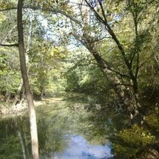
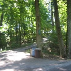
Knobstone Trail is a long hiking route in southern Indiana that runs through Clark and Jackson State Forests between two endpoints. The path climbs and descends through wooded ridge areas with occasional views across the landscape.

The trail's initial section opened in 1980 as Indiana began developing its longest natural surface hiking route. The route has since grown to its current length through gradual expansion over the following decades.

The Indiana Department of Natural Resources developed this trail through cooperation between the Divisions of Fish and Wildlife, Forestry, and Outdoor Recreation.

Brown numbered signs mark each mile to help with navigation throughout your walk. Bring sturdy hiking boots since the uneven terrain and elevation changes require good foot support and preparation.

The terrain includes elevation changes of more than 300 feet that make it a challenging training ground for serious hikers. Many people use this route to prepare their bodies and skills for harder mountain experiences elsewhere.

Location: Clark County

GPS coordinates: 38.46491,-85.85015

Latest update: December 9, 2025 18:44

Photos
Around this place
United States of America

Indiana Army Ammunition Plant

17 km
Pigeon Roost State Historic Site
United States of America

Pigeon Roost State Historic Site

18.2 km
Charlestown State Park
United States of America

Charlestown State Park

19.6 km
Culbertson Mansion
United States of America

Culbertson Mansion

20.1 km
Deam Lake State Recreation Area
United States of America

Deam Lake State Recreation Area

971 m
Town Clock Church
United States of America

Town Clock Church

20.3 km
John Work House and Mill Site
United States of America

John Work House and Mill Site

19.6 km
Prather Site
United States of America

Prather Site

16.6 km
Scribner House
United States of America

Scribner House

20.3 km
New Albany National Cemetery
United States of America

New Albany National Cemetery

18.8 km
Carnegie Center for Art & History
United States of America

Carnegie Center for Art & History

20 km
New Albany Downtown Historic District
United States of America

New Albany Downtown Historic District

20.2 km
Lapping Park
United States of America

Lapping Park

15.6 km
Woodbine
United States of America

Woodbine

19.2 km
Cedar Bough Place Historic District
United States of America

Cedar Bough Place Historic District

19.3 km
Simpson Memorial United Methodist Church
United States of America

Simpson Memorial United Methodist Church

16 km
Shelby Place Historic District
United States of America

Shelby Place Historic District

19 km
Thomas Downs House
United States of America

Thomas Downs House

16.8 km
DePauw Avenue Historic District
United States of America

DePauw Avenue Historic District

18.5 km
Benjamin Ferguson House
United States of America

Benjamin Ferguson House

16.6 km
East Spring Street Historic District
United States of America

East Spring Street Historic District

19.9 km
Watson House
United States of America

Watson House

16.6 km
Jersey Park Farm
United States of America

Jersey Park Farm

13.7 km
William Young House
United States of America

William Young House

20.4 km
Hedden's Grove Historic District
United States of America

Hedden's Grove Historic District

17.8 km
Culbertson Mansion State Historic Site
United States of America

Culbertson Mansion State Historic Site

20.1 km
Mansion Row Historic District
United States of America

Mansion Row Historic District

20.1 km
Wooded Glen Covered Bridge
United States of America

Wooded Glen Covered Bridge

16.2 km
Show the full map
Reviews

Visited this place? Tap the stars to rate it and share your experience / photos with the community! Try now! You can cancel it anytime.

« Knobstone Trail - Hiking trail in Clark County, Indiana, US » is provided by Around Us (aroundus.com). Images and texts are derived from Wikimedia project under a Creative Commons license. You are allowed to copy, distribute, and modify copies of this page, under the conditions set by the license, as long as this note is clearly visible.

Discover hidden gems everywhere you go!

From secret cafés to breathtaking viewpoints, skip the crowded tourist spots and find places that match your style. Our app makes it easy with voice search, smart filtering, route optimization, and insider tips from travelers worldwide. Download now for the complete mobile experience.

Around Us App Screenshot

A unique approach to discovering new places

Le Figaro

All the places worth exploring

France Info

A tailor-made excursion in just a few clicks

20 Minutes