Enable Location

We need your location to show you interesting places around you

Discover nearby places

Find interesting locations and hidden gems around you

Precise directions

Get accurate directions and distances to places

Your location is never shared with other users. It's only used when you tap the location button.

Matton Shipyard

Log in to your account

Start exploring — it's free

Trusted by 62,462 travelers worldwide

Continue with Google
Continue with Apple
or

We will send you a code to connect

By continuing, you accept our Terms and Conditions and our Privacy Policy

Check your inbox

We've sent a pincode in your inbox. Please enter the code below.

Matton Shipyard, amerikanische Werft

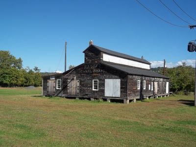
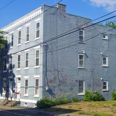
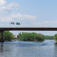
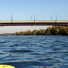
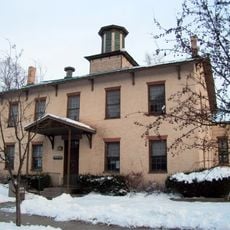
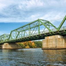
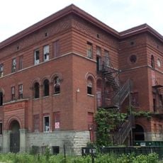
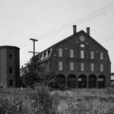
The Matton Shipyard is a former boat-building facility on Van Schaick Island near Cohoes, New York, located at the confluence of the Hudson and Mohawk Rivers. The site spans about seven acres with preserved buildings from the 1910s onward, including an office building, planing mill, and work sheds that demonstrate how vessels were traditionally constructed and repaired.

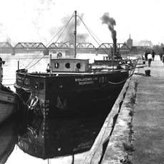
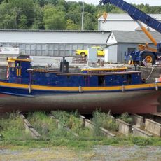
The Matton Shipyard was established in 1916 after the Matton family relocated their earlier operation from Waterford to build larger vessels. During World War II, the yard employed over 300 workers and produced submarine chasers and oil barges for the Navy, continuing operations until the final vessel was launched in 1982.

The Matton Shipyard was a place where traditional craftsmanship in boat building was valued, and the local community took pride in the vessels built there. The yard served as a community hub where workers and their families were closely connected, especially on Friday mornings when ship launches were celebrated with gatherings and meals.

The site is located on low-lying ground subject to occasional flooding, but the buildings remain accessible and walkable due to restoration efforts. Visitors can navigate walking paths with interpretive signs, and should wear sturdy shoes and weather-appropriate clothing since the area is exposed to the elements.

The yard was known for using traditional manual launching methods where workers drove wedges under ship hulls to launch them, creating a spectacular sight. The final vessel, the Mary Turecamo launched in 1982, marked the end of an era when handcrafted techniques dominated industrial production.

The community of curious travelers

AroundUs brings together thousands of curated places, local tips, and hidden gems, enriched daily by 60,000 contributors worldwide.

Start exploring
Location
GPS coordinates
42.77944,-73.68056
Latest update
February 9, 2026 08:19
Around this place
Cohoes Falls
United States of America

Cohoes Falls

2.5 km
Peebles Island State Park
United States of America

Peebles Island State Park

421 m
Harmony Mills
United States of America

Harmony Mills

1.9 km
Cohoes Music Hall
United States of America

Cohoes Music Hall

1.8 km
Day Peckinpaugh
United States of America

Day Peckinpaugh

103 m
Kate Mullany House
United States of America

Kate Mullany House

4.4 km
Urger
United States of America

Urger

2 km
Collar City Bridge
United States of America

Collar City Bridge

4.4 km
112th Street Bridge
United States of America

112th Street Bridge

867 m
Downtown Cohoes Historic District
United States of America

Downtown Cohoes Historic District

1.8 km
Lansingburgh Academy
United States of America

Lansingburgh Academy

826 m
Troy–Waterford Bridge
United States of America

Troy–Waterford Bridge

1.2 km
Harmony Mill No. 3
United States of America

Harmony Mill No. 3

2 km
Van Schaick House
United States of America

Van Schaick House

1.4 km
Lock 18 of Enlarged Erie Canal
United States of America

Lock 18 of Enlarged Erie Canal

2.6 km
Northern River Street Historic District
United States of America

Northern River Street Historic District

4.9 km
Haskell School
United States of America

Haskell School

2.4 km
Rensselaer and Saratoga Railroad: Green Island Shops
United States of America

Rensselaer and Saratoga Railroad: Green Island Shops

3.4 km
Olmstead Street Historic District
United States of America

Olmstead Street Historic District

1.9 km
Waterford Village Historic District
United States of America

Waterford Village Historic District

1.2 km
Northside Historic District
United States of America

Northside Historic District

1.2 km
Cohoes City Hall
United States of America

Cohoes City Hall

1.6 km
Trinity Church Lansingburgh
United States of America

Trinity Church Lansingburgh

690 m
J. Leonard Lackman House
United States of America

J. Leonard Lackman House

2.3 km
William J. Dickey House
United States of America

William J. Dickey House

2.3 km
St. Mark's Episcopal Church
United States of America

St. Mark's Episcopal Church

4.3 km
Ormsby-Laughlin Textile Companies Mill
United States of America

Ormsby-Laughlin Textile Companies Mill

1 km
Green Island Lanes
United States of America

Green Island Lanes

4.7 km
Show the full map
« Matton Shipyard - amerikanische Werft » is provided by Around Us (aroundus.com). Images and texts are derived from Wikimedia project under a Creative Commons license. You are allowed to copy, distribute, and modify copies of this page, under the conditions set by the license, as long as this note is clearly visible.

Discover hidden gems everywhere you go!

From secret cafés to breathtaking viewpoints, skip the crowded tourist spots and find places that match your style. Our app makes it easy with voice search, smart filtering, route optimization, and insider tips from travelers worldwide. Download now for the complete mobile experience.

Around Us App Screenshot

A unique approach to discovering new places

Le Figaro

All the places worth exploring

France Info

A tailor-made excursion in just a few clicks

20 Minutes

Around Us
Travel Guide & Maps
Download

Send to your phone

QR Code
1

Open the camera app on your mobile.

2

Point at the QR code with your camera. A notification will appear.

3

Tap the notification to open the link.