Enable Location

We need your location to show you interesting places around you

Discover nearby places

Find interesting locations and hidden gems around you

Precise directions

Get accurate directions and distances to places

Your location is never shared with other users. It's only used when you tap the location button.

Downtown Cohoes Historic District

Log in to your account

Start exploring — it's free

Trusted by 61,896 travelers worldwide

Continue with Google
Continue with Apple
or

We will send you a code to connect

By continuing, you accept our Terms and Conditions and our Privacy Policy

Check your inbox

We've sent a pincode in your inbox. Please enter the code below.

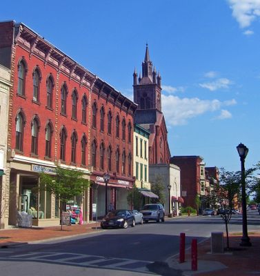
Downtown Cohoes Historic District, Historic district in Cohoes, New York, United States.

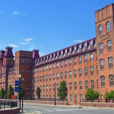
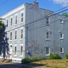
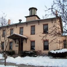
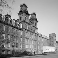
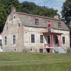
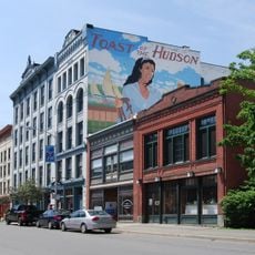
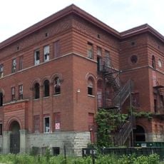
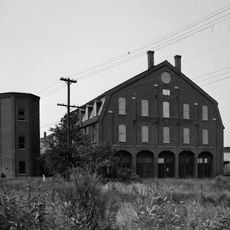
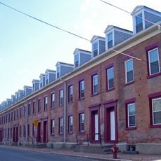
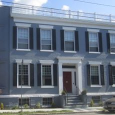
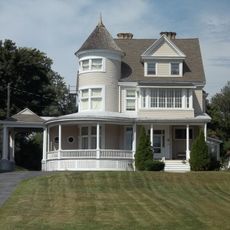
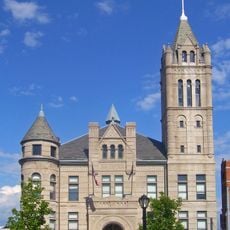
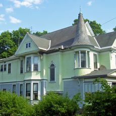
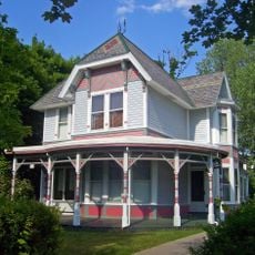
The Downtown Cohoes Historic District is a preserved area in New York covering approximately 35 acres with around 165 buildings dating from 1820 to 1930. The structures showcase Victorian, Romanesque, and Beaux-Arts styles, blending residential, commercial, and civic buildings from the region's industrial boom period.

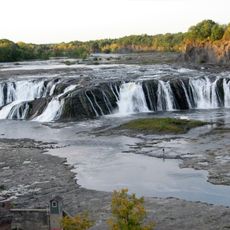
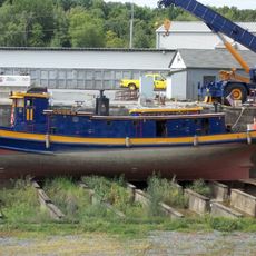
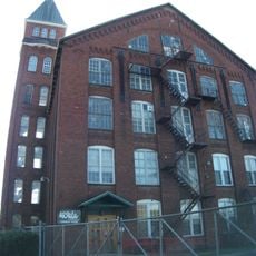
The area transformed from farmland into an industrial center after the Erie Canal construction opened new economic opportunities and attracted textile manufacturers. By the 1800s, the town had become a major hub for fabric production in the region.

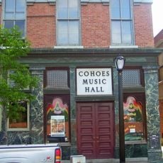
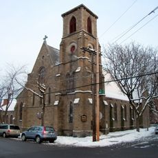
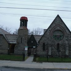
The district contains the Cohoes Music Hall and several religious buildings like St. John's Episcopal Church, which reflect how the community gathered and celebrated together during industrial times. Walking through these spaces today, you can still sense the role these places held in bringing people together.

The district is accessible by the New York Route 470 and contains numerous shops and restaurants where you can eat and shop during your visit. Walking tours are available if you want a guide to explain the architectural details and history of the buildings.

Several former textile mills in the district used the power of the nearby Cohoes Falls to run their machinery and produce fabrics. This natural water source is why textile makers chose to build their factories here and transform the area into an industrial powerhouse.

The community of curious travelers

AroundUs brings together thousands of curated places, local tips, and hidden gems, enriched daily by 60,000 contributors worldwide.

Start exploring
Location
GPS coordinates
42.77417,-73.70111
Latest update
December 14, 2025 11:02
Around this place
Cohoes Falls
United States of America

Cohoes Falls

1.7 km
Peebles Island State Park
United States of America

Peebles Island State Park

1.5 km
Green Island Bridge
United States of America

Green Island Bridge

4.4 km
Harmony Mills
United States of America

Harmony Mills

812 m
Cohoes Music Hall
United States of America

Cohoes Music Hall

161 m
Day Peckinpaugh
United States of America

Day Peckinpaugh

1.8 km
Kate Mullany House
United States of America

Kate Mullany House

4.1 km
Urger
United States of America

Urger

2.7 km
Collar City Bridge
United States of America

Collar City Bridge

3.9 km
112th Street Bridge
United States of America

112th Street Bridge

1.6 km
Lansingburgh Academy
United States of America

Lansingburgh Academy

2 km
Troy–Waterford Bridge
United States of America

Troy–Waterford Bridge

2.8 km
Harmony Mill No. 3
United States of America

Harmony Mill No. 3

902 m
Van Schaick House
United States of America

Van Schaick House

1.4 km
Lock 18 of Enlarged Erie Canal
United States of America

Lock 18 of Enlarged Erie Canal

1.4 km
Northern River Street Historic District
United States of America

Northern River Street Historic District

4.5 km
Haskell School
United States of America

Haskell School

2.6 km
Watervliet Side Cut Locks
United States of America

Watervliet Side Cut Locks

4.7 km
Rensselaer and Saratoga Railroad: Green Island Shops
United States of America

Rensselaer and Saratoga Railroad: Green Island Shops

2.7 km
Olmstead Street Historic District
United States of America

Olmstead Street Historic District

150 m
Waterford Village Historic District
United States of America

Waterford Village Historic District

2.5 km
Northside Historic District
United States of America

Northside Historic District

1.4 km
Cohoes City Hall
United States of America

Cohoes City Hall

133 m
Trinity Church Lansingburgh
United States of America

Trinity Church Lansingburgh

2.1 km
J. Leonard Lackman House
United States of America

J. Leonard Lackman House

514 m
William J. Dickey House
United States of America

William J. Dickey House

494 m
St. Mark's Episcopal Church
United States of America

St. Mark's Episcopal Church

3.7 km
Ormsby-Laughlin Textile Companies Mill
United States of America

Ormsby-Laughlin Textile Companies Mill

2.1 km
Show the full map
« Downtown Cohoes Historic District - Historic district in Cohoes, New York, United States » is provided by Around Us (aroundus.com). Images and texts are derived from Wikimedia project under a Creative Commons license. You are allowed to copy, distribute, and modify copies of this page, under the conditions set by the license, as long as this note is clearly visible.

Discover hidden gems everywhere you go!

From secret cafés to breathtaking viewpoints, skip the crowded tourist spots and find places that match your style. Our app makes it easy with voice search, smart filtering, route optimization, and insider tips from travelers worldwide. Download now for the complete mobile experience.

Around Us App Screenshot

A unique approach to discovering new places

Le Figaro

All the places worth exploring

France Info

A tailor-made excursion in just a few clicks

20 Minutes

Around Us
Travel Guide & Maps
Download

Send to your phone

QR Code
1

Open the camera app on your mobile.

2

Point at the QR code with your camera. A notification will appear.

3

Tap the notification to open the link.