Peebles Island State Park

Log in to your account

AroundUs is a community-driven map of interesting places, built by curious explorers like you. It grows with every review, story, and photo you share.
Connect to save your favorite spots, contribute locations, and create personalized routes.
Continue with Google
Continue with Apple
Continue with X
Continue with Facebook
Continue with email
By continuing, you accept our Terms and Conditions and our Privacy Policy
Create an account
Add to collection
Map
Suggest a change
Share

Peebles Island State Park, State park and historic district in Waterford, United States.

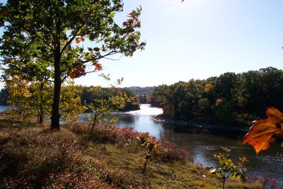
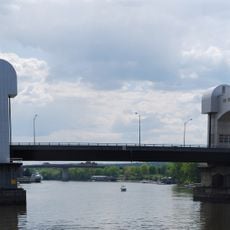
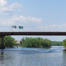
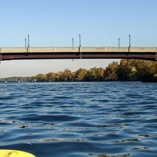
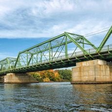
Peebles Island State Park sits where the Hudson and Mohawk Rivers meet, with a mix of wooded trails, open grasslands, and rocky areas to explore. The park spans several hundred acres and includes access to water views and historic structures from earlier times.

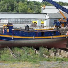
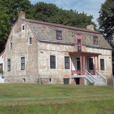
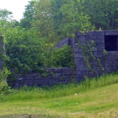
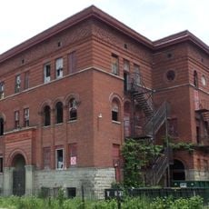
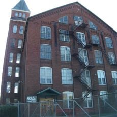
The site held military importance during the War of 1812, when defensive works were built to protect water routes leading inland. Later it became an industrial area with mills and factories before eventually turning into a public park in the 1900s.

The place takes its name from a family that settled here and shaped the landscape over generations. Walking through the park today, you can spot old stone walls and building foundations scattered across the grounds that mark their presence.

The park is open daily from sunrise to sunset and features clearly marked trails for different abilities and interests. Bring sturdy shoes for rocky and sometimes muddy sections, and plan visits around daylight hours since facilities are minimal in the evening.

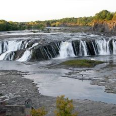
The spot where two major rivers collide creates powerful rapids that are visible and dramatic from several walking routes across the island. This natural spectacle draws visitors who want to witness the raw force of moving water.

Location: New York

Operator: New York State Office of Parks, Recreation and Historic Preservation

Phone: +15182378643

Website: http://nysparks.com/parks/111/details.aspx

GPS coordinates: 42.78117,-73.68515

Latest update: December 9, 2025 18:44

Photos
Around this place
Cohoes Falls
United States of America

Cohoes Falls

2.1 km
Green Island Bridge
United States of America

Green Island Bridge

5.1 km
Harmony Mills
United States of America

Harmony Mills

1.6 km
Cohoes Music Hall
United States of America

Cohoes Music Hall

1.5 km
Day Peckinpaugh
United States of America

Day Peckinpaugh

507 m
Kate Mullany House
United States of America

Kate Mullany House

4.6 km
Urger
United States of America

Urger

1.7 km
Collar City Bridge
United States of America

Collar City Bridge

4.6 km
112th Street Bridge
United States of America

112th Street Bridge

1.1 km
Downtown Cohoes Historic District
United States of America

Downtown Cohoes Historic District

1.5 km
Lansingburgh Academy
United States of America

Lansingburgh Academy

1.2 km
Troy–Waterford Bridge
United States of America

Troy–Waterford Bridge

1.2 km
Harmony Mill No. 3
United States of America

Harmony Mill No. 3

1.6 km
Van Schaick House
United States of America

Van Schaick House

1.5 km
Lock 18 of Enlarged Erie Canal
United States of America

Lock 18 of Enlarged Erie Canal

2.2 km
Haskell School
United States of America

Haskell School

2.7 km
Rensselaer and Saratoga Railroad: Green Island Shops
United States of America

Rensselaer and Saratoga Railroad: Green Island Shops

3.5 km
Olmstead Street Historic District
United States of America

Olmstead Street Historic District

1.6 km
Waterford Village Historic District
United States of America

Waterford Village Historic District

1.1 km
Northside Historic District
United States of America

Northside Historic District

756 m
Cohoes City Hall
United States of America

Cohoes City Hall

1.4 km
Trinity Church Lansingburgh
United States of America

Trinity Church Lansingburgh

1.1 km
J. Leonard Lackman House
United States of America

J. Leonard Lackman House

2 km
William J. Dickey House
United States of America

William J. Dickey House

2 km
St. Mark's Episcopal Church
United States of America

St. Mark's Episcopal Church

4.4 km
Ormsby-Laughlin Textile Companies Mill
United States of America

Ormsby-Laughlin Textile Companies Mill

812 m
Green Island Lanes
United States of America

Green Island Lanes

4.8 km
Cohoes Bowling Arena
United States of America

Cohoes Bowling Arena

1.7 km
Show the full map
Reviews

Visited this place? Tap the stars to rate it and share your experience / photos with the community! Try now! You can cancel it anytime.

« Peebles Island State Park - State park and historic district in Waterford, United States » is provided by Around Us (aroundus.com). Images and texts are derived from Wikimedia project under a Creative Commons license. You are allowed to copy, distribute, and modify copies of this page, under the conditions set by the license, as long as this note is clearly visible.

Discover hidden gems everywhere you go!

From secret cafés to breathtaking viewpoints, skip the crowded tourist spots and find places that match your style. Our app makes it easy with voice search, smart filtering, route optimization, and insider tips from travelers worldwide. Download now for the complete mobile experience.

Around Us App Screenshot

A unique approach to discovering new places

Le Figaro

All the places worth exploring

France Info

A tailor-made excursion in just a few clicks

20 Minutes