Enable Location

We need your location to show you interesting places around you

Discover nearby places

Find interesting locations and hidden gems around you

Precise directions

Get accurate directions and distances to places

Your location is never shared with other users. It's only used when you tap the location button.

Otis Pike Fire Island High Dune Wilderness

Log in to your account

Start exploring — it's free

Trusted by 61,814 travelers worldwide

Continue with Google
Continue with Apple
or

We will send you a code to connect

By continuing, you accept our Terms and Conditions and our Privacy Policy

Check your inbox

We've sent a pincode in your inbox. Please enter the code below.

Otis Pike Fire Island High Dune Wilderness

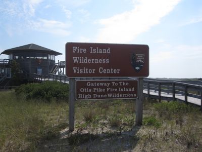
Otis Pike Fire Island High Dune Wilderness, Wilderness area on Fire Island, United States.

Description

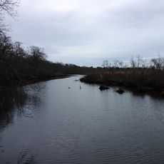
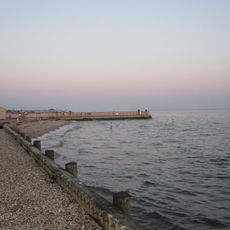
Otis Pike Fire Island High Dune Wilderness is a 1,380-acre protected area stretching seven miles along Fire Island's eastern section. The land contains pine forests, wetlands, and coastal dunes that create a varied natural landscape.

History

Congress established this wilderness area in 1980 and named it after New York Congressman Otis G. Pike. Pike had been an advocate for protecting Fire Island from development.

Culture

This land served as a seasonal hunting and gathering place for the Unkechaug, Secatogue, Shinnecock, and Montaukett nations for centuries. Visitors walking through the area today experience the same forests and waters that sustained these communities.

Practical

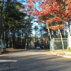
Access is on foot only through Smith Point County Park or Watch Hill, and backcountry camping requires permits. Plan ahead whether you are visiting for a day trip or an overnight adventure.

Did you know?

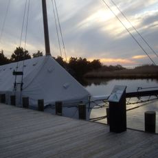
The remains of the Bessie A. White, a ship that sank in 1922, lie within the protected area. These remnants tell the story of maritime activity that once took place along this coast.

Location
GPS coordinates
40.71170,-72.92830
Latest update
December 11, 2025 11:01

AroundUs brings together thousands of curated places, local tips, and hidden gems, enriched daily by 60,000 contributors worldwide. Discover all places nearby (New York).

Around this place
Bayport - Blue Point High School
United States of America

Bayport - Blue Point High School

11.2 km
Gateway Playhouse
United States of America

Gateway Playhouse

5.7 km
Wertheim National Wildlife Refuge
United States of America

Wertheim National Wildlife Refuge

8.4 km
William Floyd House
United States of America

William Floyd House

11 km
Patchogue Theatre
United States of America

Patchogue Theatre

9.4 km
Southaven County Park
United States of America

Southaven County Park

12.2 km
Carrington House
United States of America

Carrington House

13.8 km
Smith Point Bridge
United States of America

Smith Point Bridge

5.9 km
Sandspit Park Beach & Marina
United States of America

Sandspit Park Beach & Marina

8.3 km
United States of America

Shorefront Park

7.8 km
Priscilla
United States of America

Priscilla

14.1 km
John Ellis Roosevelt Estate
United States of America

John Ellis Roosevelt Estate

12.5 km
Long Island Maritime Museum
United States of America

Long Island Maritime Museum

14.1 km
Patchogue-Medford Library
United States of America

Patchogue-Medford Library

9.4 km
United States of America

Harold H. Malkmes Wildlife Education and Ecology Center

13.3 km
Bellport Village Historic District
United States of America

Bellport Village Historic District

5.2 km
United States of America

Swan Lake Park

8.5 km
Mascot Dock
United States of America

Mascot Dock

7.9 km
Homan-Gerard House and Mills
United States of America

Homan-Gerard House and Mills

13.9 km
Suffolk County Almshouse Barn
United States of America

Suffolk County Almshouse Barn

13 km
Bellport Academy
United States of America

Bellport Academy

4.8 km
Robert Hawkins Homestead
United States of America

Robert Hawkins Homestead

11.8 km
Rudolph Oyster House
United States of America

Rudolph Oyster House

14.1 km
Smith-Rourke House
United States of America

Smith-Rourke House

7 km
Joseph Wood House
United States of America

Joseph Wood House

12.7 km
Masury Estate Ballroom
United States of America

Masury Estate Ballroom

12.8 km
Brookhaven Free
United States of America

Brookhaven Free

7 km
Patchogue-medford Library
United States of America

Patchogue-medford Library

9.4 km
Show the full map
« Otis Pike Fire Island High Dune Wilderness - Wilderness area on Fire Island, United States » is provided by Around Us (aroundus.com). Images and texts are derived from Wikimedia project under a Creative Commons license. You are allowed to copy, distribute, and modify copies of this page, under the conditions set by the license, as long as this note is clearly visible.

Discover hidden gems everywhere you go!

From secret cafés to breathtaking viewpoints, skip the crowded tourist spots and find places that match your style. Our app makes it easy with voice search, smart filtering, route optimization, and insider tips from travelers worldwide. Download now for the complete mobile experience.

Around Us App Screenshot

A unique approach to discovering new places

Le Figaro

All the places worth exploring

France Info

A tailor-made excursion in just a few clicks

20 Minutes

Around Us
Travel Guide & Maps
Download

Send to your phone

QR Code
1

Open the camera app on your mobile.

2

Point at the QR code with your camera. A notification will appear.

3

Tap the notification to open the link.