Enable Location

We need your location to show you interesting places around you

Discover nearby places

Find interesting locations and hidden gems around you

Precise directions

Get accurate directions and distances to places

Your location is never shared with other users. It's only used when you tap the location button.

Parque de los Próceres

Log in to your account

Start exploring — it's free

Trusted by 61,556 travelers worldwide

Continue with Google
Continue with Apple
or

We will send you a code to connect

By continuing, you accept our Terms and Conditions and our Privacy Policy

Check your inbox

We've sent a pincode in your inbox. Please enter the code below.

Parque de los Próceres

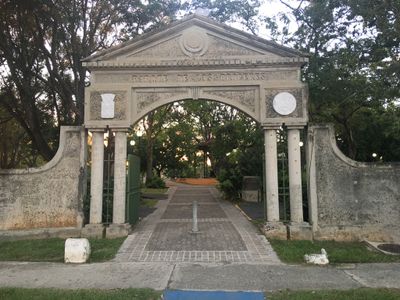
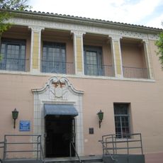
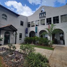
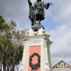
Parque de los Próceres, Urban park in Mayagüez, Puerto Rico.

Description

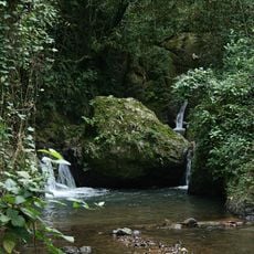
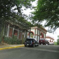
Parque de los Próceres spans approximately two acres along the banks of the Yagüez River, featuring well-maintained gardens, commemorative plaques, ornate gazebos, and decorative ponds that create a peaceful environment for visitors seeking outdoor recreation and relaxation.

History

Established in 1977 through federal funding obtained by Mayor Don Benjamín Cole from the United States Department of Commerce's Economic Development Administration, the park was created as part of broader efforts to develop recreational and memorial spaces celebrating Puerto Rican heritage.

Culture

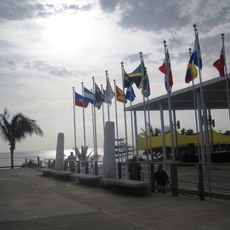
The park serves as an educational site where visitors learn about Puerto Rico's history through numerous exhibits and plaques dedicated to national heroes, making it a meaningful cultural landmark that reinforces local pride and historical awareness among residents and tourists.

Practical

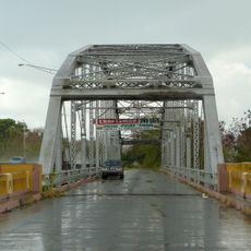
Located between roads PR-108 and PR-65 across from Palacio de Recreación y Deportes, the park offers walking and biking pathways, benches, lighting, and designated areas for public gatherings, with easy access via main transportation routes throughout Mayagüez.

Did you know?

Known as 'the lungs of the city of Mayagüez,' this park uniquely combines environmental benefits with historical commemoration, hosting patriotic celebrations and school visits while providing essential green space that contributes to the urban landscape's environmental quality and community well-being.

Location
Inception
1977
GPS coordinates
18.20624,-67.13781
Latest update
July 24, 2025 10:53

AroundUs brings together thousands of curated places, local tips, and hidden gems, enriched daily by 60,000 contributors worldwide. Discover all places nearby (Puerto Rico).

Around this place
Porta Coeli
United States of America

Porta Coeli

16.8 km
Dr. Juan A. Rivero Zoo
United States of America

Dr. Juan A. Rivero Zoo

1.1 km
Mayagüez Athletics Stadium
United States of America

Mayagüez Athletics Stadium

2.5 km
Maricao State Forest
United States of America

Maricao State Forest

19.6 km
Playa Buyé
United States of America

Playa Buyé

19.8 km
Teatro Yagüez
United States of America

Teatro Yagüez

614 m
Minor Basilica of the Virgin of Montserrat
United States of America

Minor Basilica of the Virgin of Montserrat

7.1 km
Isidoro García Stadium
United States of America

Isidoro García Stadium

2.4 km
Aguada Stadium
United States of America

Aguada Stadium

20.1 km
San Germán de Auxerre Church
United States of America

San Germán de Auxerre Church

16.8 km
Mayagüez City Hall
United States of America

Mayagüez City Hall

606 m
Puente de Añasco
United States of America

Puente de Añasco

7.8 km
Mayagüez Municipal Cemetery
United States of America

Mayagüez Municipal Cemetery

1.7 km
Parque del Litoral
United States of America

Parque del Litoral

1.7 km
San Sebastián Mártir Church
United States of America

San Sebastián Mártir Church

21.4 km
José de Diego Building
United States of America

José de Diego Building

509 m
Logia Adelphia
United States of America

Logia Adelphia

680 m
U.S. Custom House (Mayagüez, Puerto Rico)
United States of America

U.S. Custom House (Mayagüez, Puerto Rico)

1.4 km
El Mani Pavilion
United States of America

El Mani Pavilion

5.9 km
Gómez Residence
United States of America

Gómez Residence

730 m
Pico Piedra
United States of America

Pico Piedra

21.4 km
Silva Bridge
United States of America

Silva Bridge

7.5 km
Salto Curet Waterfall
United States of America

Salto Curet Waterfall

20 km
Miguel Angel García Méndez Post Office Building
United States of America

Miguel Angel García Méndez Post Office Building

830 m
MUSA Art Museum
Puerto Rico

MUSA Art Museum

669 m
Statue of Christopher Columbus (Mayagüez)
United States of America

Statue of Christopher Columbus (Mayagüez)

586 m
Manchas Grandes
United States of America

Manchas Grandes

5.9 km
Roca Blanca
United States of America

Roca Blanca

5.1 km
Show the full map
« Parque de los Próceres - Urban park in Mayagüez, Puerto Rico » is provided by Around Us (aroundus.com). Images and texts are derived from Wikimedia project under a Creative Commons license. You are allowed to copy, distribute, and modify copies of this page, under the conditions set by the license, as long as this note is clearly visible.

Discover hidden gems everywhere you go!

From secret cafés to breathtaking viewpoints, skip the crowded tourist spots and find places that match your style. Our app makes it easy with voice search, smart filtering, route optimization, and insider tips from travelers worldwide. Download now for the complete mobile experience.

Around Us App Screenshot

A unique approach to discovering new places

Le Figaro

All the places worth exploring

France Info

A tailor-made excursion in just a few clicks

20 Minutes

Around Us
Travel Guide & Maps
Download

Send to your phone

QR Code
1

Open the camera app on your mobile.

2

Point at the QR code with your camera. A notification will appear.

3

Tap the notification to open the link.