Quehanna Wild Area, Nature reserve in Pennsylvania, United States.
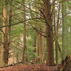
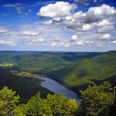
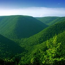
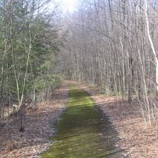
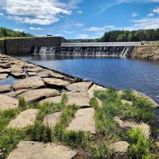
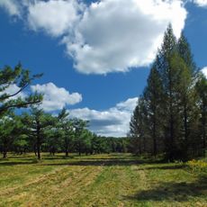
Quehanna Wild Area is a nature reserve in Pennsylvania that covers three counties and connects wooded tracts with wetlands, streams, and trails. The paths wind through hardwood and conifer forests, past small waterfalls and over gentle hills that form the Allegheny Plateau relief.
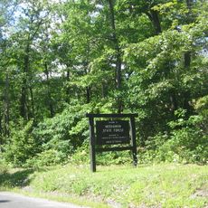
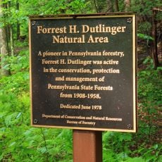
After decades of timber operations and a period as a nuclear research site in the 1950s, the area was protected by Pennsylvania in 1965. The conversion allowed nature to reclaim abandoned clearings and former access routes.
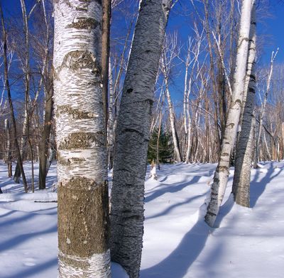
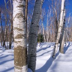
The name Quehanna comes from a Lenape term meaning elk pasture, linking the reserve to the animals that once roamed this region in great numbers. Today hikers and naturalists walk through old growth stands where birch and hemlock create pockets of cool shade and soft light.
The best months for walking are spring and fall when insects are less active and trees show color or fresh growth. Visitors should bring navigation tools because some sections have minimal markers and the terrain can become pathless.
The birches in Marion Brooks Natural Area rank among the largest of their kind east of the Mississippi and form a pale contrast to the darker conifers around them. Table Run Falls lies off the main routes and reveals a small pool that becomes a good spot for watching amphibians in warmer months.
Location: Pennsylvania
Operator: Pennsylvania Bureau of Forestry
GPS coordinates: 41.27420,-78.25670
Latest update: December 5, 2025 22:28
Parker Dam State Park
22.6 km
Kettle Creek State Park
30.4 km
Sinnemahoning State Park
26 km
Moshannon State Forest
27.7 km
Elk State Forest
7.2 km
Bucktail State Park Natural Area
26.5 km
Marion Brooks Natural Area
2.6 km
Wykoff Run Natural Area
6.9 km
Clearfield County Courthouse
31.9 km
St. Severin's Old Log Church
29.6 km
Forrest H. Duttlinger Natural Area
38.5 km
Parker Dam State Park Beach
22.8 km
Philipsburg Historic District
41.8 km
St. Marys Historic District
30.9 km
Old Town Historic District
32 km
Cameron County Courthouse
26.7 km
John E. Weidenboerner House
30.8 km
Thomas Murray House
32.1 km
S. B. Elliott State Park
29.6 km
Market Street Bridge
32.1 km
Parker Dam State Park Family Cabin District
23.3 km
S. B. Elliott State Park Family Cabin District
28.7 km
S. B. Elliott State Park Day Use District
28.8 km
Black Moshannon State Park Day Use District
43.2 km
Black Moshannon Beach
43.2 km
Clearfield Presbyterian Church
31.7 km
Black Moshannon State Park Maintenance District
42.2 km
Parker Dam State Park-Parker Dam District
22.7 kmVisited this place? Tap the stars to rate it and share your experience / photos with the community! Try now! You can cancel it anytime.
Discover hidden gems everywhere you go!
From secret cafés to breathtaking viewpoints, skip the crowded tourist spots and find places that match your style. Our app makes it easy with voice search, smart filtering, route optimization, and insider tips from travelers worldwide. Download now for the complete mobile experience.
A unique approach to discovering new places❞
— Le Figaro
All the places worth exploring❞
— France Info
A tailor-made excursion in just a few clicks❞
— 20 Minutes