Chest opened
+${chestReward.xp} XP
Explorer
NOUVEAU ×${chestReward.collectible.quantity}
tapez pour fermer
Chest locked

Open chests in the app

Around Us is built for your phone — chests unlock when you walk, explore and capture nearby places.

Enable Location

We need your location to show you interesting places around you

Discover nearby places

Find interesting locations and hidden gems around you

Precise directions

Get accurate directions and distances to places

Your location is never shared with other users. It's only used when you tap the location button.

Log in to your account

Start exploring — it's free

Trusted by 72,983 travelers worldwide

Continue with Google
Continue with Apple
or

We will send you a code to connect

By continuing, you accept our Terms and Conditions and our Privacy Policy

Check your inbox

We've sent a pincode in your inbox. Please enter the code below.

Stony River Reservoir
Discussion Reviews Photo
1.7k Popularity

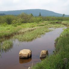
Stony River Reservoir, body of water

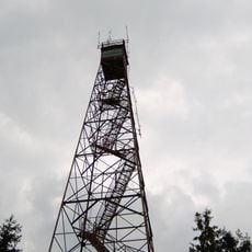
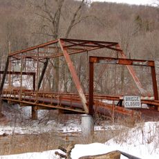
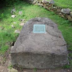
Stony River Reservoir is a former lake in Grant County created in the late 1800s to supply water for a pulp mill. The dam that held back the water was later dismantled, allowing the river to flow freely again, though portions of the structure remain on either side of the waterway.

The dam was built in the late 1800s by the Westvaco company to provide water for its pulp mill operations. Over time, structural problems developed, and workers periodically had to empty the reservoir for repairs, eventually leading to the removal of the dam's central section to restore the river's natural flow.

The reservoir was built to support Westvaco's pulp mill, a factory that turned wood into paper products for the region. The dam remnants visible today reflect how industry once shaped daily life and work in this rural West Virginia community.

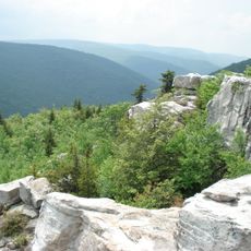
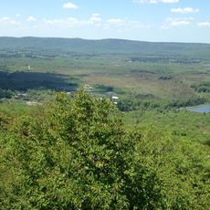
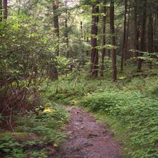
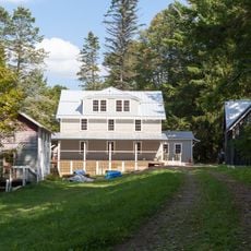
The site is easily walkable with open, natural terrain along the river for exploration. The quiet setting with no major buildings or traffic nearby makes it an accessible destination for peaceful visits.

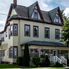
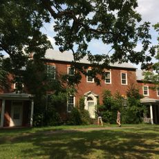
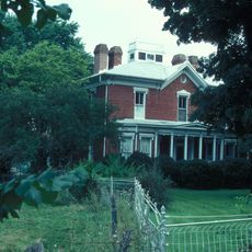
William Luke, likely a prominent Westvaco official, built his summer home right beside the reservoir to enjoy views of the water. His residence stood at the intersection of industrial development and personal retreat, capturing a moment when the altered landscape served both work and leisure.

The community of curious travelers

AroundUs brings together thousands of curated places, local tips, and hidden gems, enriched daily by 60,000 contributors worldwide.

Start exploring
Location
GPS coordinates
39.13730,-79.29870
Latest update
February 9, 2026 08:20
Around this place
Dolly Sods Wilderness
United States of America

Dolly Sods Wilderness

16.9 km
Canaan Valley
United States of America

Canaan Valley

7 km
Hoye-Crest
United States of America

Hoye-Crest

19.6 km
Blackwater Falls
United States of America

Blackwater Falls

17.3 km
Fairfax Stone State Park
United States of America

Fairfax Stone State Park

17.5 km
Canaan Valley Resort State Park
United States of America

Canaan Valley Resort State Park

19.2 km
Smoke Hole Caverns
United States of America

Smoke Hole Caverns

17.1 km
Elakala Falls
United States of America

Elakala Falls

17.6 km
Blackwater Canyon
United States of America

Blackwater Canyon

22 km
Cathedral State Park
United States of America

Cathedral State Park

29.5 km
Bear Rocks Preserve
United States of America

Bear Rocks Preserve

7.1 km
Canaan Valley National Wildlife Refuge
United States of America

Canaan Valley National Wildlife Refuge

8 km
Roaring Plains West Wilderness
United States of America

Roaring Plains West Wilderness

25 km
Olson Observation Tower
United States of America

Olson Observation Tower

26.5 km
Herman August Meyer House
United States of America

Herman August Meyer House

14.2 km
Grant County Courthouse
United States of America

Grant County Courthouse

22.2 km
Brookside Historic District
United States of America

Brookside Historic District

29.2 km
Cottrill Opera House
United States of America

Cottrill Opera House

17.3 km
Hickory Hill
United States of America

Hickory Hill

25 km
Bayard Bridge
United States of America

Bayard Bridge

16.4 km
Gaymont
United States of America

Gaymont

29.2 km
United States of America

Gormania Presbyterian Church

17.8 km
Thomas Commercial Historic District
United States of America

Thomas Commercial Historic District

17.3 km
Wilson-Kuykendall Farm
United States of America

Wilson-Kuykendall Farm

29.1 km
Hardy County Public Library
United States of America

Hardy County Public Library

29.6 km
McCoy's Grand Theatre
United States of America

McCoy's Grand Theatre

29.6 km
Grant County Public Library
United States of America

Grant County Public Library

21.9 km
Fairfax Stone Historical Monument
United States of America

Fairfax Stone Historical Monument

17.5 km
Show the full map
Reviews
Share your experience

No review yet

Discussions
Start a discussion...

No discussion yet

« Stony River Reservoir - body of water » is provided by Around Us (aroundus.com). Images and texts are derived from Wikimedia project under a Creative Commons license. You are allowed to copy, distribute, and modify copies of this page, under the conditions set by the license, as long as this note is clearly visible.

Discover hidden gems everywhere you go!

From secret cafés to breathtaking viewpoints, skip the crowded tourist spots and find places that match your style. Our app makes it easy with voice search, smart filtering, route optimization, and insider tips from travelers worldwide. Download now for the complete mobile experience.

Around Us App Screenshot

A unique approach to discovering new places

Le Figaro

All the places worth exploring

France Info

A tailor-made excursion in just a few clicks

20 Minutes

Around Us
Travel Guide & Maps
Download

Send to your phone

QR Code
1

Open the camera app on your mobile.

2

Point at the QR code with your camera. A notification will appear.

3

Tap the notification to open the link.