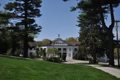
Rhodes-on-the Pawtuxet, Historic recreational complex in Cranston, United States
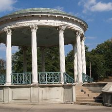
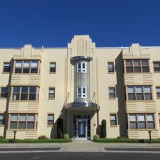
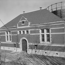
Rhodes-on-the-Pawtuxet is a recreational complex featuring a Classical Revival ballroom and a Victorian gazebo beside the Pawtuxet River, with parts dating to 1880. The ballroom was rebuilt in 1915 after a major fire, and it stands alongside the original gazebo which has survived intact.
The complex was founded in 1880 as a leisure and social destination that quickly became a popular gathering place. A major fire destroyed most of the original buildings, leaving only the gazebo standing, while a new ballroom was constructed in the early 1900s to replace what was lost.
The name comes from the original owner, and the architecture reflects early 1900s leisure culture visible in every detail. Visitors can observe how these spaces were designed for social gatherings and continue to serve that purpose today.
The site functions today as an event venue and is best visited by checking ahead about what activities or open events may be happening. Its location along the river offers the chance to walk the grounds and view both main buildings from the outside.
The original gazebo displays intricate Victorian scrollwork and turned corner posts that reveal hand-carved details from 1880. These fine decorative elements are rarely seen today and show the quality of early recreational architecture.
Location: Cranston
GPS coordinates: 41.76778,-71.39222
Latest update: December 14, 2025 11:21
Roger Williams Park
2.4 km
Pawtuxet Village
478 m
Crescent Park Looff Carousel
3 km
Crescent Park
3.1 km
Pomham Rocks Light
2.2 km
Roger Williams Park Museum of Natural History and Planetarium
2.7 km
Squantum Association
2.9 km
Roger Williams Park Botanical Center
2.1 km
Sabin Point Light
1.6 km
Rosedale Apartments
1.6 km
Return Sludge Pumping Station, Fields Point Sewage Treatment Plant
3 km
Roger Williams Botanical Center
2 km
Bicknell-Armington Lightning Splitter House
2.6 km
Christopher Rhodes House
469 m
Phillipsdale Historic District
480 m
Edgewood Historic District-Shaw Plat
843 m
Fuller Rock Light
3.1 km
John Waterman Arnold House
1.5 km
District 6 Schoolhouse
3.1 km
Chemical Building, Fields Point Sewage Treatment Plant
3 km
Washington Park Sewage Pumping Station
2.6 km
Whitcomb Farm
2.7 km
Edgewood Historic District-Sally Greene Homestead Plats
545 m
Edgewood Historic District–Anstis Greene Estate Plats
692 m
Edgewood Historic District-Arnold Farm Plat
1.1 km
Ernest Street Sewage Pumping Station
3.1 km
Edgewood Historic District-Aberdeen Plat
291 m
Edgewood Historic District-Taft Estate Plat
336 mVisited this place? Tap the stars to rate it and share your experience / photos with the community! Try now! You can cancel it anytime.
Discover hidden gems everywhere you go!
From secret cafés to breathtaking viewpoints, skip the crowded tourist spots and find places that match your style. Our app makes it easy with voice search, smart filtering, route optimization, and insider tips from travelers worldwide. Download now for the complete mobile experience.
A unique approach to discovering new places❞
— Le Figaro
All the places worth exploring❞
— France Info
A tailor-made excursion in just a few clicks❞
— 20 Minutes