Enable Location

We need your location to show you interesting places around you

Discover nearby places

Find interesting locations and hidden gems around you

Precise directions

Get accurate directions and distances to places

Your location is never shared with other users. It's only used when you tap the location button.

Riverside Farm

Log in to your account

Start exploring — it's free

Trusted by 62,377 travelers worldwide

Continue with Google
Continue with Apple
or

We will send you a code to connect

By continuing, you accept our Terms and Conditions and our Privacy Policy

Check your inbox

We've sent a pincode in your inbox. Please enter the code below.

Riverside Farm, listed on the National Register of Historic Places in Bucks County, Pennsylvania

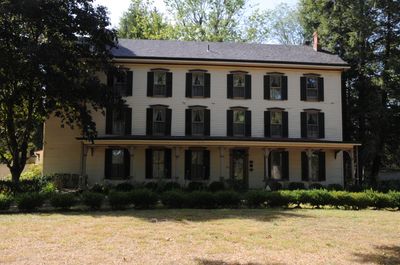
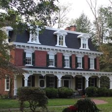
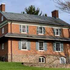
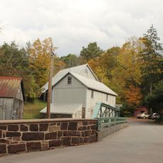
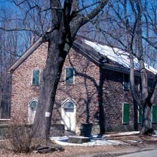
Riverside Farm, also known as Evermay-on-the-Delaware, is a historic property in Erwinna, Pennsylvania, featuring a three-and-a-half-story main house and several outbuildings. The main structure combines Greek Revival and Italianate architectural elements with wooden siding and a broad front porch.

The property was established before 1832 when Henry Stover purchased the land from Revolutionary War veteran William Erwin and developed it as a family home. Around 1880, his son Jordan transformed the grounds into a hotel called River-Side Mansion to attract wealthy clientele from nearby cities.

The name Evermay-on-the-Delaware reflects its riverside location and vision as an eternal place of rest and leisure. In the early 1900s, it served as a retreat for wealthy city visitors seeking relaxation and social gatherings in the countryside.

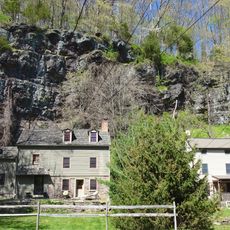
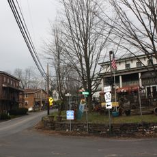
The property sits along the Delaware River in Bucks County and is accessible via River Road for easy location. Note that the estate is now privately owned and closed to public visits, though its external history and architecture remain visible from the road.

Famous baseball players like Ty Cobb and Eddie Collins visited the hotel in the 1880s, and boxer John L. Sullivan signed the guest book. Additionally, workers discovered the skeleton of a Lenni Lenape leader on the grounds in 1886, along with arrowheads that were carefully reburied on the site.

The community of curious travelers

AroundUs brings together thousands of curated places, local tips, and hidden gems, enriched daily by 60,000 contributors worldwide.

Start exploring
Location
Architectural style
Greek Revival architecture, Renaissance Revival architecture
GPS coordinates
40.50028,-75.06833
Latest update
February 9, 2026 07:46
Around this place
Treasure Island Scout Reservation
United States of America

Treasure Island Scout Reservation

3.1 km
Ralph Stover State Park
United States of America

Ralph Stover State Park

7.8 km
Lumberville – Raven Rock Bridge
United States of America

Lumberville – Raven Rock Bridge

10.6 km
Bulls Island Recreation Area
United States of America

Bulls Island Recreation Area

10.4 km
Uhlerstown–Frenchtown Bridge
United States of America

Uhlerstown–Frenchtown Bridge

2.9 km
Green Sergeant's Covered Bridge
United States of America

Green Sergeant's Covered Bridge

10.7 km
Ringing Rocks County Park
United States of America

Ringing Rocks County Park

8.4 km
Lower Delaware National Wild and Scenic River
United States of America

Lower Delaware National Wild and Scenic River

406 m
Upper Black Eddy – Milford Bridge
United States of America

Upper Black Eddy – Milford Bridge

7.8 km
Point Pleasant-Byram Bridge
United States of America

Point Pleasant-Byram Bridge

8.6 km
Loux Covered Bridge
United States of America

Loux Covered Bridge

10 km
Old Stone Church
United States of America

Old Stone Church

7.1 km
Frankenfield Covered Bridge
United States of America

Frankenfield Covered Bridge

3.8 km
Stover-Myers Mill
United States of America

Stover-Myers Mill

8.4 km
Bridge in Tinicum Township
United States of America

Bridge in Tinicum Township

8.5 km
Isaac Stover House
United States of America

Isaac Stover House

372 m
Stover Mill
United States of America

Stover Mill

402 m
Covered Bridge Historic District
United States of America

Covered Bridge Historic District

10.7 km
Erwinna Covered Bridge
United States of America

Erwinna Covered Bridge

595 m
Red Hill Church and School
United States of America

Red Hill Church and School

8.3 km
Thatcher House
United States of America

Thatcher House

5.7 km
Raven Rock Historic District
United States of America

Raven Rock Historic District

10.3 km
Point Pleasant Historic District
United States of America

Point Pleasant Historic District

8.7 km
Lewis Summers Farm
United States of America

Lewis Summers Farm

7.8 km
Ridge Valley Rural Historic District
United States of America

Ridge Valley Rural Historic District

6.8 km
Locktown Baptist Church
United States of America

Locktown Baptist Church

8.3 km
Ringing Rocks County Park
United States of America

Ringing Rocks County Park

8.4 km
Frenchtown Historic District
United States of America

Frenchtown Historic District

3.1 km
Show the full map
« Riverside Farm - listed on the National Register of Historic Places in Bucks County, Pennsylvania » is provided by Around Us (aroundus.com). Images and texts are derived from Wikimedia project under a Creative Commons license. You are allowed to copy, distribute, and modify copies of this page, under the conditions set by the license, as long as this note is clearly visible.

Discover hidden gems everywhere you go!

From secret cafés to breathtaking viewpoints, skip the crowded tourist spots and find places that match your style. Our app makes it easy with voice search, smart filtering, route optimization, and insider tips from travelers worldwide. Download now for the complete mobile experience.

Around Us App Screenshot

A unique approach to discovering new places

Le Figaro

All the places worth exploring

France Info

A tailor-made excursion in just a few clicks

20 Minutes

Around Us
Travel Guide & Maps
Download

Send to your phone

QR Code
1

Open the camera app on your mobile.

2

Point at the QR code with your camera. A notification will appear.

3

Tap the notification to open the link.