Enable Location

We need your location to show you interesting places around you

Discover nearby places

Find interesting locations and hidden gems around you

Precise directions

Get accurate directions and distances to places

Your location is never shared with other users. It's only used when you tap the location button.

Rumford Chemical Works and Mill House Historic District

Log in to your account

Start exploring — it's free

Trusted by 61,634 travelers worldwide

Continue with Google
Continue with Apple
or

We will send you a code to connect

By continuing, you accept our Terms and Conditions and our Privacy Policy

Check your inbox

We've sent a pincode in your inbox. Please enter the code below.

Rumford Chemical Works and Mill House Historic District

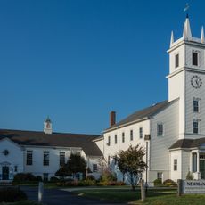
Rumford Chemical Works and Mill House Historic District, Industrial historic district in East Providence, United States.

Description

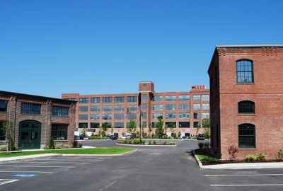
Rumford Chemical Works and Mill House Historic District is an industrial site in East Providence with structures from the 1800s. The complex includes a three-story brick warehouse built in 1895 and multiple wood-frame buildings along Newman Avenue that originally served chemical manufacturing.

History

The facility was established in 1857 and initially produced calcium sulfite. The works later shifted to manufacturing baking powder under a patent, becoming a major production center for this product.

Culture

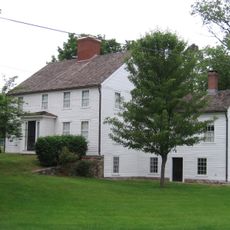
The district contains worker housing duplexes along North Broadway that reflect how factory employees lived during the 1800s. These buildings show the everyday layout of a neighborhood built around industrial work.

Practical

The site is partially accessible to the public today as it houses various local businesses and residential spaces. Visitors can view the exterior of the historic buildings and explore the industrial architecture from different angles along Newman Avenue and North Broadway.

Did you know?

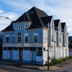
The complex preserves the original layout of a 1800s chemical plant across roughly 8.5 acres. The buildings display Queen Anne architectural elements, which were uncommon in industrial complexes of that era and show how the works blended beauty with practical design.

Location
GPS coordinates
41.83940,-71.35440
Latest update
December 12, 2025 17:44

AroundUs brings together thousands of curated places, local tips, and hidden gems, enriched daily by 60,000 contributors worldwide. Discover all places nearby (East Providence).

Around this place
Brown Stadium
United States of America

Brown Stadium

3.3 km
Crook Point Bascule Bridge
United States of America

Crook Point Bascule Bridge

3.1 km
Slater Park
United States of America

Slater Park

3.6 km
Pizzitola Sports Center
United States of America

Pizzitola Sports Center

3.7 km
Washington Bridge
United States of America

Washington Bridge

3.5 km
Henderson Bridge
United States of America

Henderson Bridge

2.2 km
United States of America

Wayland Square

3 km
Dexter Asylum
United States of America

Dexter Asylum

3.7 km
India Point Railroad Bridge
United States of America

India Point Railroad Bridge

3.7 km
Phillip Walker House
United States of America

Phillip Walker House

1.3 km
World War I Memorial
United States of America

World War I Memorial

2.6 km
Newman Congregational Church
United States of America

Newman Congregational Church

352 m
Oddfellows' Hall
United States of America

Oddfellows' Hall

3.4 km
Rochambeau Library-Providence Community Library
United States of America

Rochambeau Library-Providence Community Library

3.6 km
Boston and Providence Railroad Bridge
United States of America

Boston and Providence Railroad Bridge

850 m
Wayland Historic District
United States of America

Wayland Historic District

2.7 km
Blackstone Park Historic District
United States of America

Blackstone Park Historic District

2.3 km
Freeman Plat Historic District
United States of America

Freeman Plat Historic District

3.3 km
Stimson Avenue Historic District
United States of America

Stimson Avenue Historic District

3.6 km
Elmgrove Gardens Historic District
United States of America

Elmgrove Gardens Historic District

3.2 km
Louis Kotzow House
United States of America

Louis Kotzow House

3.8 km
Omega Pond Railroad Bridge
United States of America

Omega Pond Railroad Bridge

1.2 km
Blackstone Boulevard–Cole Avenue–Grotto Avenue Historic District
United States of America

Blackstone Boulevard–Cole Avenue–Grotto Avenue Historic District

2.6 km
Olney Street-Alumni Avenue Historic District
United States of America

Olney Street-Alumni Avenue Historic District

3.6 km
Ladd Observatory
United States of America

Ladd Observatory

3.7 km
Lippitt House Museum
United States of America

Lippitt House Museum

3.7 km
Nathaniel Daggett House
United States of America

Nathaniel Daggett House

718 m
Morris Brown House
United States of America

Morris Brown House

3.4 km
Show the full map
« Rumford Chemical Works and Mill House Historic District - Industrial historic district in East Providence, United States » is provided by Around Us (aroundus.com). Images and texts are derived from Wikimedia project under a Creative Commons license. You are allowed to copy, distribute, and modify copies of this page, under the conditions set by the license, as long as this note is clearly visible.

Discover hidden gems everywhere you go!

From secret cafés to breathtaking viewpoints, skip the crowded tourist spots and find places that match your style. Our app makes it easy with voice search, smart filtering, route optimization, and insider tips from travelers worldwide. Download now for the complete mobile experience.

Around Us App Screenshot

A unique approach to discovering new places

Le Figaro

All the places worth exploring

France Info

A tailor-made excursion in just a few clicks

20 Minutes

Around Us
Travel Guide & Maps
Download

Send to your phone

QR Code
1

Open the camera app on your mobile.

2

Point at the QR code with your camera. A notification will appear.

3

Tap the notification to open the link.