Enable Location

We need your location to show you interesting places around you

Discover nearby places

Find interesting locations and hidden gems around you

Precise directions

Get accurate directions and distances to places

Your location is never shared with other users. It's only used when you tap the location button.

Log in to your account

Start exploring — it's free

Trusted by 61,629 travelers worldwide

Continue with Google
Continue with Apple
or

We will send you a code to connect

By continuing, you accept our Terms and Conditions and our Privacy Policy

Check your inbox

We've sent a pincode in your inbox. Please enter the code below.

Wayland Square

Wayland Square, Shopping district in Providence, United States

Description

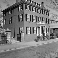
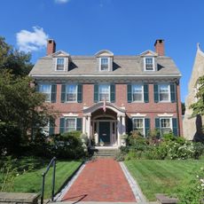
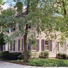
Wayland Square is a shopping district on Providence's East Side with retail stores, restaurants, and boutiques arranged along tree-lined streets near the Seekonk River. The area spreads across several blocks with a mix of local independent shops and established businesses.

History

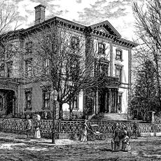
The area took its name from Francis Wayland, a Baptist minister and president of Brown University during the 1800s. His influential role in the city's religious and academic life shaped the character of this neighborhood.

Culture

The neighborhood brings together different religious communities whose houses of worship sit alongside local shops and dining spots. Residents and visitors from various backgrounds move through the same streets and patronize the same establishments, creating a mixed social fabric.

Practical

Parking is available along Wayland Avenue and nearby streets, though spaces fill up during peak shopping hours between 10 AM and 6 PM. Arriving early in the day or on weekdays offers a better chance of finding convenient parking.

Did you know?

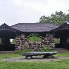
An expansive wooded park with ponds and meadows sits just beyond the shopping streets, accessible on foot from the main district. This green space provides locals and visitors with a quiet place to walk and observe nature while remaining close to urban convenience.

Location
GPS coordinates
41.83011,-71.38778
Latest update
December 12, 2025 17:44

AroundUs brings together thousands of curated places, local tips, and hidden gems, enriched daily by 60,000 contributors worldwide. Discover all places nearby (Rhode Island).

Around this place
University Hall
United States of America

University Hall

1.4 km
Meehan Auditorium
United States of America

Meehan Auditorium

942 m
Crook Point Bascule Bridge
United States of America

Crook Point Bascule Bridge

739 m
John Carter Brown Library
United States of America

John Carter Brown Library

1.4 km
Pizzitola Sports Center
United States of America

Pizzitola Sports Center

866 m
Lindemann Performing Arts Center
United States of America

Lindemann Performing Arts Center

1.2 km
Avon Cinema
United States of America

Avon Cinema

1.1 km
Haffenreffer Museum of Anthropology
United States of America

Haffenreffer Museum of Anthropology

1.4 km
Washington Bridge
United States of America

Washington Bridge

1.2 km
Henderson Bridge
United States of America

Henderson Bridge

833 m
Nelson W. Aldrich House
United States of America

Nelson W. Aldrich House

894 m
Sayles Memorial Hall
United States of America

Sayles Memorial Hall

1.3 km
Dexter Asylum
United States of America

Dexter Asylum

809 m
Governor Henry Lippitt House
United States of America

Governor Henry Lippitt House

860 m
Joseph Haile House
United States of America

Joseph Haile House

1.3 km
Wayland Historic District
United States of America

Wayland Historic District

341 m
Blackstone Park Historic District
United States of America

Blackstone Park Historic District

628 m
Edward Dexter House
United States of America

Edward Dexter House

1.4 km
Freeman Plat Historic District
United States of America

Freeman Plat Historic District

1.1 km
Stimson Avenue Historic District
United States of America

Stimson Avenue Historic District

679 m
Nathaniel Pearce House
United States of America

Nathaniel Pearce House

1.1 km
Blackstone Boulevard–Cole Avenue–Grotto Avenue Historic District
United States of America

Blackstone Boulevard–Cole Avenue–Grotto Avenue Historic District

1 km
Olney Street-Alumni Avenue Historic District
United States of America

Olney Street-Alumni Avenue Historic District

994 m
Ladd Observatory
United States of America

Ladd Observatory

1.4 km
Lippitt House Museum
United States of America

Lippitt House Museum

795 m
Hope-Power-Cooke Streets Historic District
United States of America

Hope-Power-Cooke Streets Historic District

906 m
H. P. Lovecraft House
United States of America

H. P. Lovecraft House

1.4 km
Three Piece Reclining Figure No. 2: Bridge Prop
United States of America

Three Piece Reclining Figure No. 2: Bridge Prop

1.3 km
Show the full map
« Wayland Square - Shopping district in Providence, United States » is provided by Around Us (aroundus.com). Images and texts are derived from Wikimedia project under a Creative Commons license. You are allowed to copy, distribute, and modify copies of this page, under the conditions set by the license, as long as this note is clearly visible.

Discover hidden gems everywhere you go!

From secret cafés to breathtaking viewpoints, skip the crowded tourist spots and find places that match your style. Our app makes it easy with voice search, smart filtering, route optimization, and insider tips from travelers worldwide. Download now for the complete mobile experience.

Around Us App Screenshot

A unique approach to discovering new places

Le Figaro

All the places worth exploring

France Info

A tailor-made excursion in just a few clicks

20 Minutes

Around Us
Travel Guide & Maps
Download

Send to your phone

QR Code
1

Open the camera app on your mobile.

2

Point at the QR code with your camera. A notification will appear.

3

Tap the notification to open the link.