Schuylkill Canal

Log in to your account

AroundUs is a community-driven map of interesting places, built by curious explorers like you. It grows with every review, story, and photo you share.
Connect to save your favorite spots, contribute locations, and create personalized routes.
By continuing, you accept our Terms and Conditions and our Privacy Policy
Add to collection
Map
Suggest a change
Share

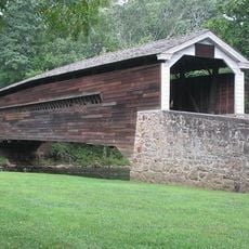
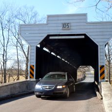
Schuylkill Canal, Historic canal and navigation system in Pennsylvania, United States

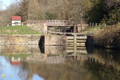
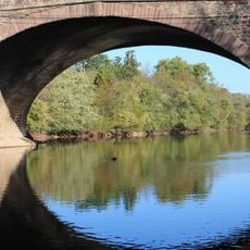
The Schuylkill Canal is a historic waterway stretching approximately 108 miles from Philadelphia to Port Carbon with 44 locks and several slack-water pools. The system follows the Schuylkill River and creates a continuous water route that once served transportation needs throughout the region.

The canal was chartered in 1815 and opened for operations in 1825 to transport anthracite coal from mines near Pottsville to Philadelphia. This waterway played a key role in the region's economic development throughout the 19th century.

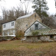
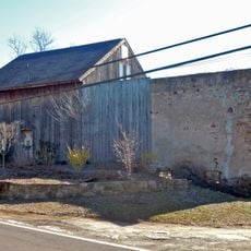
The canal holds meaning as a link to Pennsylvania's industrial past and today serves visitors as a place for walking and observing nature along the water. People in the region see it as a connection to the work and effort that shaped their communities long ago.

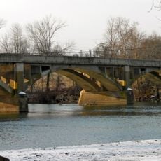
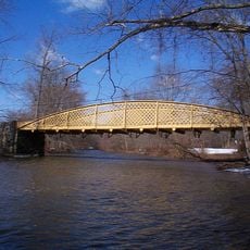
The accessible area at Lock 60 in Mont Clare offers parking and is suitable for activities like boating and fishing in the water. The location is easy to reach on foot and visitors should expect muddy and slippery ground during wet weather.

Lock 60 is one of only two preserved sections of the original navigation system that still holds water and operates as a functioning lock today. This rare condition makes it an extraordinary remnant of an era when water transport shaped the region's prosperity.

Location: Pennsylvania

Inception: 1825

Architects: Thomas Oakes

GPS coordinates: 40.13250,-75.50264

Latest update: December 8, 2025 19:54

Photos
Around this place
Show the full map
Washington's Headquarters
United States of America

Washington's Headquarters

4.9 km
Colonial Theatre
United States of America

Colonial Theatre

1.3 km
Wharton Esherick Studio
United States of America

Wharton Esherick Studio

5.5 km
American Treasure Tour
United States of America

American Treasure Tour

4.1 km
The Speaker's House
United States of America

The Speaker's House

7.6 km
Perkiomen Bridge Hotel
United States of America

Perkiomen Bridge Hotel

7.4 km
St. Basil the Great, Kimberton
United States of America

St. Basil the Great, Kimberton

5.5 km
Perkiomen Bridge
United States of America

Perkiomen Bridge

7.4 km
White Horse Farm
United States of America

White Horse Farm

1.6 km
Black Rock Bridge
United States of America

Black Rock Bridge

3 km
Moore Hall
United States of America

Moore Hall

1.3 km
Mont Clare Bridge
United States of America

Mont Clare Bridge

601 m
Gen. Frederick Von Steuben Headquarters
United States of America

Gen. Frederick Von Steuben Headquarters

4.6 km
Henry Melchior Muhlenberg House
United States of America

Henry Melchior Muhlenberg House

7.6 km
Hares Hill Road Bridge
United States of America

Hares Hill Road Bridge

5.6 km
Rapps Bridge
United States of America

Rapps Bridge

4.3 km
Gay Street School
United States of America

Gay Street School

1.3 km
Continental Stove Works
United States of America

Continental Stove Works

6.8 km
Moses Coates Jr. Farm
United States of America

Moses Coates Jr. Farm

2.5 km
Kennedy Bridge
United States of America

Kennedy Bridge

6.4 km
Charlestown Village Historic District
United States of America

Charlestown Village Historic District

5.9 km
French Creek Farm
United States of America

French Creek Farm

7.2 km
Kimberton Historic District
United States of America

Kimberton Historic District

6.3 km
Matthias Pennypacker Farm
United States of America

Matthias Pennypacker Farm

2.5 km
John Williams Farm
United States of America

John Williams Farm

5.6 km
Prizer's Mill Complex
United States of America

Prizer's Mill Complex

6.1 km
Wharton Esherick Museum
United States of America

Wharton Esherick Museum

5.5 km
Mill Grove
United States of America

Mill Grove

5.1 km
Show the full map
Reviews

Visited this place? Tap the stars to rate it and share your experience / photos with the community! Try now! You can cancel it anytime.

« Schuylkill Canal - Historic canal and navigation system in Pennsylvania, United States » is provided by Around Us (aroundus.com). Images and texts are derived from Wikimedia project under a Creative Commons license. You are allowed to copy, distribute, and modify copies of this page, under the conditions set by the license, as long as this note is clearly visible.

Discover hidden gems everywhere you go!

From secret cafés to breathtaking viewpoints, skip the crowded tourist spots and find places that match your style. Our app makes it easy with voice search, smart filtering, route optimization, and insider tips from travelers worldwide. Download now for the complete mobile experience.

Around Us App Screenshot

A unique approach to discovering new places

Le Figaro

All the places worth exploring

France Info

A tailor-made excursion in just a few clicks

20 Minutes