Enable Location

We need your location to show you interesting places around you

Discover nearby places

Find interesting locations and hidden gems around you

Precise directions

Get accurate directions and distances to places

Your location is never shared with other users. It's only used when you tap the location button.

Short Woods Park Mound

Log in to your account

Start exploring — it's free

Trusted by 61,657 travelers worldwide

Continue with Google
Continue with Apple
or

We will send you a code to connect

By continuing, you accept our Terms and Conditions and our Privacy Policy

Check your inbox

We've sent a pincode in your inbox. Please enter the code below.

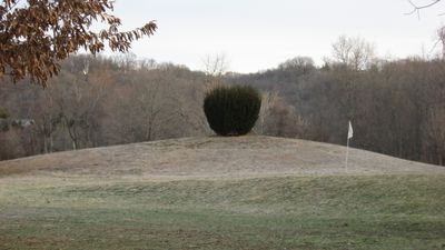
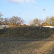
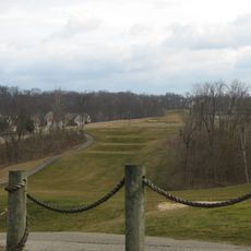
Short Woods Park Mound, Native American burial mound in Sayler Park, Cincinnati, United States.

Description

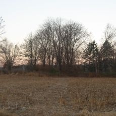
Short Woods Park Mound is a large earthen burial structure with an oval shape built by the Adena culture roughly 2000 years ago. The mound rises considerably within the park boundaries and contains the remains of multiple individuals who were interred in log tombs.

History

The Adena culture built this mound as part of their burial practices and social organization in the Ohio region. Archaeological digs revealed the internal structures and objects that help explain how this ancient society developed and maintained their communities.

Culture

The mound shows how the Adena people in this region honored their dead and organized their community through monumental construction. Walking around it today, you can sense the care and effort that went into creating such a lasting structure for their ancestors.

Practical

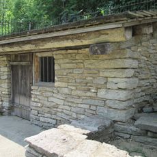
The site sits within Short Woods Park in Cincinnati and is easily accessible on foot to visitors exploring the area. The mound itself is visible year-round and the park setting allows you to walk around and observe it from different angles.

Did you know?

Excavations uncovered objects from distant sources, suggesting that people traveled far to bring goods to this location. These findings indicate the mound was connected to broader trade routes that linked communities across the region.

Location
GPS coordinates
39.12133,-84.69500
Latest update
December 14, 2025 18:46

AroundUs brings together thousands of curated places, local tips, and hidden gems, enriched daily by 60,000 contributors worldwide. Discover all places nearby (Ohio).

Around this place
Creation Museum
United States of America

Creation Museum

8.6 km
William Henry Harrison Tomb State Memorial
United States of America

William Henry Harrison Tomb State Memorial

6 km
Mount Airy Forest
United States of America

Mount Airy Forest

12.9 km
Lower Price Hill Historic District
United States of America

Lower Price Hill Historic District

12.5 km
Carroll Lee Cropper Bridge
United States of America

Carroll Lee Cropper Bridge

11.5 km
St. Lawrence Church
United States of America

St. Lawrence Church

10.6 km
Shawnee Lookout Archeological District
United States of America

Shawnee Lookout Archeological District

9 km
Story Mound
United States of America

Story Mound

692 m
State Line Archeological District
United States of America

State Line Archeological District

10.9 km
Mount Nebo Archaeological District
United States of America

Mount Nebo Archaeological District

9.2 km
George Scott House
United States of America

George Scott House

11.4 km
Pine Meer
United States of America

Pine Meer

6.7 km
Wesley Butler Archeological District
United States of America

Wesley Butler Archeological District

10.9 km
Episcopal Church of the Resurrection
United States of America

Episcopal Church of the Resurrection

897 m
Conrad Mound Archeological Site
United States of America

Conrad Mound Archeological Site

7.3 km
Sedam Springhouse
United States of America

Sedam Springhouse

9.5 km
Westwood Town Center Historic District
United States of America

Westwood Town Center Historic District

8.9 km
Rennert Mound Archeological District
United States of America

Rennert Mound Archeological District

10.7 km
Thomas Miller House
United States of America

Thomas Miller House

10.8 km
Village of Addyston Historic District
United States of America

Village of Addyston Historic District

2.4 km
W. L. Williams House
United States of America

W. L. Williams House

7.6 km
John Aston Warder House
United States of America

John Aston Warder House

4.2 km
Beech Avenue Houses
United States of America

Beech Avenue Houses

10.2 km
Daniel Thew Wright House
United States of America

Daniel Thew Wright House

9.8 km
St. Peter's Lick Run Historic District
United States of America

St. Peter's Lick Run Historic District

11 km
J.M. Aylor House
United States of America

J.M. Aylor House

6.2 km
Mount Airy Arboretum
United States of America

Mount Airy Arboretum

12.6 km
Cincinnati Moonwatch Team
United States of America

Cincinnati Moonwatch Team

8 km
Show the full map
« Short Woods Park Mound - Native American burial mound in Sayler Park, Cincinnati, United States » is provided by Around Us (aroundus.com). Images and texts are derived from Wikimedia project under a Creative Commons license. You are allowed to copy, distribute, and modify copies of this page, under the conditions set by the license, as long as this note is clearly visible.

Discover hidden gems everywhere you go!

From secret cafés to breathtaking viewpoints, skip the crowded tourist spots and find places that match your style. Our app makes it easy with voice search, smart filtering, route optimization, and insider tips from travelers worldwide. Download now for the complete mobile experience.

Around Us App Screenshot

A unique approach to discovering new places

Le Figaro

All the places worth exploring

France Info

A tailor-made excursion in just a few clicks

20 Minutes

Around Us
Travel Guide & Maps
Download

Send to your phone

QR Code
1

Open the camera app on your mobile.

2

Point at the QR code with your camera. A notification will appear.

3

Tap the notification to open the link.