Chest opened
+${chestReward.xp} XP
Explorer
NOUVEAU ×${chestReward.collectible.quantity}
tapez pour fermer
Chest locked

Open chests in the app

Around Us is built for your phone — chests unlock when you walk, explore and capture nearby places.

Enable Location

We need your location to show you interesting places around you

Discover nearby places

Find interesting locations and hidden gems around you

Precise directions

Get accurate directions and distances to places

Your location is never shared with other users. It's only used when you tap the location button.

Snowshoe

Log in to your account

Start exploring — it's free

Trusted by 72,889 travelers worldwide

Continue with Google
Continue with Apple
or

We will send you a code to connect

By continuing, you accept our Terms and Conditions and our Privacy Policy

Check your inbox

We've sent a pincode in your inbox. Please enter the code below.

Discussion Reviews 1 Photos
26.1k Popularity

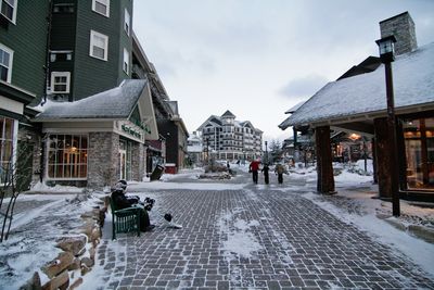
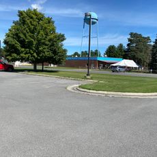
Snowshoe, Mountain resort community in Pocahontas County, West Virginia, United States

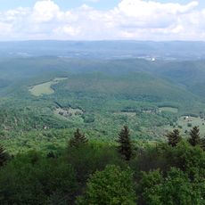
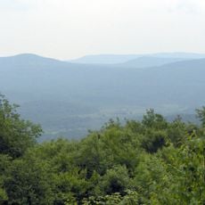
Snowshoe sits where the Cheat and Back Allegheny Mountains meet in a natural bowl formation at about 4,850 feet (1,478 meters) elevation. The resort spreads across 244 acres of ski slopes divided into three areas: Snowshoe Basin, Western Territory, and Silver Creek.

The area was logged for timber until 1960, when Thomas Brigham founded the ski resort in 1974. This shift transformed the mountainside from industrial use to a winter sports destination.

The village maintains ties to Appalachian culture through regional music performances, local crafts, and seasonal community gatherings where visitors experience traditional arts. Walking through, you notice how local artisans and musicians shape the character of the community.

The village sits at the summit rather than the base, which shapes how visitors navigate the area. This elevation means most slopes are directly accessible, and you can walk between areas without long uphill climbs.

The area receives over 13 feet (4 meters) of natural snow yearly due to its high location, making it one of the snowiest spots in the southern Appalachians. This abundant snowfall allows for a long ski season with reliable conditions.

The community of curious travelers

AroundUs brings together thousands of curated places, local tips, and hidden gems, enriched daily by 60,000 contributors worldwide.

Start exploring
Elevation above the sea
1,478 m
GPS coordinates
38.40970,-80.01420
Latest update
December 20, 2025 15:36
Around this place
Green Bank Telescope
United States of America

Green Bank Telescope

15.4 km
Cass Scenic Railroad State Park
United States of America

Cass Scenic Railroad State Park

8.8 km
Durbin and Greenbrier Valley Railroad
United States of America

Durbin and Greenbrier Valley Railroad

21.9 km
Greenbrier River Trail
United States of America

Greenbrier River Trail

22.1 km
Bald Knob
United States of America

Bald Knob

8.4 km
Cranberry Wilderness
United States of America

Cranberry Wilderness

31.5 km
Green Bank Interferometer
United States of America

Green Bank Interferometer

15.5 km
White Top
United States of America

White Top

26.7 km
Gaudineer Scenic Area
United States of America

Gaudineer Scenic Area

28.5 km
Gaudineer Knob
United States of America

Gaudineer Knob

27.3 km
Reber Radio Telescope
United States of America

Reber Radio Telescope

17.3 km
40-foot telescope
United States of America

40-foot telescope

16.2 km
Seneca State Forest
United States of America

Seneca State Forest

11.4 km
Shavers Fork Mountain Complex
United States of America

Shavers Fork Mountain Complex

27.3 km
Camp Bartow Historic District
United States of America

Camp Bartow Historic District

25.6 km
Pocahontas Times Print Shop
United States of America

Pocahontas Times Print Shop

21.9 km
Pocahontas County Opera House
United States of America

Pocahontas County Opera House

22 km
Frank and Anna Hunter House
United States of America

Frank and Anna Hunter House

22.4 km
Pocahontas County Courthouse and Jail
United States of America

Pocahontas County Courthouse and Jail

22.3 km
Cass Historic District
United States of America

Cass Historic District

8.6 km
IOOF Lodge Building
United States of America

IOOF Lodge Building

21.9 km
Green Bank Observatory
United States of America

Green Bank Observatory

15.8 km
Green Bank Observatory Science Center
United States of America

Green Bank Observatory Science Center

17.3 km
300 foot Radio Telescope
United States of America

300 foot Radio Telescope

15.4 km
Green Bank Jansky Antenna
United States of America

Green Bank Jansky Antenna

17.4 km
Howard E. Tatel Radio Telescope
United States of America

Howard E. Tatel Radio Telescope

16.5 km
Green Bank 85-3 telescope
United States of America

Green Bank 85-3 telescope

15.1 km
Green Bank 45ft telescope
United States of America

Green Bank 45ft telescope

16.9 km
Show the full map
Reviews
Share your experience

No review yet

Discussions
Start a discussion...

No discussion yet

« Snowshoe - Mountain resort community in Pocahontas County, West Virginia, United States » is provided by Around Us (aroundus.com). Images and texts are derived from Wikimedia project under a Creative Commons license. You are allowed to copy, distribute, and modify copies of this page, under the conditions set by the license, as long as this note is clearly visible.

Discover hidden gems everywhere you go!

From secret cafés to breathtaking viewpoints, skip the crowded tourist spots and find places that match your style. Our app makes it easy with voice search, smart filtering, route optimization, and insider tips from travelers worldwide. Download now for the complete mobile experience.

Around Us App Screenshot

A unique approach to discovering new places

Le Figaro

All the places worth exploring

France Info

A tailor-made excursion in just a few clicks

20 Minutes

Around Us
Travel Guide & Maps
Download

Send to your phone

QR Code
1

Open the camera app on your mobile.

2

Point at the QR code with your camera. A notification will appear.

3

Tap the notification to open the link.