Chest opened
+${chestReward.xp} XP
Explorer
NOUVEAU ×${chestReward.collectible.quantity}
tapez pour fermer
Chest locked

Open chests in the app

Around Us is built for your phone — chests unlock when you walk, explore and capture nearby places.

Enable Location

We need your location to show you interesting places around you

Discover nearby places

Find interesting locations and hidden gems around you

Precise directions

Get accurate directions and distances to places

Your location is never shared with other users. It's only used when you tap the location button.

Log in to your account

Start exploring — it's free

Trusted by 72,886 travelers worldwide

Continue with Google
Continue with Apple
or

We will send you a code to connect

By continuing, you accept our Terms and Conditions and our Privacy Policy

Check your inbox

We've sent a pincode in your inbox. Please enter the code below.

St. Clair Incline
Discussion Reviews Photo
1.5k Popularity

St. Clair Incline, Historical funicular in South Side Slopes, Pittsburgh, United States

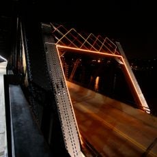
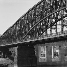
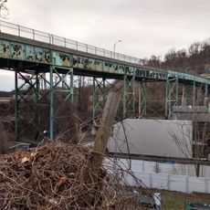
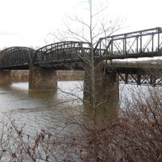
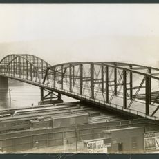
The St. Clair Incline was a funicular in Pittsburgh's South Side Slopes that connected Josephine Street with Salisbury Street. The system used steel rails and wooden ties to carry both passengers and freight up the slope.

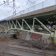
The funicular was designed by engineer J.H. McRoberts and opened in 1888 to make Pittsburgh's steep slopes more accessible. It was demolished in 1934 as the city's transportation system modernized.

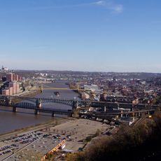
The funicular was woven into the daily rhythms of Pittsburgh residents who needed to cross between neighborhoods separated by steep terrain. It reflected how the city's hillside communities depended on mechanical help to stay connected.

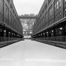
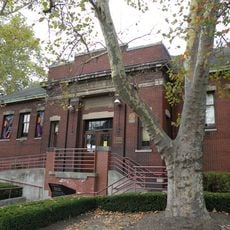
Visitors should know this system no longer operates and exists only as a historical site. The hillside location was once difficult to reach and today serves as a reminder of how cities solved steep terrain challenges.

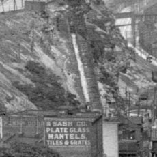
The track followed a curved path that grew steeper toward the upper section. This design was engineered specifically to work with the challenging topography of the site.

The community of curious travelers

AroundUs brings together thousands of curated places, local tips, and hidden gems, enriched daily by 60,000 contributors worldwide.

Start exploring
Location
Official opening
March 5, 1888
GPS coordinates
40.42180,-79.97460
Latest update
December 14, 2025 14:21
Around this place
Hot Metal Bridge
United States of America

Hot Metal Bridge

1.4 km
UPMC Cooper Fieldhouse
United States of America

UPMC Cooper Fieldhouse

2.1 km
South Tenth Street Bridge
United States of America

South Tenth Street Bridge

1.7 km
Birmingham Bridge
United States of America

Birmingham Bridge

1.3 km
Gumberg Library
United States of America

Gumberg Library

2.2 km
Richard King Mellon Hall
United States of America

Richard King Mellon Hall

2.1 km
Brady Street Bridge
United States of America

Brady Street Bridge

1.3 km
Saint Michael's Roman Catholic Church & Rectory
United States of America

Saint Michael's Roman Catholic Church & Rectory

899 m
Paramount Film Exchange
United States of America

Paramount Film Exchange

1.7 km
Fort Pitt Incline
United States of America

Fort Pitt Incline

1.9 km
St. John the Baptist Ukrainian Catholic Church
United States of America

St. John the Baptist Ukrainian Catholic Church

1.6 km
United States of America

McAnulty College and Graduate School of Liberal Arts

2.2 km
Pittsburgh Terminal Properties
United States of America

Pittsburgh Terminal Properties

2.1 km
South Side Market Building
United States of America

South Side Market Building

1.3 km
St. Agnes Church
United States of America

St. Agnes Church

2 km
Pittsburgh Mercantile Company Building
United States of America

Pittsburgh Mercantile Company Building

804 m
St. Peter's Episcopal Church
United States of America

St. Peter's Episcopal Church

2 km
Croatian Fraternal Union Building
United States of America

Croatian Fraternal Union Building

2.3 km
Bedford School
United States of America

Bedford School

1.5 km
Garrison Foundry-Mackintosh Hemphill Company Offices
United States of America

Garrison Foundry-Mackintosh Hemphill Company Offices

1.5 km
Birmingham Public School
United States of America

Birmingham Public School

985 m
South Side Branch of the Carnegie Library of Pittsburgh
United States of America

South Side Branch of the Carnegie Library of Pittsburgh

768 m
Liberty Bridge
United States of America

Liberty Bridge

2.2 km
Swinburne Bridge
United States of America

Swinburne Bridge

2.1 km
Frazier Street Bridge
United States of America

Frazier Street Bridge

2.3 km
Hot Metal Bridge
United States of America

Hot Metal Bridge

1.4 km
Soho Public Baths building
United States of America

Soho Public Baths building

1.7 km
1904 South Tenth Street Bridge
United States of America

1904 South Tenth Street Bridge

1.7 km
Show the full map
Reviews
Share your experience

No review yet

Discussions
Start a discussion...

No discussion yet

« St. Clair Incline - Historical funicular in South Side Slopes, Pittsburgh, United States » is provided by Around Us (aroundus.com). Images and texts are derived from Wikimedia project under a Creative Commons license. You are allowed to copy, distribute, and modify copies of this page, under the conditions set by the license, as long as this note is clearly visible.

Discover hidden gems everywhere you go!

From secret cafés to breathtaking viewpoints, skip the crowded tourist spots and find places that match your style. Our app makes it easy with voice search, smart filtering, route optimization, and insider tips from travelers worldwide. Download now for the complete mobile experience.

Around Us App Screenshot

A unique approach to discovering new places

Le Figaro

All the places worth exploring

France Info

A tailor-made excursion in just a few clicks

20 Minutes

Around Us
Travel Guide & Maps
Download

Send to your phone

QR Code
1

Open the camera app on your mobile.

2

Point at the QR code with your camera. A notification will appear.

3

Tap the notification to open the link.