Enable Location

We need your location to show you interesting places around you

Discover nearby places

Find interesting locations and hidden gems around you

Precise directions

Get accurate directions and distances to places

Your location is never shared with other users. It's only used when you tap the location button.

Stroudwater Historic District

Log in to your account

Start exploring — it's free

Trusted by 62,562 travelers worldwide

Continue with Google
Continue with Apple
or

We will send you a code to connect

By continuing, you accept our Terms and Conditions and our Privacy Policy

Check your inbox

We've sent a pincode in your inbox. Please enter the code below.

Stroudwater Historic District, historic district in Maine, United States

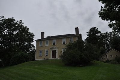
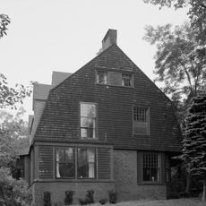
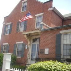
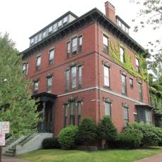
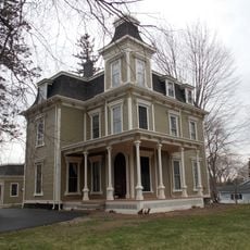
Stroudwater Historic District is a neighborhood in Portland, Maine, containing homes from various periods and sites tied to the area's early settlement and trade. It spreads from the Stroudwater River through residential blocks and includes period houses, a museum in a colonial home, and an old burial ground.

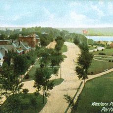
The area was founded in the early 1700s as one of the region's first villages and grew as a center for shipbuilding and timber trade. It became an important transport hub after the Cumberland & Oxford Canal opened in the 1830s to move goods toward Portland.

The neighborhood takes its name from the Stroudwater River, which once anchored daily work and trade in the area. Walking through today, you can see historic homes that housed generations of families and reflect how residents built their lives with skill and care.

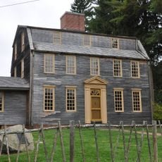
The area is best explored on foot, with walking trails along the old canal route and through the Salt Marsh providing good access. The Tate House Museum is the main building for visitors and offers a look into how people lived during colonial times.

A notable feature is the white pine trees that were cut for shipbuilding and marked with a broad arrow symbol to show they belonged to the king. This special practice reveals how valuable these trees were to the British Navy during the colonial period.

The community of curious travelers

AroundUs brings together thousands of curated places, local tips, and hidden gems, enriched daily by 60,000 contributors worldwide.

Start exploring
Location
GPS coordinates
43.65667,-70.31444
Latest update
February 9, 2026 07:40
Around this place
Fitzpatrick Stadium
United States of America

Fitzpatrick Stadium

3 km
Deering Oaks
United States of America

Deering Oaks

3.5 km
Western Promenade
United States of America

Western Promenade

3.3 km
Tate House
United States of America

Tate House

184 m
Memorial Stadium
United States of America

Memorial Stadium

2.2 km
Children's Museum of Maine
United States of America

Children's Museum of Maine

2 km
The Gothic House
United States of America

The Gothic House

3.4 km
John Calvin Stevens House
United States of America

John Calvin Stevens House

3.4 km
Neal S. Dow House
United States of America

Neal S. Dow House

3.6 km
Thomas Brackett Reed House
United States of America

Thomas Brackett Reed House

3.8 km
Western Promenade Historic District
United States of America

Western Promenade Historic District

3.5 km
Nathan Clifford School
United States of America

Nathan Clifford School

2.8 km
Williston-West Church and Parish House
United States of America

Williston-West Church and Parish House

3.6 km
John B. Russwurm House
United States of America

John B. Russwurm House

3.7 km
Albert Brenner Glickman Family Library
United States of America

Albert Brenner Glickman Family Library

3.4 km
Leonard Bond Chapman House
United States of America

Leonard Bond Chapman House

1.1 km
Harrison B. Brown House
United States of America

Harrison B. Brown House

3.7 km
US Post Office-Portland Main
United States of America

US Post Office-Portland Main

3.9 km
F.O.J. Smith Tomb
United States of America

F.O.J. Smith Tomb

2.7 km
Statue of Thomas Brackett Reed
United States of America

Statue of Thomas Brackett Reed

3.2 km
Westbrook College Historic District
United States of America

Westbrook College Historic District

3.3 km
Maine Central Railroad General Office Building
United States of America

Maine Central Railroad General Office Building

2.9 km
A.B. Butler House
United States of America

A.B. Butler House

3.7 km
Deering Street Historic District
United States of America

Deering Street Historic District

3.7 km
State Reform School Historic District
United States of America

State Reform School Historic District

2.3 km
Sparrow House
United States of America

Sparrow House

3 km
Adam P. Leighton House
United States of America

Adam P. Leighton House

3.1 km
Stevens Avenue Armory
United States of America

Stevens Avenue Armory

3.5 km
Show the full map
« Stroudwater Historic District - historic district in Maine, United States » is provided by Around Us (aroundus.com). Images and texts are derived from Wikimedia project under a Creative Commons license. You are allowed to copy, distribute, and modify copies of this page, under the conditions set by the license, as long as this note is clearly visible.

Discover hidden gems everywhere you go!

From secret cafés to breathtaking viewpoints, skip the crowded tourist spots and find places that match your style. Our app makes it easy with voice search, smart filtering, route optimization, and insider tips from travelers worldwide. Download now for the complete mobile experience.

Around Us App Screenshot

A unique approach to discovering new places

Le Figaro

All the places worth exploring

France Info

A tailor-made excursion in just a few clicks

20 Minutes

Around Us
Travel Guide & Maps
Download

Send to your phone

QR Code
1

Open the camera app on your mobile.

2

Point at the QR code with your camera. A notification will appear.

3

Tap the notification to open the link.