Enable Location

We need your location to show you interesting places around you

Discover nearby places

Find interesting locations and hidden gems around you

Precise directions

Get accurate directions and distances to places

Your location is never shared with other users. It's only used when you tap the location button.

Strickland Road Historic District

Log in to your account

Start exploring — it's free

Trusted by 62,519 travelers worldwide

Continue with Google
Continue with Apple
or

We will send you a code to connect

By continuing, you accept our Terms and Conditions and our Privacy Policy

Check your inbox

We've sent a pincode in your inbox. Please enter the code below.

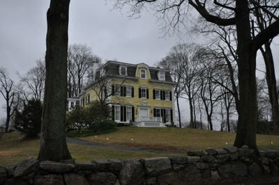
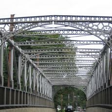
Strickland Road Historic District, historic district in Connecticut, United States

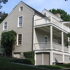
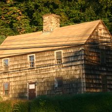
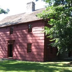
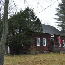
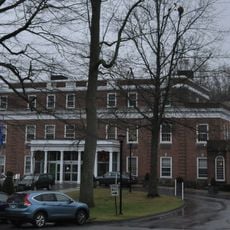
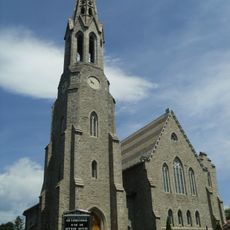
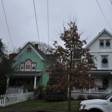
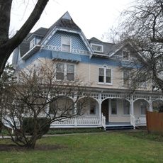
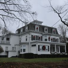
The Strickland Road Historic District is a small residential neighborhood in Cos Cob, Connecticut, containing 28 historic buildings constructed from roughly 1740 to 1934. The homes display different architectural styles, including wood-frame structures, Tudor Revival, and Colonial Revival, with buildings ranging from one to three stories tall.

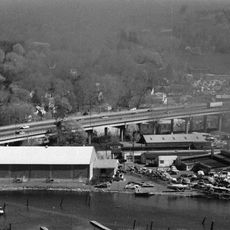
The area was founded in the 17th century as a fishing and trading spot and later developed into a port called Lower Landing with homes of ship captains and merchants. Decline came in the late 1800s when transportation shifted from boats to trains, transforming the area into a quiet residential neighborhood.

The name Strickland Road refers to the street running through the neighborhood where historic homes cluster together. Visitors can see how the buildings and their arrangement reflect the daily lives of generations, from ship captains to craftspeople who built their homes here.

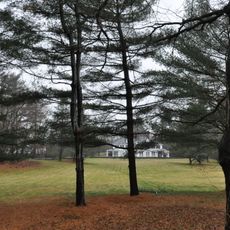
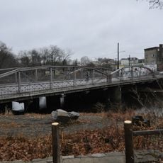
The neighborhood consists of tree-lined residential streets inviting visitors to walk at their own pace and observe the different architectural styles. The Mill Pond within the district creates a peaceful setting and provides a pleasant spot to pause while viewing the surroundings.

Painter Childe Hassam, a noted American artist, created works inspired by this region and shared the area's story through his paintings. His artworks continue to help visitors understand the artistic significance of the neighborhood and reveal connections between local history and the art world.

The community of curious travelers

AroundUs brings together thousands of curated places, local tips, and hidden gems, enriched daily by 60,000 contributors worldwide.

Start exploring
Location
Elevation above the sea
3 m
GPS coordinates
41.03500,-73.60083
Latest update
February 9, 2026 07:42
Around this place
Mianus River Bridge
United States of America

Mianus River Bridge

774 m
Lauder Greenway Estate
United States of America

Lauder Greenway Estate

1.8 km
Rosemary Hall
United States of America

Rosemary Hall

3 km
Bruce Museum of Arts and Science
United States of America

Bruce Museum of Arts and Science

2.4 km
Bush-Holley House
United States of America

Bush-Holley House

613 m
Thomas Lyon House
United States of America

Thomas Lyon House

5.1 km
Mianus River Railroad Bridge
United States of America

Mianus River Railroad Bridge

692 m
Putnam Cottage
United States of America

Putnam Cottage

1.6 km
Cos Cob Power Station
United States of America

Cos Cob Power Station

689 m
Greenwich Town Hall
United States of America

Greenwich Town Hall

2.4 km
Christ Church, Greenwich
United States of America

Christ Church, Greenwich

1.5 km
Greenwich Y.M.C.A.
United States of America

Greenwich Y.M.C.A.

2.1 km
Samuel Ferris House
United States of America

Samuel Ferris House

1.3 km
Riverside Avenue Bridge
United States of America

Riverside Avenue Bridge

1.1 km
Nathaniel Witherell Historic District
United States of America

Nathaniel Witherell Historic District

3.7 km
Putnam Hill Historic District
United States of America

Putnam Hill Historic District

1.5 km
French Farm
United States of America

French Farm

3.8 km
Fourth Ward Historic District
United States of America

Fourth Ward Historic District

2.3 km
Main Street Bridge
United States of America

Main Street Bridge

5.1 km
Josiah Wilcox House
United States of America

Josiah Wilcox House

4.7 km
St. Catherine of Sienna Church
United States of America

St. Catherine of Sienna Church

1.4 km
Methodist Episcopal Church
United States of America

Methodist Episcopal Church

2.2 km
Stamford Cone
United States of America

Stamford Cone

5.1 km
Bowman Observatory
United States of America

Bowman Observatory

1.7 km
Gustavus and Sarah T. Pike House
United States of America

Gustavus and Sarah T. Pike House

3.4 km
River Road-Mead Avenue Historic District
United States of America

River Road-Mead Avenue Historic District

504 m
Bruce Museum
United States of America

Bruce Museum

2.5 km
Greenwich Point Park
United States of America

Greenwich Point Park

4.1 km
Show the full map
« Strickland Road Historic District - historic district in Connecticut, United States » is provided by Around Us (aroundus.com). Images and texts are derived from Wikimedia project under a Creative Commons license. You are allowed to copy, distribute, and modify copies of this page, under the conditions set by the license, as long as this note is clearly visible.

Discover hidden gems everywhere you go!

From secret cafés to breathtaking viewpoints, skip the crowded tourist spots and find places that match your style. Our app makes it easy with voice search, smart filtering, route optimization, and insider tips from travelers worldwide. Download now for the complete mobile experience.

Around Us App Screenshot

A unique approach to discovering new places

Le Figaro

All the places worth exploring

France Info

A tailor-made excursion in just a few clicks

20 Minutes

Around Us
Travel Guide & Maps
Download

Send to your phone

QR Code
1

Open the camera app on your mobile.

2

Point at the QR code with your camera. A notification will appear.

3

Tap the notification to open the link.