Chest opened
+${chestReward.xp} XP
Explorer
NOUVEAU ×${chestReward.collectible.quantity}
tapez pour fermer
Chest locked

Open chests in the app

Around Us is built for your phone — chests unlock when you walk, explore and capture nearby places.

Enable Location

We need your location to show you interesting places around you

Discover nearby places

Find interesting locations and hidden gems around you

Precise directions

Get accurate directions and distances to places

Your location is never shared with other users. It's only used when you tap the location button.

Log in to your account

Start exploring — it's free

Trusted by 72,892 travelers worldwide

Continue with Google
Continue with Apple
or

We will send you a code to connect

By continuing, you accept our Terms and Conditions and our Privacy Policy

Check your inbox

We've sent a pincode in your inbox. Please enter the code below.

Turkey Point Park
Discussion Reviews Photo
1.5k Popularity

Turkey Point Park, Public park in Essex, Maryland, US.

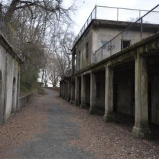
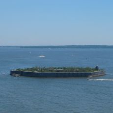
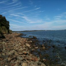
Turkey Point Park is a green space covering 32 acres on a peninsula in Baltimore County with views of surrounding waterways and landscapes. The grounds feature walking paths and are completely surrounded by water, creating a distinct natural setting on the shoreline.

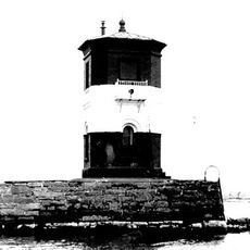
The location gained local recognition after being used as a filming site for the 1990 film Cry-Baby, becoming part of the area's recorded past. This connection has remained part of regional memory and cultural identity.

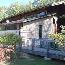
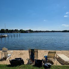
The park serves as a meeting place where locals come to walk and spend time by the water. Visitors can observe how the community uses the space as part of their everyday lives, enjoying the natural surroundings together.

The grounds are open from sunrise to sunset and require dogs to be kept on a leash during visits. Motorized vehicles are not permitted, keeping the space quiet and suitable for walking and outdoor time.

The grounds are almost entirely surrounded by water and sit on a narrow point of land, making it feel like an island. This isolated location turns it into a peaceful retreat surrounded by the wider urban landscape.

The community of curious travelers

AroundUs brings together thousands of curated places, local tips, and hidden gems, enriched daily by 60,000 contributors worldwide.

Start exploring
GPS coordinates
39.29780,-76.40470
Latest update
December 14, 2025 14:43
Around this place
NS Savannah
United States of America

NS Savannah

13.7 km
Francis Scott Key Bridge
United States of America

Francis Scott Key Bridge

13.9 km
SS John W. Brown
United States of America

SS John W. Brown

14.6 km
Fort Carroll
United States of America

Fort Carroll

13.5 km
Patterson Park
United States of America

Patterson Park

15 km
National Brewing Company
United States of America

National Brewing Company

13.9 km
Fort Howard
United States of America

Fort Howard

11.6 km
Greater Grace World Outreach
United States of America

Greater Grace World Outreach

12 km
Pooles Island Light
United States of America

Pooles Island Light

11.9 km
Hart-Miller Island State Park, Maryland
United States of America

Hart-Miller Island State Park, Maryland

5.7 km
Glenn L. Martin Maryland Aviation Museum
United States of America

Glenn L. Martin Maryland Aviation Museum

3.7 km
Craighill Channel Lower Range Front Light
United States of America

Craighill Channel Lower Range Front Light

12.2 km
East Monument Historic District
United States of America

East Monument Historic District

15.1 km
Fort Carroll Light
United States of America

Fort Carroll Light

13.6 km
Todd Farmhouse
United States of America

Todd Farmhouse

9.8 km
Craighill Channel Lower Range Rear Light
United States of America

Craighill Channel Lower Range Rear Light

7.7 km
Ballestone Mansion
United States of America

Ballestone Mansion

5.2 km
Lazaretto Point Light
United States of America

Lazaretto Point Light

14.9 km
Gunpowder Meetinghouse
United States of America

Gunpowder Meetinghouse

14.4 km
Craighill Channel Upper Range Front Light
United States of America

Craighill Channel Upper Range Front Light

11.8 km
Craighill Channel Upper Range Rear Light
United States of America

Craighill Channel Upper Range Rear Light

10.4 km
Old Hamilton Library
United States of America

Old Hamilton Library

14.7 km
Arcadia–Beverly Hills Historic District
United States of America

Arcadia–Beverly Hills Historic District

14.7 km
North Point State Park
United States of America

North Point State Park

9.4 km
Marshy Point Nature Center
United States of America

Marshy Point Nature Center

6.3 km
Wilson Point Mens' Club; Stansbury Beach Club
United States of America

Wilson Point Mens' Club; Stansbury Beach Club

2.5 km
Statue of John O'Donnell
United States of America

Statue of John O'Donnell

14.8 km
Patterson Park-Highlandtown Historic District
United States of America

Patterson Park-Highlandtown Historic District

14.5 km
Show the full map
Reviews
Share your experience

No review yet

Discussions
Start a discussion...

No discussion yet

« Turkey Point Park - Public park in Essex, Maryland, US » is provided by Around Us (aroundus.com). Images and texts are derived from Wikimedia project under a Creative Commons license. You are allowed to copy, distribute, and modify copies of this page, under the conditions set by the license, as long as this note is clearly visible.

Discover hidden gems everywhere you go!

From secret cafés to breathtaking viewpoints, skip the crowded tourist spots and find places that match your style. Our app makes it easy with voice search, smart filtering, route optimization, and insider tips from travelers worldwide. Download now for the complete mobile experience.

Around Us App Screenshot

A unique approach to discovering new places

Le Figaro

All the places worth exploring

France Info

A tailor-made excursion in just a few clicks

20 Minutes

Around Us
Travel Guide & Maps
Download

Send to your phone

QR Code
1

Open the camera app on your mobile.

2

Point at the QR code with your camera. A notification will appear.

3

Tap the notification to open the link.