Enable Location

We need your location to show you interesting places around you

Discover nearby places

Find interesting locations and hidden gems around you

Precise directions

Get accurate directions and distances to places

Your location is never shared with other users. It's only used when you tap the location button.

University Heights Historic District

Log in to your account

Start exploring — it's free

Trusted by 62,454 travelers worldwide

Continue with Google
Continue with Apple
or

We will send you a code to connect

By continuing, you accept our Terms and Conditions and our Privacy Policy

Check your inbox

We've sent a pincode in your inbox. Please enter the code below.

University Heights Historic District, historic district in Madison, Wisconsin

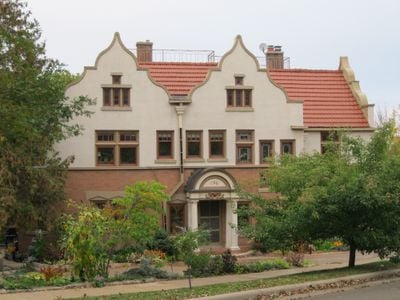
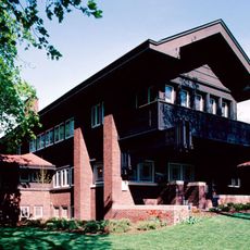
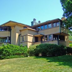
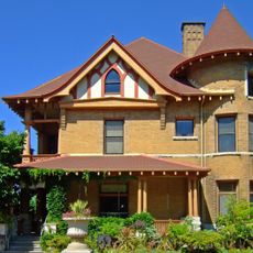
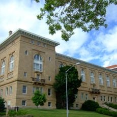
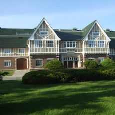
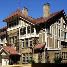
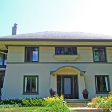
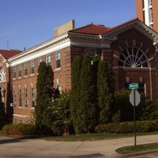
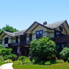
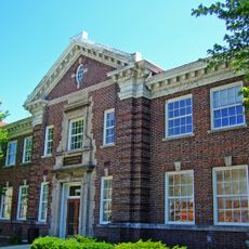
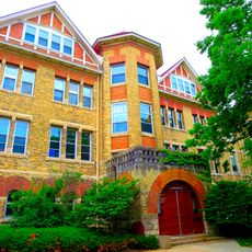
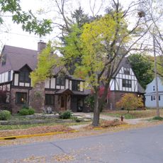
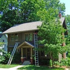
University Heights Historic District is a residential area on Madison's west side, Wisconsin, with about one hundred properties built between the late 1800s and mid-1900s. The buildings display various architectural styles, including Queen Anne, Prairie style, and Craftsman homes, arranged on a hill with curved streets.

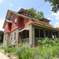
The area was originally forest and farmland, sold for development in 1893. The first house, known as Buell's Folly, was built in 1894, and the neighborhood grew rapidly with homes for university professors and professionals before being annexed into Madison in 1903.

The name University Heights reflects its proximity to the University of Wisconsin and was intended to attract professional families. The curved streets and spacious lots create a quiet, refined residential setting that visitors notice immediately when walking through the neighborhood.

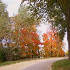
The neighborhood is fully walkable, with curved streets that are easy to navigate and offer views of the city and university. Plan to explore on foot and allow time to admire the varied architectural styles and house details visible from the street.

The first house built here in 1894 was called Buell's Folly because people thought living on a remote hill was foolish. Early residents recall windmills pumping water from artesian wells and children sledding down hills in winter.

The community of curious travelers

AroundUs brings together thousands of curated places, local tips, and hidden gems, enriched daily by 60,000 contributors worldwide.

Start exploring
Location
GPS coordinates
43.07000,-89.41890
Latest update
February 9, 2026 07:42
Around this place
Camp Randall Stadium
United States of America

Camp Randall Stadium

498 m
Camp Randall
United States of America

Camp Randall

770 m
Henry Vilas Zoo
United States of America

Henry Vilas Zoo

1.4 km
Harold C. Bradley House
United States of America

Harold C. Bradley House

243 m
Eugene A. Gilmore House
United States of America

Eugene A. Gilmore House

91 m
Washburn Observatory
United States of America

Washburn Observatory

1.1 km
University of Wisconsin–Madison Lakeshore Nature Preserve
United States of America

University of Wisconsin–Madison Lakeshore Nature Preserve

797 m
Allen Centennial Gardens
United States of America

Allen Centennial Gardens

914 m
United States of America

Wisconsin Institutes for Discovery

937 m
University of Wisconsin Dairy Barn
United States of America

University of Wisconsin Dairy Barn

509 m
DeLuca Biochemistry Building
United States of America

DeLuca Biochemistry Building

803 m
Agriculture Hall
United States of America

Agriculture Hall

941 m
Lathrop Hall
United States of America

Lathrop Hall

1.4 km
Stock Pavilion
United States of America

Stock Pavilion

614 m
Hiram Smith Hall and Annex
United States of America

Hiram Smith Hall and Annex

876 m
Edward C. Elliott House
United States of America

Edward C. Elliott House

96 m
Agricultural Heating Station
United States of America

Agricultural Heating Station

899 m
Agricultural Engineering Building
United States of America

Agricultural Engineering Building

861 m
Samuel Moore House
United States of America

Samuel Moore House

301 m
August Cornelius Larson House
United States of America

August Cornelius Larson House

788 m
Old U.S. Forest Products Laboratory
United States of America

Old U.S. Forest Products Laboratory

719 m
Horticulture and Agricultural Physics and Soil Science Building
United States of America

Horticulture and Agricultural Physics and Soil Science Building

983 m
West Lawn Heights Historic District
United States of America

West Lawn Heights Historic District

637 m
Fire Station No. 4
United States of America

Fire Station No. 4

842 m
William Ellery Leonard House
United States of America

William Ellery Leonard House

1 km
Geology Museum
United States of America

Geology Museum

1 km
Monroe Street Branch
United States of America

Monroe Street Branch

525 m
Bascom Hall
United States of America

Bascom Hall

1.3 km
Show the full map
« University Heights Historic District - historic district in Madison, Wisconsin » is provided by Around Us (aroundus.com). Images and texts are derived from Wikimedia project under a Creative Commons license. You are allowed to copy, distribute, and modify copies of this page, under the conditions set by the license, as long as this note is clearly visible.

Discover hidden gems everywhere you go!

From secret cafés to breathtaking viewpoints, skip the crowded tourist spots and find places that match your style. Our app makes it easy with voice search, smart filtering, route optimization, and insider tips from travelers worldwide. Download now for the complete mobile experience.

Around Us App Screenshot

A unique approach to discovering new places

Le Figaro

All the places worth exploring

France Info

A tailor-made excursion in just a few clicks

20 Minutes

Around Us
Travel Guide & Maps
Download

Send to your phone

QR Code
1

Open the camera app on your mobile.

2

Point at the QR code with your camera. A notification will appear.

3

Tap the notification to open the link.