Enable Location

We need your location to show you interesting places around you

Discover nearby places

Find interesting locations and hidden gems around you

Precise directions

Get accurate directions and distances to places

Your location is never shared with other users. It's only used when you tap the location button.

Log in to your account

Start exploring — it's free

Trusted by 63,029 travelers worldwide

Continue with Google
Continue with Apple
or

We will send you a code to connect

By continuing, you accept our Terms and Conditions and our Privacy Policy

Check your inbox

We've sent a pincode in your inbox. Please enter the code below.

Warriors' Path State Park
Discussion Reviews Photo
7.3k Popularity

Warriors' Path State Park, State park in Kingsport, Tennessee.

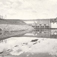
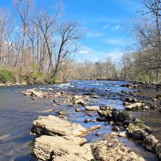
Warriors' Path State Park is a recreation area near Kingsport featuring lakes and trails through wooded landscape. The grounds include designated camping areas, picnic zones, and spaces for outdoor activities spread across the property.

The path was originally established by Native Americans as a trading route connecting different regions. This route lost importance as European settlers arrived and created new pathways through the area.

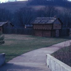
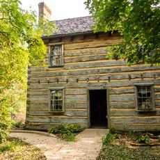
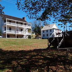
The park takes its name from a historic path used by Native Americans, and this origin still shapes the place's identity today. Visitors encounter interpretive signs and occasional programs that share stories about the region's past and the people who once traveled through it.

The site has camping areas with and without electrical hookups, plus restrooms and shower facilities throughout. Visitors should check trail conditions and difficulty levels before heading out, as routes vary in their physical demands.

The grounds feature a professionally designed disc golf course with 27 holes that winds across different elevations. This amenity draws players from throughout the region and offers a distinctive activity alongside hiking.

The community of curious travelers

AroundUs brings together thousands of curated places, local tips, and hidden gems, enriched daily by 60,000 contributors worldwide.

Start exploring
Location
GPS coordinates
36.49140,-82.48390
Latest update
December 8, 2025 20:03
Around this place
Bristol Motor Speedway
United States of America

Bristol Motor Speedway

20.5 km
United States of America

Gray Fossil Site

11.8 km
Sycamore Shoals
United States of America

Sycamore Shoals

26.3 km
William B. Greene Jr. Stadium
United States of America

William B. Greene Jr. Stadium

23.6 km
Boone Lake
United States of America

Boone Lake

7 km
Long Island
United States of America

Long Island

9 km
Sycamore Shoals State Historic Area
United States of America

Sycamore Shoals State Historic Area

26.4 km
Maybelle and Ezra Carter House
United States of America

Maybelle and Ezra Carter House

21.6 km
Tipton-Haynes State Historic Site
United States of America

Tipton-Haynes State Historic Site

25.7 km
A. P. and Sara Carter House
United States of America

A. P. and Sara Carter House

20.8 km
Rocky Mount, Tennessee
United States of America

Rocky Mount, Tennessee

16.3 km
A. P. Carter Homeplace
United States of America

A. P. Carter Homeplace

21.1 km
Mountain Home National Cemetery
United States of America

Mountain Home National Cemetery

22.2 km
Mt. Vernon Methodist Church
United States of America

Mt. Vernon Methodist Church

22.3 km
Sabine Hill
United States of America

Sabine Hill

26.6 km
Jonesborough Historic District
United States of America

Jonesborough Historic District

22.1 km
Aquone
United States of America

Aquone

21.1 km
Sycamore Shoals State Historic Park
United States of America

Sycamore Shoals State Historic Park

26.3 km
Shelbridge
United States of America

Shelbridge

21.2 km
Yancey's Tavern
United States of America

Yancey's Tavern

6.8 km
Thankful Baptist Church
United States of America

Thankful Baptist Church

22.5 km
Jonesborough United Methodist Church
United States of America

Jonesborough United Methodist Church

22.1 km
Henry Hoss House
United States of America

Henry Hoss House

20.8 km
Gate City Historic District
United States of America

Gate City Historic District

22.6 km
Boatyard Historic District
United States of America

Boatyard Historic District

12.7 km
Fulkerson-Hilton House
United States of America

Fulkerson-Hilton House

18.1 km
Sulphur Springs Methodist Campground
United States of America

Sulphur Springs Methodist Campground

16.8 km
Netherland Inn
United States of America

Netherland Inn

11.9 km
Show the full map
Reviews
Share your experience

No review yet

Discussions
Start a discussion...

No discussion yet

« Warriors' Path State Park - State park in Kingsport, Tennessee » is provided by Around Us (aroundus.com). Images and texts are derived from Wikimedia project under a Creative Commons license. You are allowed to copy, distribute, and modify copies of this page, under the conditions set by the license, as long as this note is clearly visible.

Discover hidden gems everywhere you go!

From secret cafés to breathtaking viewpoints, skip the crowded tourist spots and find places that match your style. Our app makes it easy with voice search, smart filtering, route optimization, and insider tips from travelers worldwide. Download now for the complete mobile experience.

Around Us App Screenshot

A unique approach to discovering new places

Le Figaro

All the places worth exploring

France Info

A tailor-made excursion in just a few clicks

20 Minutes

Around Us
Travel Guide & Maps
Download

Send to your phone

QR Code
1

Open the camera app on your mobile.

2

Point at the QR code with your camera. A notification will appear.

3

Tap the notification to open the link.