Enable Location

We need your location to show you interesting places around you

Discover nearby places

Find interesting locations and hidden gems around you

Precise directions

Get accurate directions and distances to places

Your location is never shared with other users. It's only used when you tap the location button.

Interstate 78 Toll Bridge

Log in to your account

Start exploring — it's free

Trusted by 61,553 travelers worldwide

Continue with Google
Continue with Apple
or

We will send you a code to connect

By continuing, you accept our Terms and Conditions and our Privacy Policy

Check your inbox

We've sent a pincode in your inbox. Please enter the code below.

Interstate 78 Toll Bridge

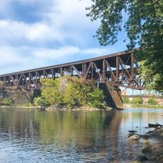
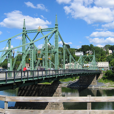
Interstate 78 Toll Bridge, Road bridge in Williams Township, United States

Description

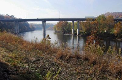
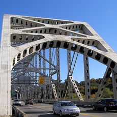
The Interstate 78 Toll Bridge is a road bridge that crosses the Delaware River between Williams Township, Pennsylvania, and Phillipsburg, New Jersey. It carries six traffic lanes and provides a direct connection between the two states.

History

The bridge opened in 1989 when the Delaware River Joint Toll Bridge Commission established this new crossing over the Delaware River. It has since become a key transportation route connecting the two states.

Culture

The bridge serves as a daily crossing point where thousands of commuters and travelers pass through to connect two states. It marks a symbolic boundary between two distinct regions and enables movement and exchange between Pennsylvania and New Jersey.

Practical

Travelers heading west into Pennsylvania should expect to pay a toll, while eastbound traffic into New Jersey crosses without charge. The toll booths and E-ZPass lanes keep traffic moving relatively smoothly, especially outside rush hours.

Did you know?

The bridge sits above karst limestone where sinkholes can suddenly develop, requiring ongoing specialized maintenance work. This challenging geology makes maintaining this crossing more demanding than many other structures in the region.

Location
Location
Official opening
November 21, 1989
GPS coordinates
40.67210,-75.17780
Latest update
December 9, 2025 18:42

AroundUs brings together thousands of curated places, local tips, and hidden gems, enriched daily by 60,000 contributors worldwide. Discover all places nearby (New Jersey).

Around this place
Delaware Division of the Pennsylvania Canal
United States of America

Delaware Division of the Pennsylvania Canal

2.9 km
Peace Candle
United States of America

Peace Candle

3.4 km
Fisher Stadium
United States of America

Fisher Stadium

4.2 km
Easton–Phillipsburg Toll Bridge
United States of America

Easton–Phillipsburg Toll Bridge

3.3 km
State Theatre
United States of America

State Theatre

3.6 km
Easton Area Public Library
United States of America

Easton Area Public Library

3.8 km
Easton Cemetery
United States of America

Easton Cemetery

4.5 km
College Hill Residential Historic District
United States of America

College Hill Residential Historic District

4.3 km
Zeta Psi Fraternity House
United States of America

Zeta Psi Fraternity House

3.8 km
United States of America

Nurture Nature Center

3.7 km
Herman Simon House
United States of America

Herman Simon House

3.2 km
Lehigh Valley Railroad Bridge
United States of America

Lehigh Valley Railroad Bridge

2.7 km
Easton House
United States of America

Easton House

3.3 km
Parsons-Taylor House
United States of America

Parsons-Taylor House

3.4 km
Easton Historic District
United States of America

Easton Historic District

3.6 km
Jacob Mixsell House
United States of America

Jacob Mixsell House

2.9 km
St. James Lutheran Church
United States of America

St. James Lutheran Church

2.8 km
Phillipsburg Commercial Historic District
United States of America

Phillipsburg Commercial Historic District

3 km
Jacob Nicholas House
United States of America

Jacob Nicholas House

3.5 km
William Jacob Heller House
United States of America

William Jacob Heller House

4.1 km
Hixson–Mixsell House
United States of America

Hixson–Mixsell House

3.7 km
Lander–Stewart Mansion and Stites Building
United States of America

Lander–Stewart Mansion and Stites Building

2.8 km
Hixson–Skinner Mill Complex
United States of America

Hixson–Skinner Mill Complex

4 km
Northampton Street Bridge
United States of America

Northampton Street Bridge

3.1 km
Karl Stirner Arts Trail
United States of America

Karl Stirner Arts Trail

4.6 km
John Roseberry Homestead
United States of America

John Roseberry Homestead

1.9 km
Lehigh and Hudson River Railway Bridge
United States of America

Lehigh and Hudson River Railway Bridge

2.9 km
Green's Bridge
United States of America

Green's Bridge

851 m
Show the full map
« Interstate 78 Toll Bridge - Road bridge in Williams Township, United States » is provided by Around Us (aroundus.com). Images and texts are derived from Wikimedia project under a Creative Commons license. You are allowed to copy, distribute, and modify copies of this page, under the conditions set by the license, as long as this note is clearly visible.

Discover hidden gems everywhere you go!

From secret cafés to breathtaking viewpoints, skip the crowded tourist spots and find places that match your style. Our app makes it easy with voice search, smart filtering, route optimization, and insider tips from travelers worldwide. Download now for the complete mobile experience.

Around Us App Screenshot

A unique approach to discovering new places

Le Figaro

All the places worth exploring

France Info

A tailor-made excursion in just a few clicks

20 Minutes

Around Us
Travel Guide & Maps
Download

Send to your phone

QR Code
1

Open the camera app on your mobile.

2

Point at the QR code with your camera. A notification will appear.

3

Tap the notification to open the link.