Enable Location

We need your location to show you interesting places around you

Discover nearby places

Find interesting locations and hidden gems around you

Precise directions

Get accurate directions and distances to places

Your location is never shared with other users. It's only used when you tap the location button.

Delaware Division of the Pennsylvania Canal

Log in to your account

Start exploring — it's free

Trusted by 61,565 travelers worldwide

Continue with Google
Continue with Apple
or

We will send you a code to connect

By continuing, you accept our Terms and Conditions and our Privacy Policy

Check your inbox

We've sent a pincode in your inbox. Please enter the code below.

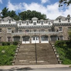
Delaware Division of the Pennsylvania Canal, Canal waterway in Pennsylvania, United States

Description

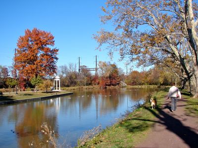
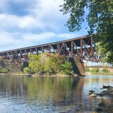
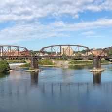
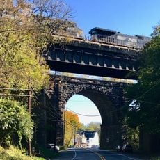
The Delaware Division is a canal waterway running through Pennsylvania and equipped with locks that helped boats navigate changes in elevation. It was constructed with bridges to cross waterways and valleys, and preserved a towpath that visitors can walk today to explore the historic route.

History

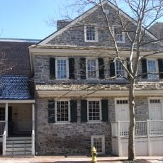
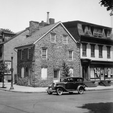
Canal construction began in the 1820s as part of a larger project to connect trade between cities and enable coal transport. It played an important role in the regional economy for several decades before railroads eventually replaced its economic influence.

Culture

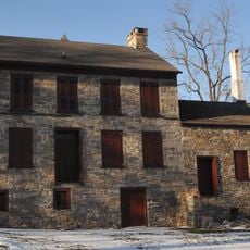
The canal shaped daily life in the region, with workers and their families depending on the waterway for trade and livelihood along the towpath route. Today, the visible locks and bridges remind visitors of this human connection and show how deeply the waterway influenced local communities.

Practical

The towpath is accessible to visitors and offers a relaxed way to explore the area, especially during warmer months when conditions are pleasant. The terrain is generally flat, making it suitable for less experienced walkers.

Did you know?

The waterway still maintains functioning sections where original water flows and small boats can operate, setting it apart from many abandoned canals. These living segments allow visitors to see the transportation system actually at work.

Location
GPS coordinates
40.68806,-75.20500
Latest update
December 8, 2025 19:56

AroundUs brings together thousands of curated places, local tips, and hidden gems, enriched daily by 60,000 contributors worldwide. Discover all places nearby (Pennsylvania).

Around this place
Bushkill Park
United States of America

Bushkill Park

4.2 km
Interstate 78 Toll Bridge
United States of America

Interstate 78 Toll Bridge

2.9 km
Peace Candle
United States of America

Peace Candle

478 m
Fisher Stadium
United States of America

Fisher Stadium

1.5 km
Easton–Phillipsburg Toll Bridge
United States of America

Easton–Phillipsburg Toll Bridge

727 m
State Theatre
United States of America

State Theatre

734 m
Easton Area Public Library
United States of America

Easton Area Public Library

859 m
Easton Cemetery
United States of America

Easton Cemetery

1.6 km
College Hill Residential Historic District
United States of America

College Hill Residential Historic District

1.9 km
Zeta Psi Fraternity House
United States of America

Zeta Psi Fraternity House

1.1 km
United States of America

Nurture Nature Center

802 m
Herman Simon House
United States of America

Herman Simon House

3.5 km
Lehigh Valley Railroad Bridge
United States of America

Lehigh Valley Railroad Bridge

235 m
Easton House
United States of America

Easton House

421 m
Parsons-Taylor House
United States of America

Parsons-Taylor House

504 m
Easton Historic District
United States of America

Easton Historic District

658 m
Jacob Mixsell House
United States of America

Jacob Mixsell House

943 m
St. James Lutheran Church
United States of America

St. James Lutheran Church

5.1 km
Phillipsburg Commercial Historic District
United States of America

Phillipsburg Commercial Historic District

439 m
Jacob Nicholas House
United States of America

Jacob Nicholas House

700 m
William Jacob Heller House
United States of America

William Jacob Heller House

1.8 km
Lander–Stewart Mansion and Stites Building
United States of America

Lander–Stewart Mansion and Stites Building

377 m
Holy Ghost Ukrainian Catholic Church
United States of America

Holy Ghost Ukrainian Catholic Church

2.9 km
Northampton Street Bridge
United States of America

Northampton Street Bridge

393 m
Karl Stirner Arts Trail
United States of America

Karl Stirner Arts Trail

1.7 km
John Roseberry Homestead
United States of America

John Roseberry Homestead

2 km
Lehigh and Hudson River Railway Bridge
United States of America

Lehigh and Hudson River Railway Bridge

175 m
Green's Bridge
United States of America

Green's Bridge

3.2 km
Show the full map
« Delaware Division of the Pennsylvania Canal - Canal waterway in Pennsylvania, United States » is provided by Around Us (aroundus.com). Images and texts are derived from Wikimedia project under a Creative Commons license. You are allowed to copy, distribute, and modify copies of this page, under the conditions set by the license, as long as this note is clearly visible.

Discover hidden gems everywhere you go!

From secret cafés to breathtaking viewpoints, skip the crowded tourist spots and find places that match your style. Our app makes it easy with voice search, smart filtering, route optimization, and insider tips from travelers worldwide. Download now for the complete mobile experience.

Around Us App Screenshot

A unique approach to discovering new places

Le Figaro

All the places worth exploring

France Info

A tailor-made excursion in just a few clicks

20 Minutes

Around Us
Travel Guide & Maps
Download

Send to your phone

QR Code
1

Open the camera app on your mobile.

2

Point at the QR code with your camera. A notification will appear.

3

Tap the notification to open the link.