Chest opened
+${chestReward.xp} XP
Explorer
NOUVEAU ×${chestReward.collectible.quantity}
tapez pour fermer
Chest locked

Open chests in the app

Around Us is built for your phone — chests unlock when you walk, explore and capture nearby places.

Enable Location

We need your location to show you interesting places around you

Discover nearby places

Find interesting locations and hidden gems around you

Precise directions

Get accurate directions and distances to places

Your location is never shared with other users. It's only used when you tap the location button.

Log in to your account

Start exploring — it's free

Trusted by 73,068 travelers worldwide

Continue with Google
Continue with Apple
or

We will send you a code to connect

By continuing, you accept our Terms and Conditions and our Privacy Policy

Check your inbox

We've sent a pincode in your inbox. Please enter the code below.

Indiana's 8th congressional district
Discussion Reviews Photo
19.4k Popularity

Indiana's 8th congressional district, Congressional district in southwestern Indiana, United States.

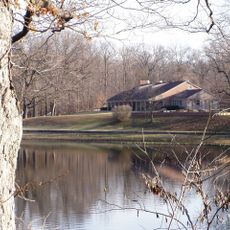
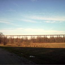
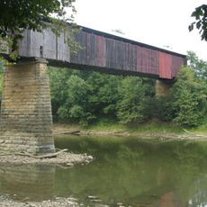
Indiana's 8th Congressional District covers 20 counties across southwestern Indiana and includes agricultural areas, industrial centers, and residential communities. The region connects farmland with small and mid-sized urban centers.

The district was established following the 1820 census and redrawn multiple times to ensure fair representation. These changes followed population shifts across more than 200 years.

The district is home to farmers, factory workers, teachers, and service professionals who shape daily life across the region. Agricultural traditions mix with urban habits in the communities scattered throughout the area.

Residents can find their congressional representative and legislative information through official government websites. Online platforms offer access to contact details and current actions of their representatives.

The district has shown strong Republican voting patterns since the 1990s. This long-standing political tendency sets it apart from other parts of the state.

The community of curious travelers

AroundUs brings together thousands of curated places, local tips, and hidden gems, enriched daily by 60,000 contributors worldwide.

Start exploring
Location
GPS coordinates
39.00000,-87.00000
Latest update
December 7, 2025 10:07
Around this place
Shakamak State Park
United States of America

Shakamak State Park

28.1 km
Tulip Viaduct
United States of America

Tulip Viaduct

15.1 km
Williams Bridge
United States of America

Williams Bridge

36.8 km
Prairie Creek Site
United States of America

Prairie Creek Site

34.5 km
Owen County Courthouse
United States of America

Owen County Courthouse

36.2 km
Sullivan County Poor Home
United States of America

Sullivan County Poor Home

34.8 km
David Enoch Beem House
United States of America

David Enoch Beem House

38 km
Sullivan County Courthouse
United States of America

Sullivan County Courthouse

36.8 km
Ennis Archaeological Site
United States of America

Ennis Archaeological Site

38 km
Richland-Plummer Creek Covered Bridge
United States of America

Richland-Plummer Creek Covered Bridge

5.4 km
Greene County Courthouse
United States of America

Greene County Courthouse

6.1 km
Allison-Robinson House
United States of America

Allison-Robinson House

37.9 km
Spencer Public Library
United States of America

Spencer Public Library

37.8 km
Tide Water Pumping Station
United States of America

Tide Water Pumping Station

28.7 km
Moffett-Ralston House
United States of America

Moffett-Ralston House

36.7 km
Linton Public Library Building
United States of America

Linton Public Library Building

14.7 km
John F. and Malissa Koontz House
United States of America

John F. and Malissa Koontz House

33.2 km
Linton Commercial Historic District
United States of America

Linton Commercial Historic District

14.9 km
Alfred Simonson House
United States of America

Alfred Simonson House

30.1 km
Leroy Mayfield House
United States of America

Leroy Mayfield House

37.8 km
Sherman Building
United States of America

Sherman Building

36.9 km
Sullivan County Public Library
United States of America

Sullivan County Public Library

36.7 km
Parkview Lanes (closed)
United States of America

Parkview Lanes (closed)

13.8 km
Tulip Trestle
United States of America

Tulip Trestle

15.2 km
Karst Farm Park splash pad
United States of America

Karst Farm Park splash pad

37.6 km
Ketcham Travis House
United States of America

Ketcham Travis House

38.3 km
Busseron Creek Bridge
United States of America

Busseron Creek Bridge

31 km
Hamilton Bridge
United States of America

Hamilton Bridge

35 km
Show the full map
Reviews
Share your experience

No review yet

Discussions
Start a discussion...

No discussion yet

« Indiana's 8th congressional district - Congressional district in southwestern Indiana, United States » is provided by Around Us (aroundus.com). Images and texts are derived from Wikimedia project under a Creative Commons license. You are allowed to copy, distribute, and modify copies of this page, under the conditions set by the license, as long as this note is clearly visible.

Discover hidden gems everywhere you go!

From secret cafés to breathtaking viewpoints, skip the crowded tourist spots and find places that match your style. Our app makes it easy with voice search, smart filtering, route optimization, and insider tips from travelers worldwide. Download now for the complete mobile experience.

Around Us App Screenshot

A unique approach to discovering new places

Le Figaro

All the places worth exploring

France Info

A tailor-made excursion in just a few clicks

20 Minutes

Around Us
Travel Guide & Maps
Download

Send to your phone

QR Code
1

Open the camera app on your mobile.

2

Point at the QR code with your camera. A notification will appear.

3

Tap the notification to open the link.