Enable Location

We need your location to show you interesting places around you

Discover nearby places

Find interesting locations and hidden gems around you

Precise directions

Get accurate directions and distances to places

Your location is never shared with other users. It's only used when you tap the location button.

Conway Bridge

Log in to your account

Start exploring — it's free

Trusted by 63,023 travelers worldwide

Continue with Google
Continue with Apple
or

We will send you a code to connect

By continuing, you accept our Terms and Conditions and our Privacy Policy

Check your inbox

We've sent a pincode in your inbox. Please enter the code below.

Discussion Reviews 1 Photos
1.3k Popularity

Conway Bridge, Historic bridge in Briar Thicket, Tennessee.

Conway Bridge is a road bridge crossing the Nolichucky River in eastern Tennessee, connecting Greene County and Cocke County. It features four concrete arch spans with closed spandrels and displays a solid, functional design from the early 20th century.

The bridge was built between 1924 and 1925 by the Steel and Lebby Bridge Company from Knoxville, replacing the earlier ferry service. Its construction followed the completion of Nolichucky Dam and shaped regional transportation development.

The Conway Bridge earned recognition on the National Register of Historic Places in 2009 for its contribution to Tennessee's transportation development.

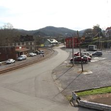
The bridge is located near Briar Thicket in eastern Tennessee and serves as an important road link between the two counties. Plan your visit during dry weather conditions, as the structure over the river may be affected by water flow and weather changes.

The bridge goes by multiple names including Nolichucky River Bridge and Bridge at Bird Hill, reflecting its long local history. A hurricane in 2024 caused significant structural damage, requiring restoration work on this aging infrastructure.

The community of curious travelers

AroundUs brings together thousands of curated places, local tips, and hidden gems, enriched daily by 60,000 contributors worldwide.

Start exploring
Location
GPS coordinates
36.12390,-83.12530
Latest update
December 14, 2025 18:07
Around this place
Cherokee Lake
United States of America

Cherokee Lake

29.6 km
Andrew Johnson National Cemetery
United States of America

Andrew Johnson National Cemetery

26.1 km
Morristown College
United States of America

Morristown College

18.5 km
Panther Creek State Park
United States of America

Panther Creek State Park

27.2 km
Forbidden Caverns
United States of America

Forbidden Caverns

31.6 km
Bush's Visitor Center
United States of America

Bush's Visitor Center

29 km
Crockett Tavern Museum
United States of America

Crockett Tavern Museum

16.8 km
United States of America

Morristown Main Street Historic District

18.1 km
Tate Springs Springhouse
United States of America

Tate Springs Springhouse

31 km
Rose Center
United States of America

Rose Center

18.5 km
Fairfax
United States of America

Fairfax

13 km
Greeneville Historic District
United States of America

Greeneville Historic District

26.9 km
Bethesda Presbyterian Church
United States of America

Bethesda Presbyterian Church

16.6 km
Hawkins County Courthouse
United States of America

Hawkins County Courthouse

33.2 km
Burke–Tarr Stadium
United States of America

Burke–Tarr Stadium

32.4 km
Swaggerty Blockhouse
United States of America

Swaggerty Blockhouse

13.3 km
Bulls Gap Historic District
United States of America

Bulls Gap Historic District

14.8 km
Maden Hall Farm
United States of America

Maden Hall Farm

31.5 km
Rural Mount
United States of America

Rural Mount

6.3 km
Hamblen County Courthouse
United States of America

Hamblen County Courthouse

18.4 km
Glenmore
United States of America

Glenmore

32.2 km
Lawson D. Franklin House
United States of America

Lawson D. Franklin House

12.7 km
Squirewood Hall
United States of America

Squirewood Hall

29.3 km
Branner-Hicks House
United States of America

Branner-Hicks House

31.5 km
St. Paul Presbyterian Church
United States of America

St. Paul Presbyterian Church

10 km
Fairvue
United States of America

Fairvue

30.5 km
Crockett Tavern Museum
United States of America

Crockett Tavern Museum

16.8 km
Glenmore Mansion
United States of America

Glenmore Mansion

32.2 km
Show the full map
Reviews
Share your experience

No review yet

Discussions
Start a discussion...

No discussion yet

« Conway Bridge - Historic bridge in Briar Thicket, Tennessee » is provided by Around Us (aroundus.com). Images and texts are derived from Wikimedia project under a Creative Commons license. You are allowed to copy, distribute, and modify copies of this page, under the conditions set by the license, as long as this note is clearly visible.

Discover hidden gems everywhere you go!

From secret cafés to breathtaking viewpoints, skip the crowded tourist spots and find places that match your style. Our app makes it easy with voice search, smart filtering, route optimization, and insider tips from travelers worldwide. Download now for the complete mobile experience.

Around Us App Screenshot

A unique approach to discovering new places

Le Figaro

All the places worth exploring

France Info

A tailor-made excursion in just a few clicks

20 Minutes

Around Us
Travel Guide & Maps
Download

Send to your phone

QR Code
1

Open the camera app on your mobile.

2

Point at the QR code with your camera. A notification will appear.

3

Tap the notification to open the link.