Greeneville Historic District

Log in to your account

AroundUs is a community-driven map of interesting places, built by curious explorers like you. It grows with every review, story, and photo you share.
Connect to save your favorite spots, contribute locations, and create personalized routes.
Continue with Google
Continue with Apple
Continue with X
Continue with Facebook
Continue with email
By continuing, you accept our Terms and Conditions and our Privacy Policy
Create an account
Add to collection
Map
Suggest a change
Share

Greeneville Historic District, Historic district in Greeneville, Tennessee, US.

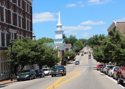
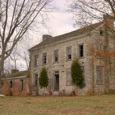
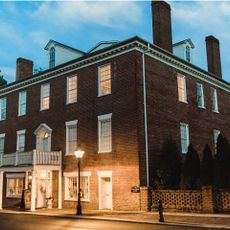
Greeneville Historic District is a neighborhood of more than 170 buildings in Tennessee that combines homes, shops, and churches built across different periods and styles. The structures range from Federal and Greek Revival designs to later Victorian buildings spread across the central area and surrounding blocks.

The district was founded in 1783 as a trading settlement centered around a natural spring and officially recognized in 1974 for its historical importance. Over two centuries, it developed from a small outpost into a notable town while maintaining many of its early structures.

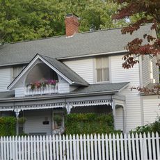
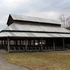
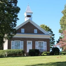
The town center gathers homes, shops, and churches that show how people organized their daily lives across different periods, with buildings standing side by side that reflect both work and worship. Walking through reveals how residents valued both family life and community gathering spaces in their choices of where to build and what to preserve.

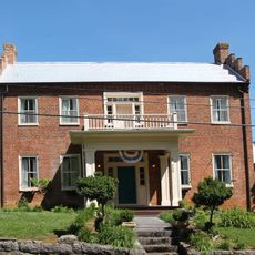
The district is best explored on foot, as the buildings are arranged along walkable streets in a compact area. Comfortable shoes are recommended since you will be walking between different blocks to see the various structures and their architectural details.

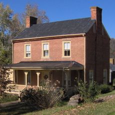
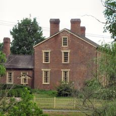
A house built in 1822 still stands in the district and was constructed by a relative of Tennessee's first governor, creating a direct link to the state's early leadership. This family connection added social weight to the town and shows how regional power and local growth were intertwined.

Location: Greeneville

GPS coordinates: 36.16139,-82.82972

Latest update: December 14, 2025 11:21

Photos
Around this place
Andrew Johnson National Cemetery
United States of America

Andrew Johnson National Cemetery

993 m
Davy Crockett Birthplace State Park
United States of America

Davy Crockett Birthplace State Park

16.3 km
Earnest Farms Historic District
United States of America

Earnest Farms Historic District

14 km
Amis House
United States of America

Amis House

30.9 km
Rogersville Historic District
United States of America

Rogersville Historic District

31.6 km
Jonesborough Historic District
United States of America

Jonesborough Historic District

35.2 km
Lamar Alexander Rocky Fork State Park
United States of America

Lamar Alexander Rocky Fork State Park

26.3 km
Hawkins County Courthouse
United States of America

Hawkins County Courthouse

31.6 km
Swaggerty Blockhouse
United States of America

Swaggerty Blockhouse

27.3 km
United States of America

Overton Lodge

31.9 km
Bulls Gap Historic District
United States of America

Bulls Gap Historic District

25.3 km
Conway Bridge
United States of America

Conway Bridge

26.9 km
Maden Hall Farm
United States of America

Maden Hall Farm

7 km
St. Marks Presbyterian Church
United States of America

St. Marks Presbyterian Church

31.9 km
Rural Mount
United States of America

Rural Mount

32.4 km
Salem Presbyterian Church
United States of America

Salem Presbyterian Church

24 km
Stony Point
United States of America

Stony Point

36.5 km
A.R. Brown House
United States of America

A.R. Brown House

37 km
Thomas Telford House
United States of America

Thomas Telford House

20.9 km
Jonesborough United Methodist Church
United States of America

Jonesborough United Methodist Church

35 km
Henry Hoss House
United States of America

Henry Hoss House

36.6 km
Gate City Historic District
United States of America

Gate City Historic District

27.4 km
Sunnybank
United States of America

Sunnybank

30.1 km
Waterfall on West Prong Hickey Fork
United States of America

Waterfall on West Prong Hickey Fork

21 km
Sulphur Springs Methodist Campground
United States of America

Sulphur Springs Methodist Campground

33.2 km
St. Paul Presbyterian Church
United States of America

St. Paul Presbyterian Church

35.6 km
Hale Springs Inn
United States of America

Hale Springs Inn

31.6 km
Washington College Historic District
United States of America

Washington College Historic District

24 km
Show the full map
Reviews

Visited this place? Tap the stars to rate it and share your experience / photos with the community! Try now! You can cancel it anytime.

« Greeneville Historic District - Historic district in Greeneville, Tennessee, US » is provided by Around Us (aroundus.com). Images and texts are derived from Wikimedia project under a Creative Commons license. You are allowed to copy, distribute, and modify copies of this page, under the conditions set by the license, as long as this note is clearly visible.

Discover hidden gems everywhere you go!

From secret cafés to breathtaking viewpoints, skip the crowded tourist spots and find places that match your style. Our app makes it easy with voice search, smart filtering, route optimization, and insider tips from travelers worldwide. Download now for the complete mobile experience.

Around Us App Screenshot

A unique approach to discovering new places

Le Figaro

All the places worth exploring

France Info

A tailor-made excursion in just a few clicks

20 Minutes