Laurel-Snow State Natural Area, Protected natural area in Rhea County, Tennessee.
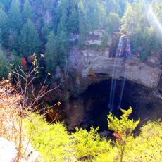
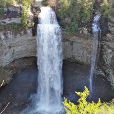
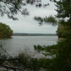
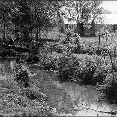
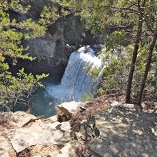
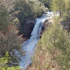
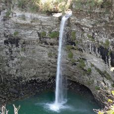
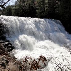
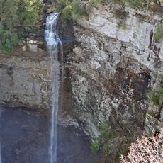
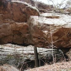
Laurel-Snow State Natural Area is a protected zone spanning 2,259 acres across Walden Ridge within the Cumberland Plateau. The terrain features dense hardwood forests, multiple creeks running through ravines, and two notable waterfalls that drop at different rates and heights.
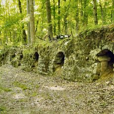
The area experienced significant coal mining activity from the late 1800s into the early 1900s, leaving marks across the landscape. Old railroad beds and mine openings remain visible today as reminders of this industrial period in the region's development.
The place holds meaning for local hikers and nature lovers who have long valued this corner of the Cumberland Plateau for outdoor recreation. Walking through the forest, visitors notice how the old mining traces blend into the landscape, telling stories of the people who worked here generations ago.
The site is accessible through marked trails during daylight hours, with routes leading to both waterfalls that vary in length and difficulty. Visitors should wear proper footwear and plan for steep terrain, ensuring they have sufficient time to complete their chosen route before dark.
The area was designated as Tennessee's first National Recreation Trail, an honor recognizing its value within the state's network of outdoor routes. This designation distinguishes it from many other protected zones in the region and highlights its importance to recreational users.
The community of curious travelers
AroundUs brings together thousands of curated places, local tips, and hidden gems, enriched daily by 60,000 contributors worldwide.