Townshend Dam, Embankment dam in Townshend, Vermont, US
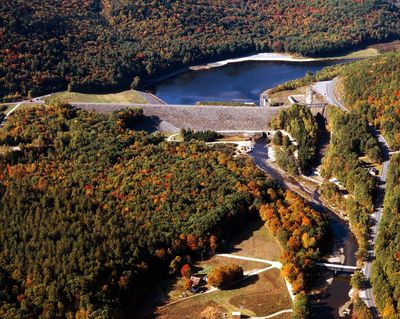
Townshend Dam is an embankment dam in Vermont that spans across the West River valley and creates a substantial reservoir for water storage. The structure was designed as a flood control facility and today serves as a recreation area with picnic grounds and water activities.
The dam was built during the 1960s by the U.S. Army Corps of Engineers as part of a regional flood control strategy. Its construction marked a significant effort to protect downstream communities from seasonal river flooding.
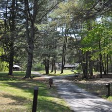
The dam serves as a focal point for the surrounding community, with designated picnic areas and shelters that bring neighbors together for gatherings and outdoor recreation. Local residents view the waterway it creates as an important part of their landscape and way of life.
The recreation area is easily accessible from Route 30 and welcomes visitors throughout the day. It's helpful to arrive earlier in the day if you want to secure a picnic area, especially on weekends when families gather.
The dam operates with a sophisticated system designed to slowly release water and prevent dangerous flooding downstream. Many visitors don't realize this carefully managed flow helps protect entire communities during heavy rainfall seasons.
The community of curious travelers
AroundUs brings together thousands of curated places, local tips, and hidden gems, enriched daily by 60,000 contributors worldwide.