Log in to your account

AroundUs is a community-driven map of interesting places, built by curious explorers like you. It grows with every review, story, and photo you share.
Connect to save your favorite spots, contribute locations, and create personalized routes.
Continue with Google
Continue with Apple
Continue with X
Continue with Facebook
Continue with email
By continuing, you accept our Terms and Conditions and our Privacy Policy
Create an account

New Fairfield Historical District

Add to collection
Map
Suggest a change
Share

New Fairfield Historical District, Historical district in New Fairfield, Connecticut, US.

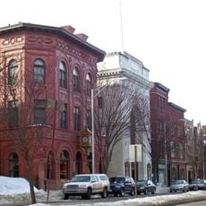
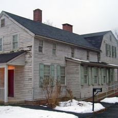
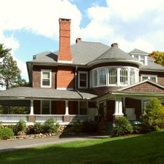
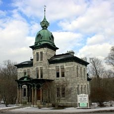
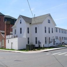
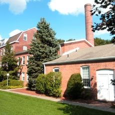
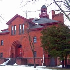
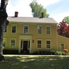
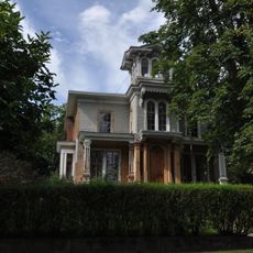
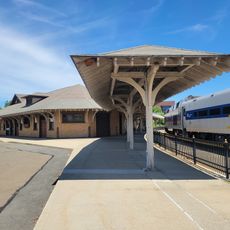
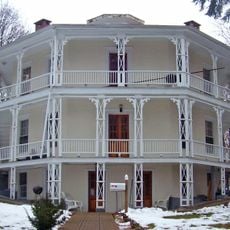
The New Fairfield Historical District is an area that holds a collection of buildings from different periods, including a town hall, public library, and houses spread along Old Post Road. The structures display varied architectural styles and purposes, ranging from simple residences to significant civic buildings.

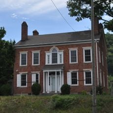
The district developed during the early 1800s as the core of the town's growth, with public and residential structures added over time. Its current form was shaped by preservation efforts that protected endangered buildings from deterioration in the early 2000s.

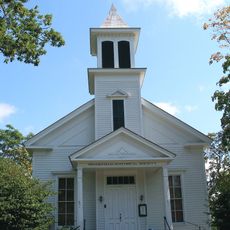
The meetinghouse and church buildings served as gathering places where community members came together for worship, meetings, and celebrations throughout the centuries. These structures shaped how neighbors connected and maintained their bonds across generations.

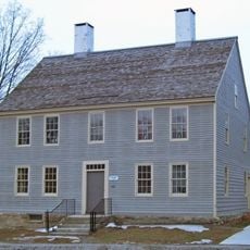
Most buildings in the district are viewable from outside and sit within walking distance of one another along or near Old Post Road. Taking time to stroll through the area and observe the different architectural styles and exterior details lets you experience the variety of the district at your own pace.

Several houses were moved to new locations in the early 2000s to rescue them from decay and create a living history village where visitors can explore them. These relocations represent an unusual preservation approach that brings history closer to visitors while keeping buildings intact.

GPS coordinates: 41.46810,-73.49010

Latest update: December 14, 2025 09:42

Photos
Around this place
Hearthstone Castle
United States of America

Hearthstone Castle

10.6 km
Lovers Leap State Park
United States of America

Lovers Leap State Park

11.3 km
Squantz Pond State Park
United States of America

Squantz Pond State Park

4.9 km
East Branch Reservoir
United States of America

East Branch Reservoir

11.6 km
Main Street Historic District
United States of America

Main Street Historic District

8.7 km
Bog Brook Reservoir
United States of America

Bog Brook Reservoir

9.9 km
Brewster High School
United States of America

Brewster High School

9.9 km
Charles Ives House
United States of America

Charles Ives House

10.4 km
Tarrywile
United States of America

Tarrywile

10.3 km
Danbury Museum and Historical Society
United States of America

Danbury Museum and Historical Society

9.6 km
Meeker's Hardware
United States of America

Meeker's Hardware

8.5 km
Pootatuck State Forest
United States of America

Pootatuck State Forest

5.3 km
Akin Free Library
United States of America

Akin Free Library

11.2 km
Kohanza Reservoir
United States of America

Kohanza Reservoir

5 km
John Rider House
United States of America

John Rider House

9.6 km
Ball and Roller Bearing Company
United States of America

Ball and Roller Bearing Company

8.4 km
Brookfield Center Historic District
United States of America

Brookfield Center Historic District

8.5 km
P. Robinson Fur Cutting Company
United States of America

P. Robinson Fur Cutting Company

8.9 km
John Glover Noble House
United States of America

John Glover Noble House

7.2 km
Joseph W. Pepin Memorial Building
United States of America

Joseph W. Pepin Memorial Building

8.5 km
Cosier-Murphy House
United States of America

Cosier-Murphy House

1.3 km
Williams House
United States of America

Williams House

1.4 km
Frederick S. Sanford House
United States of America

Frederick S. Sanford House

12.3 km
Danbury Railway Museum
United States of America

Danbury Railway Museum

8.5 km
Lover's Leap Bridge
United States of America

Lover's Leap Bridge

10.9 km
Octagon House
United States of America

Octagon House

8.6 km
Pine Ledge
United States of America

Pine Ledge

6.7 km
Tonetta Lake Beach
United States of America

Tonetta Lake Beach

11.5 km
Show the full map
Reviews

Visited this place? Tap the stars to rate it and share your experience / photos with the community! Try now! You can cancel it anytime.

« New Fairfield Historical District - Historical district in New Fairfield, Connecticut, US » is provided by Around Us (aroundus.com). Images and texts are derived from Wikimedia project under a Creative Commons license. You are allowed to copy, distribute, and modify copies of this page, under the conditions set by the license, as long as this note is clearly visible.

Discover hidden gems everywhere you go!

From secret cafés to breathtaking viewpoints, skip the crowded tourist spots and find places that match your style. Our app makes it easy with voice search, smart filtering, route optimization, and insider tips from travelers worldwide. Download now for the complete mobile experience.

Around Us App Screenshot

A unique approach to discovering new places

Le Figaro

All the places worth exploring

France Info

A tailor-made excursion in just a few clicks

20 Minutes