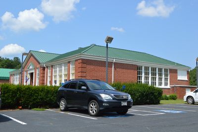
Armstead T. Johnson High School, high school in Westmoreland County, Virginia, United States
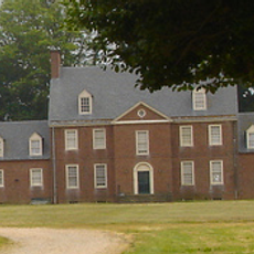
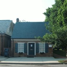
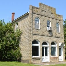
Armstead T. Johnson High School is a brick school building in Westmoreland County built in 1937 in Colonial Revival style and designed for African-American students. The structure features symmetrical wings, classic columns, and careful brickwork that reflects the craftsmanship of that era.
The school was built in 1937 with federal funding from the Works Progress Administration, replacing a smaller three-room school to improve education for African-American students in the Northern Neck area. It was added to the National Register of Historic Places in 1998 and is considered the most complete example of rural school construction from that period in the county.
The school is named after Armstead Tasker Johnson, a respected teacher and community leader who served the region for more than 30 years. The name honors his commitment to advancing education for African-American students in this rural area.
The property is visible from the nearby road but is partially private, so visitors should respect any access restrictions that may apply. The best time to visit is during daylight hours when you can clearly see the architectural details and auxiliary buildings like the Industrial Arts Building and Home Economics Cottage on the grounds.
The grounds include several auxiliary buildings, including an Industrial Arts Building where students learned crafts and practical skills, and a Home Economics Cottage for instruction in cooking and household management. These smaller structures reveal the comprehensive education the school provided to African-American students who had limited opportunities elsewhere.
The community of curious travelers
AroundUs brings together thousands of curated places, local tips, and hidden gems, enriched daily by 60,000 contributors worldwide.