Enable Location

We need your location to show you interesting places around you

Discover nearby places

Find interesting locations and hidden gems around you

Precise directions

Get accurate directions and distances to places

Your location is never shared with other users. It's only used when you tap the location button.

Westmoreland State Park

Log in to your account

Start exploring — it's free

Trusted by 61,991 travelers worldwide

Continue with Google
Continue with Apple
or

We will send you a code to connect

By continuing, you accept our Terms and Conditions and our Privacy Policy

Check your inbox

We've sent a pincode in your inbox. Please enter the code below.

Westmoreland State Park

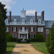
Westmoreland State Park, Public recreation area in Westmoreland County, Virginia, US.

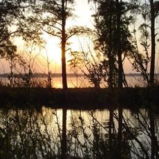
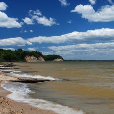
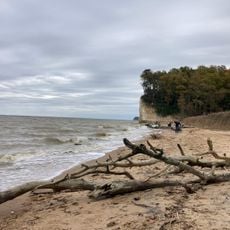
Westmoreland State Park is a recreation area along the Potomac River shoreline in Westmoreland County, featuring tall cliffs that rise above the water. The park extends for about one and a half miles and offers various outdoor activities for visitors.

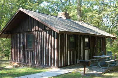
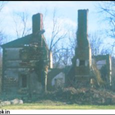
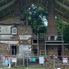
The park was developed in the 1930s by the Civilian Conservation Corps, with workers hand-digging roads and building cabins from local timber. This early construction shaped the park as visitors see it today.

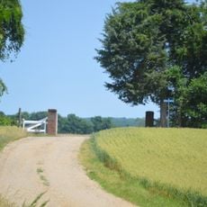
The park forms part of the Captain John Smith Chesapeake National Historic Trail, linking visitors to the story of early American exploration. People walking these paths can follow the routes that once shaped this region.

The park offers hiking and camping options with various facilities including rental cabins and designated camping sites. A boat launch provides access to the river for water activities and exploration.

The park's beach area is known for the abundance of ancient shark teeth fossils that visitors can find while walking along the Potomac shore. These remains offer a glimpse into the geological past of the region.

The community of curious travelers

AroundUs brings together thousands of curated places, local tips, and hidden gems, enriched daily by 60,000 contributors worldwide.

Start exploring
Inception
June 1936
GPS coordinates
38.16250,-76.86610
Latest update
December 7, 2025 20:44
Around this place
Stratford Hall
United States of America

Stratford Hall

2.6 km
St. Clement's Island State Park
United States of America

St. Clement's Island State Park

11.8 km
Bell House
United States of America

Bell House

11.9 km
James Monroe Family Home Site
United States of America

James Monroe Family Home Site

14 km
St. Francis Xavier Church and Newtown Manor House Historic District
United States of America

St. Francis Xavier Church and Newtown Manor House Historic District

17.8 km
Rappahannock River Valley National Wildlife Refuge
United States of America

Rappahannock River Valley National Wildlife Refuge

18.2 km
Bushfield (Mount Holly, Virginia)
United States of America

Bushfield (Mount Holly, Virginia)

13.7 km
Ingleside Vineyards
United States of America

Ingleside Vineyards

12.2 km
Blakistone Island Light
United States of America

Blakistone Island Light

11.7 km
Panorama
United States of America

Panorama

6.9 km
Cobb Point Bar Light
United States of America

Cobb Point Bar Light

9.5 km
Ocean Hall
United States of America

Ocean Hall

14.6 km
Wirtland
United States of America

Wirtland

12.5 km
Armstead T. Johnson High School
United States of America

Armstead T. Johnson High School

12 km
Wheatland
United States of America

Wheatland

19.1 km
Blenheim
United States of America

Blenheim

7.3 km
St. Peter's Episcopal Church
United States of America

St. Peter's Episcopal Church

11.6 km
St. Matthew's Church
United States of America

St. Matthew's Church

19.7 km
Glebe House of St. Anne's Parish
United States of America

Glebe House of St. Anne's Parish

16.6 km
Roxbury
United States of America

Roxbury

11.9 km
Spring Grove
United States of America

Spring Grove

16.4 km
Port Micou
United States of America

Port Micou

18.3 km
Stratford Hall Historic Preserve
United States of America

Stratford Hall Historic Preserve

2.6 km
Fossil Beach
United States of America

Fossil Beach

1.2 km
Menokin
United States of America

Menokin

13.9 km
Menokin
United States of America

Menokin

18 km
The Sands
United States of America

The Sands

1.6 km
Westmoreland State Park Fountain
United States of America

Westmoreland State Park Fountain

228 m
Show the full map
« Westmoreland State Park - Public recreation area in Westmoreland County, Virginia, US » is provided by Around Us (aroundus.com). Images and texts are derived from Wikimedia project under a Creative Commons license. You are allowed to copy, distribute, and modify copies of this page, under the conditions set by the license, as long as this note is clearly visible.

Discover hidden gems everywhere you go!

From secret cafés to breathtaking viewpoints, skip the crowded tourist spots and find places that match your style. Our app makes it easy with voice search, smart filtering, route optimization, and insider tips from travelers worldwide. Download now for the complete mobile experience.

Around Us App Screenshot

A unique approach to discovering new places

Le Figaro

All the places worth exploring

France Info

A tailor-made excursion in just a few clicks

20 Minutes

Around Us
Travel Guide & Maps
Download

Send to your phone

QR Code
1

Open the camera app on your mobile.

2

Point at the QR code with your camera. A notification will appear.

3

Tap the notification to open the link.