Nissequogue River State Park

Log in to your account

AroundUs is a community-driven map of interesting places, built by curious explorers like you. It grows with every review, story, and photo you share.
Connect to save your favorite spots, contribute locations, and create personalized routes.
Continue with Google
Continue with Apple
Continue with X
Continue with Facebook
Continue with email
By continuing, you accept our Terms and Conditions and our Privacy Policy
Create an account

Nissequogue River State Park

Add to collection
Map
Suggest a change
Share

Nissequogue River State Park, State park in Kings Park, New York.

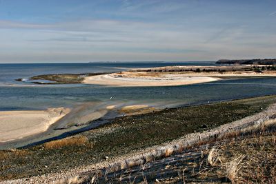
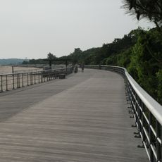
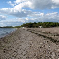
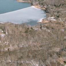
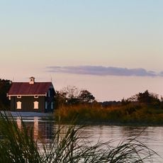
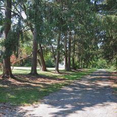
Nissequogue River State Park is a 521-acre nature preserve along the river of the same name, featuring tidal wetlands, hardwood forests, and elevated bluffs overlooking Long Island Sound. The grounds also contain a marina, boat launches, and marked hiking trails suitable for different fitness levels.

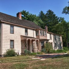
The park was established in 2000 on the waterfront portion of the former Kings Park Psychiatric Center, which operated until its closure in 1996. The conversion from a psychiatric institution to public parkland marked a turning point in how this waterfront area is used.

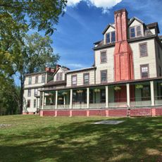
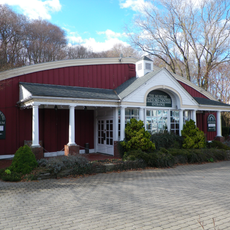
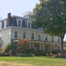
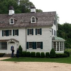
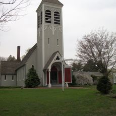
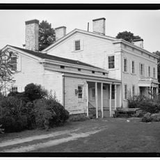
The park contains York Hall, a historic building listed on the National Register that once served as the primary assembly space for the neighboring psychiatric hospital. Visitors can observe this structure and recognize how it reflects the site's former institutional purpose.

The grounds are best visited at low tide when more shoreline is available for exploration. The marina operates seasonally from April through November, so visitors should check the time of year before planning any boating activities.

From July through October, more than 100 egrets gather each evening at dusk around the pond and river to select their roosts for the night. These large white birds create a natural spectacle that is especially common to witness during this seasonal period.

Location: Suffolk County

Website: https://parks.ny.gov/parks/nissequogueriver/details.aspx

GPS coordinates: 40.89770,-73.23150

Latest update: December 11, 2025 11:00

Photos
Around this place
Sunken Meadow State Park
United States of America

Sunken Meadow State Park

2.7 km
Kenneth P. LaValle Stadium
United States of America

Kenneth P. LaValle Stadium

9.3 km
Caleb Smith State Park Preserve
United States of America

Caleb Smith State Park Preserve

5.2 km
Long Island Museum of American Art, History, and Carriages
United States of America

Long Island Museum of American Art, History, and Carriages

7.7 km
Charles B. Wang Center
United States of America

Charles B. Wang Center

9.6 km
West Meadow Beach Historic District
United States of America

West Meadow Beach Historic District

8.2 km
Blydenburgh Park Historic District
United States of America

Blydenburgh Park Historic District

6.1 km
Kate Annette Wetherill Estate
United States of America

Kate Annette Wetherill Estate

5.2 km
Northport Public Library
United States of America

Northport Public Library

9.5 km
Carll S. Burr Mansion
United States of America

Carll S. Burr Mansion

7.5 km
Stony Brook Grist Mill
United States of America

Stony Brook Grist Mill

7.3 km
Staller Center
United States of America

Staller Center

9.5 km
William Sidney Mount House
United States of America

William Sidney Mount House

7.9 km
Gamecock Cottage
United States of America

Gamecock Cottage

7.8 km
East Farm
United States of America

East Farm

6.7 km
Land of Clover
United States of America

Land of Clover

4.2 km
Hawkins Homestead
United States of America

Hawkins Homestead

8.6 km
Obadiah Smith House
United States of America

Obadiah Smith House

449 m
First Presbyterian Church
United States of America

First Presbyterian Church

5.8 km
Saint James District
United States of America

Saint James District

6 km
Harbor House
United States of America

Harbor House

4.4 km
Rassapeague
United States of America

Rassapeague

4.6 km
Nathaniel Longbotham House
United States of America

Nathaniel Longbotham House

8.2 km
Mills Pond District
United States of America

Mills Pond District

6.9 km
Marion Carll Farm
United States of America

Marion Carll Farm

9.6 km
Short Beach
United States of America

Short Beach

1.2 km
Smithtown Center for the Performing Arts
United States of America

Smithtown Center for the Performing Arts

5.7 km
The Smithtown Library - Kings Park Branch
United States of America

The Smithtown Library - Kings Park Branch

2.4 km
Show the full map
Reviews

Visited this place? Tap the stars to rate it and share your experience / photos with the community! Try now! You can cancel it anytime.

« Nissequogue River State Park - State park in Kings Park, New York » is provided by Around Us (aroundus.com). Images and texts are derived from Wikimedia project under a Creative Commons license. You are allowed to copy, distribute, and modify copies of this page, under the conditions set by the license, as long as this note is clearly visible.

Discover hidden gems everywhere you go!

From secret cafés to breathtaking viewpoints, skip the crowded tourist spots and find places that match your style. Our app makes it easy with voice search, smart filtering, route optimization, and insider tips from travelers worldwide. Download now for the complete mobile experience.

Around Us App Screenshot

A unique approach to discovering new places

Le Figaro

All the places worth exploring

France Info

A tailor-made excursion in just a few clicks

20 Minutes